Category:Coleshill, Warwickshire
Jump to navigation
Jump to search
town in Warwickshire, England, UK  | |||||
| Upload media | |||||
| Instance of | |||||
|---|---|---|---|---|---|
| Location | North Warwickshire, Warwickshire, West Midlands, England | ||||
| Population |
| ||||
| Area |
| ||||
 | |||||
Coleshill is a market town in the English county of Warwickshire.
Subcategories
This category has the following 9 subcategories, out of 9 total.
B
- Blyth Hall (5 F)
C
- Cole Bridge, Coleshill (3 F)
- Coleshill Manor (3 F)
D
- Chris Dangerfield (2 F)
M
- Maxstoke railway station (3 F)
P
Pages in category "Coleshill, Warwickshire"
This category contains only the following page.
Media in category "Coleshill, Warwickshire"
The following 200 files are in this category, out of 412 total.
(previous page) (next page)-
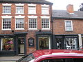
 1 High Street, Coleshill - geograph.org.uk - 5963183.jpg 2,774 × 2,081; 1.77 MB
-
 104 ^ 106 High Street, Coleshill - geograph.org.uk - 5905779.jpg 2,371 × 1,996; 1.45 MB
-
 105 High Street, Coleshill - geograph.org.uk - 5900648.jpg 1,958 × 2,611; 1.66 MB
-
 107 ^ 109 High Street, Coleshill - geograph.org.uk - 5903770.jpg 2,774 × 2,081; 1.63 MB
-
 108 ^ 110 High Street, Coleshill - geograph.org.uk - 5905773.jpg 2,774 × 2,081; 1.68 MB
-
 109 High Street Coleshill.JPG 4,000 × 3,000; 1.23 MB
-
 111 High Street Coleshill.JPG 4,000 × 3,000; 1,007 KB
-
 111 High Street, Coleshill - geograph.org.uk - 5903778.jpg 2,081 × 2,774; 1.53 MB
-
 112a ^ 112b High Street, Coleshill - geograph.org.uk - 5905765.jpg 1,958 × 2,611; 1.65 MB
-
 113 High Street Coleshill.JPG 4,000 × 3,000; 1.45 MB
-
 113 High Street, Coleshill - geograph.org.uk - 5903779.jpg 2,081 × 2,774; 1.64 MB
-
 118 ^ 120 High Street, Coleshill - geograph.org.uk - 5905760.jpg 2,326 × 3,101; 1.62 MB
-
 119 High Street Coleshill.JPG 4,000 × 3,000; 1.42 MB
-
 119 High Street, Coleshill - geograph.org.uk - 5903780.jpg 2,081 × 2,774; 1.68 MB
-
 122 ^ 124 High Street, Coleshill - geograph.org.uk - 5903804.jpg 2,938 × 2,203; 1.6 MB
-
 131 High Street, Coleshill - Queen Anne House - geograph.org.uk - 5903789.jpg 3,264 × 2,448; 1.58 MB
-
 132, High Street, Coleshill - geograph.org.uk - 5818259.jpg 3,264 × 2,448; 1.64 MB
-
 134 ^ 136, High Street, Coleshill - geograph.org.uk - 5818252.jpg 3,264 × 2,448; 1.7 MB
-
 137 ^ 139, High Street, Coleshill - geograph.org.uk - 5813529.jpg 2,774 × 2,081; 1.68 MB
-
 138 ^ 140, High Street, Coleshill - geograph.org.uk - 5818087.jpg 3,264 × 2,448; 1.53 MB
-
 143, High Street, Coleshill - geograph.org.uk - 5813523.jpg 2,611 × 1,958; 1.73 MB
-
 148, High Street, Coleshill - geograph.org.uk - 5813527.jpg 2,611 × 1,958; 1.45 MB
-
 37 High Street, Coleshill - geograph.org.uk - 5204416.jpg 1,306 × 979; 447 KB
-
 74 ^ 76 High Street, Coleshill - geograph.org.uk - 5941640.jpg 2,611 × 1,958; 1.49 MB
-
 78 High Street, Coleshill - geograph.org.uk - 5941644.jpg 2,611 × 1,958; 1.33 MB
-
 80 ^ 82 High Street, Coleshill - geograph.org.uk - 5941649.jpg 2,611 × 1,958; 1.4 MB
-
 92 ^ 94 High Street, Coleshill - geograph.org.uk - 5900629.jpg 1,836 × 2,448; 1.55 MB
-
 A cornucopia of motorways - geograph.org.uk - 2724962.jpg 640 × 480; 56 KB
-
 A446 - A452 slip road overbridge - geograph.org.uk - 2332226.jpg 640 × 480; 74 KB
-

-
 A446 at Chattle Hill - geograph.org.uk - 2332170.jpg 640 × 480; 65 KB
-
 A446 at Chattle Hill traffic lights - geograph.org.uk - 2332166.jpg 640 × 480; 65 KB
-
 A446 Coleshill By-Pass - geograph.org.uk - 5138644.jpg 640 × 480; 51 KB
-
 A446 northbound - geograph.org.uk - 4103367.jpg 1,142 × 857; 493 KB
-
 A452 slip road, A446 southbound - geograph.org.uk - 2332221.jpg 640 × 480; 66 KB
-
 Access Road to Coleshill Tennis and Sports Club - geograph.org.uk - 5914513.jpg 4,128 × 2,322; 2.87 MB
-
 Agricultural land NE of Coleshill - geograph.org.uk - 5335731.jpg 1,469 × 1,102; 590 KB
-
 Alms Cottages ^ - geograph.org.uk - 391029.jpg 640 × 480; 113 KB
-
 Alms Houses in Sumner Road Coleshill - geograph.org.uk - 903125.jpg 640 × 480; 112 KB
-
 Along Maxstoke Lane - geograph.org.uk - 5276981.jpg 1,469 × 1,102; 686 KB
-

-

-
 Approaching the A446 roundabout - geograph.org.uk - 3703260.jpg 3,311 × 1,585; 1.16 MB
-

-
 Approaching the M42 - geograph.org.uk - 1887992.jpg 640 × 480; 56 KB
-
 Approaching the M42 - geograph.org.uk - 1887997.jpg 640 × 480; 58 KB
-

-
 B4114 Bridge over the M42 - geograph.org.uk - 2676417.jpg 640 × 430; 45 KB
-

-

-
 Between the M6 and the M42 - geograph.org.uk - 1887988.jpg 640 × 480; 75 KB
-
 Big Gantry, Small Road - geograph.org.uk - 1636345.jpg 640 × 480; 142 KB
-
 Birmingham Road Bridge - geograph.org.uk - 3703550.jpg 3,689 × 2,304; 1.77 MB
-
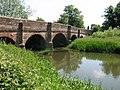
 Blythe Bridge - geograph.org.uk - 5470550.jpg 2,048 × 1,152; 933 KB
-
 Blythe Bridge and the B4114 - geograph.org.uk - 5668349.jpg 2,448 × 1,836; 1.73 MB
-
 Blythe Bridge from the south - geograph.org.uk - 5668354.jpg 2,448 × 1,836; 1.56 MB
-
 Blythe Road out of Coleshill - geograph.org.uk - 5335728.jpg 1,469 × 1,102; 793 KB
-
 Blythe Road, Coleshill - geograph.org.uk - 3336818.jpg 640 × 480; 56 KB
-
 Brick barn at The Bogs Farm - geograph.org.uk - 5199770.jpg 1,142 × 857; 475 KB
-

-
 Bridge over the Tame - geograph.org.uk - 5673559.jpg 1,469 × 1,102; 930 KB
-

-
 Cameo Cottage, Coleshill - geograph.org.uk - 5812575.jpg 2,774 × 2,081; 1.55 MB
-
 Car park, Church Hill, Coleshill, November 1981 - geograph.org.uk - 2082600.jpg 1,080 × 720; 362 KB
-
 Chantry House, Coleshill - geograph.org.uk - 5818266.jpg 2,648 × 1,984; 1.64 MB
-

-
 Churchyard cross, St Peter ^ St Paul church - geograph.org.uk - 5941778.jpg 1,836 × 2,448; 1.78 MB
-
 Cole Bridge at Cole End - geograph.org.uk - 5206442.jpg 1,306 × 979; 626 KB
-
 Cole End roundabout - geograph.org.uk - 5211563.jpg 1,469 × 1,102; 481 KB
-
 Colemeadow Road, Coleshill - geograph.org.uk - 5204390.jpg 1,306 × 979; 418 KB
-
-
 Coleshill , M42 Motorway - geograph.org.uk - 6626166.jpg 6,000 × 4,000; 6.8 MB
-
 Coleshill - B4117 at Sumner Road - geograph.org.uk - 3336828.jpg 640 × 480; 61 KB
-

-
 Coleshill Castle Farmhouse.JPG 2,689 × 1,899; 725 KB
-
 Coleshill Catholic Church - geograph.org.uk - 5278246.jpg 1,469 × 1,102; 766 KB
-

-
 Coleshill Cocksparrow Hall.JPG 4,000 × 3,000; 1.52 MB
-
 Coleshill Cut Tree Cottage.JPG 4,000 × 3,000; 2.24 MB
-
 Coleshill Duke End Bridge.JPG 4,000 × 3,000; 2.3 MB
-
 Coleshill Fire Station - geograph.org.uk - 418400.jpg 640 × 427; 205 KB
-
 Coleshill Frog Pond Cottage.JPG 4,000 × 3,000; 1.57 MB
-
 Coleshill Hall bridge - geograph.org.uk - 4568335.jpg 1,469 × 1,102; 508 KB
-
 Coleshill Hall Farmhouse - geograph.org.uk - 6103190.jpg 2,774 × 2,081; 1.95 MB
-
 Coleshill Harvester bar ^ grill - geograph.org.uk - 5206449.jpg 1,469 × 1,102; 422 KB
-

-
 Coleshill High Street - geograph.org.uk - 1342478.jpg 426 × 640; 98 KB
-
 Coleshill High Street - geograph.org.uk - 3549406.jpg 640 × 480; 260 KB
-
 Coleshill High Street.jpg 640 × 426; 71 KB
-
 Coleshill Industrial Estate - geograph.org.uk - 5206487.jpg 1,306 × 979; 357 KB
-
 Coleshill Interchange M42-M6 Toll - geograph.org.uk - 3786298.jpg 640 × 480; 236 KB
-
 Coleshill Manor buildings - geograph.org.uk - 6103208.jpg 2,611 × 1,958; 1.99 MB
-
 Coleshill Maxstoke School Farm Barn.JPG 4,000 × 3,000; 1.38 MB
-
 Coleshill Maxstoke School Farm Farmhouse.JPG 4,000 × 3,000; 1.15 MB
-
 Coleshill Parish Church (1980) - geograph.org.uk - 2165006.jpg 731 × 1,024; 103 KB
-
 Coleshill Parkway - geograph.org.uk - 3541548.jpg 640 × 480; 69 KB
-
 Coleshill Parkway - geograph.org.uk - 5698003.jpg 6,032 × 4,014; 5 MB
-

-
 Coleshill Parkway Station - geograph.org.uk - 5009407.jpg 2,000 × 1,333; 1.51 MB
-
 Coleshill Parkway.jpg 640 × 480; 82 KB
-
 Coleshill pillory - geograph.org.uk - 4934621.jpg 3,678 × 2,456; 4.83 MB
-
 Coleshill public library - geograph.org.uk - 5813532.jpg 2,081 × 2,774; 1.68 MB
-
 Coleshill School - geograph.org.uk - 5267542.jpg 1,632 × 1,224; 825 KB
-
 Coleshill Stocks.JPG 4,000 × 3,000; 1.55 MB
-
 Coleshill The Dairy Farm.JPG 4,000 × 3,000; 1.2 MB
-
 Coleshill Town Hall, High Street - geograph.org.uk - 3549377.jpg 640 × 480; 282 KB
-
 Coleshill War Memorial - geograph.org.uk - 4934613.jpg 3,679 × 2,455; 3.47 MB
-
 Coleshill War Memorial - geograph.org.uk - 4934617.jpg 4,439 × 3,667; 4.95 MB
-
 Coleshill War Memorial, Church Hill - geograph.org.uk - 3549389.jpg 640 × 480; 322 KB
-
 Coleshill Woodbine Cottage.JPG 4,000 × 3,000; 1.9 MB
-
 Coleshill, St.Peter and St. Paul's church and war memorial - geograph.org.uk - 4934605.jpg 3,716 × 3,510; 7.48 MB
-
 Coleshill, Warwickshire skyline.jpg 3,264 × 2,448; 1.78 MB
-

-

-
 Coventry Road at Hall Walk - geograph.org.uk - 3336842.jpg 640 × 480; 60 KB
-
 Coventry Road, Coleshill - geograph.org.uk - 5267545.jpg 1,632 × 1,224; 868 KB
-
 Derelict barns at The Bogs farm - geograph.org.uk - 5199741.jpg 1,142 × 857; 398 KB
-
 Derelict wet woodland, Bannerly Pool - geograph.org.uk - 3126222.jpg 640 × 480; 624 KB
-
 Descending to Coleshill crossroads - geograph.org.uk - 3336816.jpg 640 × 480; 62 KB
-
 Devereaux House, Church Hill, Coleshill - geograph.org.uk - 5941714.jpg 2,081 × 2,774; 1.46 MB
-
 Dismantled railway near Hawkeswell Farm - geograph.org.uk - 3131533.jpg 640 × 480; 500 KB
-
 Disused railway line - geograph.org.uk - 5277014.jpg 1,142 × 857; 640 KB
-
 Don Bosco House and statue, Coleshill.jpg 1,024 × 806; 316 KB
-
 Double line of trees, Hawkeswell Farm - geograph.org.uk - 3131562.jpg 640 × 480; 531 KB
-
 Dugdale Court, Coleshill - geograph.org.uk - 5276970.jpg 1,469 × 1,102; 692 KB
-
 Duke Bridge - geograph.org.uk - 5445748.jpg 1,469 × 1,102; 715 KB
-
 Earthwork by Gilson Drive - geograph.org.uk - 5240914.jpg 1,306 × 979; 556 KB
-
 Eastbound M6 at Coleshill - geograph.org.uk - 3303546.jpg 640 × 480; 496 KB
-
 Easterly view at The Bogs Farm - geograph.org.uk - 5199776.jpg 1,142 × 857; 459 KB
-
 Electricity at Junction 7a - geograph.org.uk - 3703268.jpg 2,575 × 3,407; 1.64 MB
-
 Electricity Pylon by the M42 link - geograph.org.uk - 4464338.jpg 4,216 × 2,139; 3.36 MB
-
 Ennersdale Close - geograph.org.uk - 390610.jpg 640 × 481; 83 KB
-

-
 Entrance to Coleshill Quarry - geograph.org.uk - 4346555.jpg 1,024 × 683; 188 KB
-

-
 Entrance to Temple Court - geograph.org.uk - 1586798.jpg 640 × 426; 63 KB
-
 Fair View, Coleshill - geograph.org.uk - 5335727.jpg 1,102 × 1,469; 598 KB
-
 Fairview High Street Coleshill.JPG 4,000 × 3,000; 1.04 MB
-
 Farmland east of Coleshill - geograph.org.uk - 5276963.jpg 1,306 × 979; 439 KB
-
 Ferndale House, Coleshill - geograph.org.uk - 5813522.jpg 2,448 × 1,836; 1.52 MB
-
 Field between Gilson Drive and the M42 - geograph.org.uk - 5230715.jpg 1,306 × 979; 532 KB
-
 Field edge south of Green Lane - geograph.org.uk - 5230720.jpg 1,306 × 979; 746 KB
-
 Field of rape stalks - geograph.org.uk - 3131279.jpg 640 × 480; 437 KB
-
 Flooding at Old Railway Bridge - geograph.org.uk - 582643.jpg 640 × 360; 71 KB
-
 Footbridge across the Blythe in the rain - geograph.org.uk - 3131267.jpg 640 × 480; 504 KB
-
 Footbridge over the M42, J4a - geograph.org.uk - 3125218.jpg 640 × 430; 50 KB
-
 Footbridge over the M42- M6 (Toll) - geograph.org.uk - 2725008.jpg 640 × 480; 52 KB
-
 Footbridge over the M6 (Toll)-M42 - geograph.org.uk - 2676393.jpg 640 × 382; 44 KB
-

-

-
 Footpath from Maxstoke Golf Course - geograph.org.uk - 390958.jpg 640 × 481; 155 KB
-
 Footpath in The Catmore - geograph.org.uk - 5230718.jpg 979 × 1,306; 817 KB
-
 Footpath junction ^ - geograph.org.uk - 390570.jpg 640 × 481; 52 KB
-
 Footpath north of the landfill site - geograph.org.uk - 5107896.jpg 1,142 × 857; 657 KB
-
 Footpath through The Belt - geograph.org.uk - 5240922.jpg 979 × 1,306; 782 KB
-
 Former Midland-HSBC Bank, Coleshill - geograph.org.uk - 5204410.jpg 1,469 × 1,102; 435 KB
-
 Former police station and courthouse - geograph.org.uk - 5204395.jpg 1,306 × 979; 445 KB
-
 Gantry over the M42 - geograph.org.uk - 3197204.jpg 3,983 × 2,833; 2.21 MB
-
 Gantry over the M42 at junction 7 - geograph.org.uk - 3197211.jpg 4,041 × 1,810; 1.5 MB
-
 Gantry with advance sign for junction 9 of M42 - geograph.org.uk - 3193409.jpg 1,024 × 768; 525 KB
-
 George and Dragon Public House - geograph.org.uk - 905290.jpg 640 × 480; 91 KB
-
 Gorsey Lane at the junction with the A446 - geograph.org.uk - 5206490.jpg 1,142 × 857; 443 KB
-
 Green Lane bridge over M42 and M6 toll - geograph.org.uk - 3193327.jpg 1,024 × 512; 325 KB
-

-
 Green Lane overbridge - geograph.org.uk - 4103365.jpg 1,142 × 857; 289 KB
-
 Hawkeswell Farm, Coleshill - geograph.org.uk - 5276959.jpg 1,469 × 1,102; 687 KB
-
 Hawkeswell Lane - geograph.org.uk - 5276967.jpg 1,306 × 979; 690 KB
-
 Hawkeswell Lane leaves Packington Lane - geograph.org.uk - 5267549.jpg 1,632 × 1,224; 922 KB
-
 High Street, Coleshill - geograph.org.uk - 2386742.jpg 950 × 675; 372 KB
-
 Houses on Gorsey Way, Chattle Hill - geograph.org.uk - 5211557.jpg 1,306 × 979; 455 KB
-
 Industrial Estate by the railway - geograph.org.uk - 4461945.jpg 640 × 426; 51 KB
-

-
-

-
 Inside M42 junction 8 - geograph.org.uk - 3195183.jpg 800 × 600; 55 KB
-
 Irrigation or stormwater pool^ - geograph.org.uk - 4103396.jpg 1,142 × 857; 425 KB
-
-
 Joining the M42 - geograph.org.uk - 1888003.jpg 640 × 480; 54 KB
-
 Joining the M42 - geograph.org.uk - 4597245.jpg 1,936 × 1,252; 923 KB
-
 Junction 7a, M42 - geograph.org.uk - 2676409.jpg 640 × 413; 55 KB
-
 Keepers Spinney - geograph.org.uk - 390930.jpg 640 × 481; 73 KB
-
 Laburnam House, Coleshill - geograph.org.uk - 5963169.jpg 2,938 × 2,203; 1.54 MB
-
 Large Building Site on Church Hill - geograph.org.uk - 5914511.jpg 4,128 × 2,322; 1.99 MB
-
 Last house out of Coleshill - geograph.org.uk - 5335729.jpg 1,469 × 1,102; 524 KB
-

-
 Link road from M6 south to M42 - geograph.org.uk - 4226876.jpg 640 × 417; 45 KB
-
 Listed chest tomb in the churchyard - geograph.org.uk - 5941769.jpg 2,285 × 1,714; 1.73 MB
-

-
 Loggia - geograph.org.uk - 1230748.jpg 640 × 426; 114 KB
-

-

-

-

-

-
 M42 - M6 Toll Interchange - geograph.org.uk - 3703452.jpg 3,359 × 2,537; 1.85 MB
-
 M42 descends to the M6 Toll - geograph.org.uk - 2332590.jpg 640 × 480; 52 KB
-
 M42 Link Road from M6 - geograph.org.uk - 3786293.jpg 640 × 480; 256 KB
-

-
 M42 link to the M6 - geograph.org.uk - 4688314.jpg 1,142 × 857; 385 KB
-


_station_site_geograph-3095855-by-Ben-Brooksbank.jpg)


_-_geograph.org.uk_-_2165006.jpg)


_-_geograph.org.uk_-_2725008.jpg)
-M42_-_geograph.org.uk_-_2676393.jpg)


_-_geograph.org.uk_-_2724965.jpg)


