Category:Coldsmouth Hill
Jump to navigation
Jump to search
Media in category "Coldsmouth Hill"
The following 14 files are in this category, out of 14 total.
-
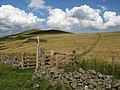 Border fence and Eccles Cairn - geograph.org.uk - 1438488.jpg 640 × 480; 102 KB
-
 Border landscape - geograph.org.uk - 1438556.jpg 640 × 480; 102 KB
-
 Cairns on Coldsmouth Hill - geograph.org.uk - 1636933.jpg 640 × 265; 208 KB
-
 Cairns on Coldsmouth Hill - geograph.org.uk - 1636990.jpg 640 × 427; 150 KB
-
 Coldsmouth Hill - geograph.org.uk - 160834.jpg 640 × 477; 82 KB
-
 Eccles Cairn - geograph.org.uk - 1636966.jpg 640 × 427; 148 KB
-
 Looking towards Coldsmouth Hill from Eccles Cairn - geograph.org.uk - 2212990.jpg 2,592 × 1,944; 1.37 MB
-
 Madam Law's Cairn - geograph.org.uk - 150704.jpg 640 × 418; 103 KB
-
 Northern Cheviots - geograph.org.uk - 147176.jpg 640 × 479; 103 KB
-
 Scaldhill Shank - geograph.org.uk - 777714.jpg 640 × 480; 55 KB
-
 Sheepfold below Ring Chesters - geograph.org.uk - 1514601.jpg 640 × 426; 195 KB
-
 The Border from Whitelaw Nick - geograph.org.uk - 1954728.jpg 800 × 530; 162 KB
-
 The summit of Burnt Humbleton - geograph.org.uk - 1526956.jpg 640 × 480; 101 KB
-
 Upper Kilham valley - geograph.org.uk - 146937.jpg 640 × 475; 133 KB


