Category:Col du Cendrier
Jump to navigation
Jump to search
 | |||||
| Upload media | |||||
| Instance of | |||||
|---|---|---|---|---|---|
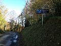
| Location | Boyeux-Saint-Jérôme, Ain, Auvergne-Rhône-Alpes, Metropolitan France, France | ||||
| Mountain range | |||||
| Elevation above sea level |
| ||||
 | |||||
Media in category "Col du Cendrier"
The following 2 files are in this category, out of 2 total.
-
 Col du Cendrier dans l'Ain - 2.JPG 3,264 × 2,448; 3.75 MB
-
 Col du Cendrier dans l'Ain.JPG 3,264 × 2,448; 4.64 MB
