Category:Col de Perjuret
Jump to navigation
Jump to search
| Object location | | View all coordinates using: OpenStreetMap |
|---|
 | |||||
| Upload media | |||||
| Instance of | |||||
|---|---|---|---|---|---|
| Located in protected area | |||||
| Location | |||||
| Mountain range | |||||
| Elevation above sea level |
| ||||
 | |||||
Media in category "Col de Perjuret"
The following 11 files are in this category, out of 11 total.
-
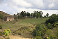
 Col de Perjuret.jpg 3,872 × 2,592; 4.63 MB
-
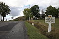
 FR48 Fraissinet-de-Fourques Col de Perjuret 00.JPG 3,888 × 2,592; 8.41 MB
-
 FR48 Fraissinet-de-Fourques Col de Perjuret 01.JPG 3,888 × 2,592; 8.91 MB
-
 FR48 Fraissinet-de-Fourques Col de Perjuret 02.JPG 3,888 × 2,592; 8.76 MB
-
 FR48 Fraissinet-de-Fourques Col de Perjuret 03.JPG 3,888 × 2,592; 9.2 MB
-
 FR48 Fraissinet-de-Fourques Col de Perjuret 04.JPG 3,888 × 2,592; 8.62 MB
-
 FR48 Fraissinet-de-Fourques Col de Perjuret 05.JPG 2,592 × 3,888; 10.32 MB
-
 FR48 Fraissinet-de-Fourques Col de Perjuret 06.JPG 3,888 × 2,592; 8.02 MB
-
 FR48 Fraissinet-de-Fourques Col de Perjuret 07.JPG 3,888 × 2,592; 8.41 MB
-
 FR48 Fraissinet-de-Fourques Col de Perjuret 08.JPG 3,888 × 2,592; 8.88 MB
-
 FR48 Fraissinet-de-Fourques Col de Perjuret 09.JPG 3,888 × 2,592; 8.71 MB


