Category:Colònia Majem
Jump to navigation
Jump to search
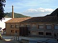
Català: Colònia Majem (les Planes d'Hostoles)
This is a category about a building listed in the Catalan heritage register as Bé Cultural d'Interès Local (BCIL) under the reference IPA-10085. |
| Object location | | View all coordinates using: OpenStreetMap |
|---|
human settlement in Les Planes d'Hostoles, Garrotxa, Girona Province, Spain _2.jpg) | |||||
| Upload media | |||||
| Instance of | |||||
|---|---|---|---|---|---|
| Location | Les Planes d'Hostoles, Garrotxa, Province of Girona, Catalonia | ||||
| Street address |
| ||||
| Architectural style | |||||
| Heritage designation |
| ||||
| Elevation above sea level |
| ||||
 | |||||
Media in category "Colònia Majem"
The following 2 files are in this category, out of 2 total.
-
 Colònia Majem (les Planes d'Hostoles) 1.jpg 5,152 × 3,864; 7.44 MB
-
 Colònia Majem (les Planes d'Hostoles) 2.jpg 5,152 × 3,864; 5.39 MB
_1.jpg)