Category:Cogenhoe
Jump to navigation
Jump to search
English: Cogenhoe is a village in the civil parish of Cogenhoe and Whiston, in the South Northamptonshire district, in the county of Northamptonshire, England.
village in Northamptonshire, United Kingdom | |||||
| Upload media | |||||
| Instance of | |||||
|---|---|---|---|---|---|
| Location | Cogenhoe and Whiston, West Northamptonshire, Northamptonshire, East Midlands, England | ||||
| official website | |||||
 | |||||
Media in category "Cogenhoe"
The following 18 files are in this category, out of 18 total.
-
Cogenhoe Mill - geograph.org.uk - 162050.jpg 640 × 480; 89 KB
-
Cogenhoe Pocket Park - geograph.org.uk - 3549308.jpg 478 × 640; 123 KB
-
Cogenhoe War Memorial - geograph.org.uk - 1371923.jpg 640 × 503; 507 KB
-
Entering Cogenhoe along the Nene Way - geograph.org.uk - 171401.jpg 640 × 480; 100 KB
-
Footpath to Cogenhoe - geograph.org.uk - 3549321.jpg 640 × 478; 104 KB
-
Footpath to Denton - geograph.org.uk - 3549275.jpg 478 × 640; 104 KB
-
Poignant Grave Stone - geograph.org.uk - 1371927.jpg 640 × 480; 375 KB
-
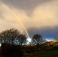
RainbowG.jpg 1,200 × 1,177; 222 KB
-
Royal Oak Inn Sign, 2009 - geograph.org.uk - 1371964.jpg 640 × 580; 463 KB
-
Station Road, Cogenhoe - geograph.org.uk - 171412.jpg 640 × 480; 78 KB
-
The Royal Oak Public House, Cogenhoe - geograph.org.uk - 117896.jpg 640 × 478; 109 KB
-
Village Sign Cogenhoe - geograph.org.uk - 1053747.jpg 428 × 640; 257 KB
-
Station Road - geograph.org.uk - 171416.jpg 640 × 480; 89 KB
-
Towards the Nene - geograph.org.uk - 161939.jpg 640 × 480; 113 KB
-
View towards the Nene Valley - geograph.org.uk - 171695.jpg 640 × 480; 93 KB


