Category:Coasts of County Donegal
Jump to navigation
Jump to search
Subcategories
This category has the following 4 subcategories, out of 4 total.
B
- Bloody Foreland (11 F)
L
- Lenan Head Fort (12 F)
- Low tide in County Donegal (7 F)
Media in category "Coasts of County Donegal"
The following 200 files are in this category, out of 335 total.
(previous page) (next page)-
 "Crystal Dawn" and "Rí na Mara" - geograph.org.uk - 2523759.jpg 640 × 480; 51 KB
-
 "Inver Lass", St. John's Point - geograph.org.uk - 5500454.jpg 640 × 481; 169 KB
-
 A lighthouse on Lough Foyle - geograph.org.uk - 5334778.jpg 2,000 × 1,333; 2.16 MB
-
 A lobster boat beached at Tra na Cruit - geograph.org.uk - 3230062.jpg 1,024 × 767; 148 KB
-
 A long way down from the cliff road - geograph.org.uk - 6473998.jpg 4,000 × 3,000; 2.15 MB
-
 A small harbour - geograph.org.uk - 5513146.jpg 2,000 × 1,333; 1.67 MB
-
 An isolated house - geograph.org.uk - 5507279.jpg 2,000 × 1,333; 2.05 MB
-
 Atlantic Coast at Port - geograph.org.uk - 1156101.jpg 640 × 426; 272 KB
-
 Atlantic coast at Port - geograph.org.uk - 1156103.jpg 640 × 426; 229 KB
-
 Atlantic Ocean - geograph.org.uk - 2437050.jpg 640 × 480; 44 KB
-
 Atlantic Ocean - geograph.org.uk - 2524186.jpg 640 × 480; 47 KB
-
 Back Strand - geograph.org.uk - 3900904.jpg 640 × 427; 43 KB
-
 Back Strand - geograph.org.uk - 884938.jpg 640 × 480; 89 KB
-
 Ballymastoker Bay - geograph.org.uk - 3595466.jpg 640 × 360; 205 KB
-
 Ballyness Bay - geograph.org.uk - 3993671.jpg 640 × 427; 437 KB
-
 Ballyness Bay - geograph.org.uk - 6195600.jpg 1,024 × 576; 115 KB
-
 Ballyness Pier - geograph.org.uk - 3993655.jpg 640 × 424; 392 KB
-
 Ballysaggart Friary in front of Inver Bay 2010 09 22.jpg 3,504 × 2,336; 4.31 MB
-
 Ballywhoriskey pier - geograph.org.uk - 1313813.jpg 640 × 475; 58 KB
-
 Bathing in Donegal - geograph.org.uk - 2517765.jpg 640 × 480; 64 KB
-
 Bay at Knockfola - geograph.org.uk - 5027269.jpg 1,024 × 676; 168 KB
-
 Beach at Mucros - geograph.org.uk - 4013919.jpg 640 × 408; 366 KB
-
 Beach at St John's Point - geograph.org.uk - 3025709.jpg 640 × 480; 56 KB
-
 Beach below Pollet - geograph.org.uk - 1933828.jpg 640 × 480; 91 KB
-
 Beach near Ards Friary - geograph.org.uk - 4105046.jpg 640 × 380; 75 KB
-
 Beach north of Ned's Point - geograph.org.uk - 2305023.jpg 3,072 × 2,304; 4.52 MB
-
 Beach west of R257 near Glashagh - geograph.org.uk - 1159772.jpg 640 × 426; 325 KB
-
 Beach, Dunaff - geograph.org.uk - 4006926.jpg 640 × 360; 222 KB
-
 Beds in traction - geograph.org.uk - 2554520.jpg 640 × 480; 89 KB
-
 Belle's Island - geograph.org.uk - 914349.jpg 640 × 480; 43 KB
-
 Bend in road at Ballylin - geograph.org.uk - 6561958.jpg 1,024 × 685; 270 KB
-
 Blue flag beach, Tramore Strand - geograph.org.uk - 4538070.jpg 640 × 480; 141 KB
-
 Boat at Anchor in Inch Harbour - geograph.org.uk - 3086295.jpg 3,008 × 2,000; 2.52 MB
-

-
 Boat, Carrickfin - geograph.org.uk - 2424708.jpg 640 × 480; 51 KB
-
 Boat, Rossbeg - geograph.org.uk - 3025564.jpg 640 × 480; 40 KB
-
 Boats near Towney Pier - geograph.org.uk - 3534179.jpg 640 × 480; 38 KB
-
 Boats, Cruit Island - geograph.org.uk - 2426009.jpg 640 × 480; 47 KB
-
 Boulder Beach - geograph.org.uk - 3994474.jpg 640 × 411; 352 KB
-
 Broken Blocks - geograph.org.uk - 3994487.jpg 640 × 427; 431 KB
-
 Bundoran coast, Ireland.jpg 4,128 × 2,322; 2.73 MB
-
 Bundoran Strand, Co. Donegal.jpg 2,560 × 1,920; 2.28 MB
-
 Béal an Bheara (Gweebarra Bay) - geograph.org.uk - 2517761.jpg 640 × 480; 37 KB
-
 Cahirs Hill - geograph.org.uk - 1337021.jpg 640 × 479; 57 KB
-
 Caravan site - geograph.org.uk - 1032571.jpg 640 × 480; 106 KB
-
 Carrick pier - geograph.org.uk - 2426172.jpg 640 × 480; 45 KB
-
 Carrigan Head - geograph.org.uk - 2523817.jpg 640 × 480; 42 KB
-

-
 Cerca de Dunloe - panoramio.jpg 1,760 × 1,168; 182 KB
-
 Cliff scenery west of Crockaclogher - geograph.org.uk - 1051328.jpg 640 × 480; 90 KB
-
 Cliffs and Kilbarron Castle - geograph.org.uk - 942890.jpg 640 × 480; 98 KB
-
 Cliffs by Bundoran - geograph.org.uk - 2535829.jpg 640 × 480; 91 KB
-
 Cliffs near Claggan - geograph.org.uk - 3993757.jpg 640 × 423; 371 KB
-
 Cliffs of north east Tory Island - geograph.org.uk - 673995.jpg 640 × 480; 101 KB
-
 Cliffs on Ros Guill - geograph.org.uk - 3994466.jpg 640 × 412; 364 KB
-
 Clifftop Pool - geograph.org.uk - 3994469.jpg 427 × 640; 357 KB
-
 Clifftop road at Inishowen Head - geograph.org.uk - 909090.jpg 640 × 480; 74 KB
-
 Cnocfola335.jpg 500 × 375; 50 KB
-
 Coast at Leenan - panoramio.jpg 2,048 × 1,536; 1.37 MB
-
 Coast at Port - geograph.org.uk - 924940.jpg 640 × 480; 79 KB
-
 Coast of Northwest Donegal - geograph.org.uk - 5027031.jpg 1,024 × 682; 178 KB
-
 Coast path - geograph.org.uk - 5508731.jpg 2,000 × 1,333; 2.15 MB
-
 Coast Path - geograph.org.uk - 5508744.jpg 2,000 × 1,333; 2.21 MB
-
 Coast-line, Ballyboyle - geograph.org.uk - 3027738.jpg 640 × 480; 64 KB
-
 Coastal Farm - geograph.org.uk - 861597.jpg 480 × 640; 75 KB
-
 Coastal path - geograph.org.uk - 5508761.jpg 2,000 × 1,333; 2.15 MB
-
 Coastal path, Ned's Point - geograph.org.uk - 4576921.jpg 640 × 480; 189 KB
-
 Coastal path, Ned's Point - geograph.org.uk - 4576937.jpg 640 × 480; 176 KB
-
 Coastal path, north of Ned's Point - geograph.org.uk - 2595255.jpg 640 × 480; 67 KB
-
 Coastal scene (1) - geograph.org.uk - 5512685.jpg 4,320 × 3,240; 2.82 MB
-
 Coastal scenery west of Horn Head - geograph.org.uk - 1051315.jpg 640 × 480; 88 KB
-
 Coastal walk, Kildoney - geograph.org.uk - 1241749.jpg 640 × 427; 117 KB
-
 Coastguard station, Ned's Point - geograph.org.uk - 2595218.jpg 640 × 480; 42 KB
-
 Coastline, Croaghan - geograph.org.uk - 4001751.jpg 640 × 480; 274 KB
-
 Contact Metamorphism - geograph.org.uk - 3994548.jpg 640 × 427; 464 KB
-
 Contact of Limestone and Dolerite - geograph.org.uk - 3994492.jpg 418 × 640; 371 KB
-
 Cottages near the Shore at Dunuisce - geograph.org.uk - 5674290.jpg 640 × 427; 328 KB
-
 Countryside at Claggan - geograph.org.uk - 873738.jpg 640 × 480; 65 KB
-
 Cove at Cassan Sound - geograph.org.uk - 1214786.jpg 640 × 360; 79 KB
-
 Cove below Rabley Hill - geograph.org.uk - 2553727.jpg 640 × 480; 96 KB
-
 Crockacooan Townland - geograph.org.uk - 3025100.jpg 640 × 480; 46 KB
-
 Cruit Island Rock.jpg 2,956 × 3,941; 5.63 MB
-
 Dark Cliffs at Kilbarron - geograph.org.uk - 942905.jpg 480 × 640; 98 KB
-
 Dead dolphin on slipway - geograph.org.uk - 2419154.jpg 640 × 480; 94 KB
-
 Dead dolphin, close-up - geograph.org.uk - 2419159.jpg 640 × 480; 126 KB
-
 Discarded shells, Trawbreaga Bay - geograph.org.uk - 1359747.jpg 640 × 479; 97 KB
-
 Doagh Beach - geograph.org.uk - 3994583.jpg 640 × 421; 396 KB
-
 Donegal Bay - geograph.org.uk - 819554.jpg 640 × 480; 69 KB
-
 Donegal Bay inlet at Mullanasole - geograph.org.uk - 2555614.jpg 640 × 480; 57 KB
-
 Dooey Townland - geograph.org.uk - 3025542.jpg 640 × 480; 56 KB
-
 Doorin Head - geograph.org.uk - 2810801.jpg 1,011 × 1,024; 152 KB
-
 Downings - Coastal View - geograph.org.uk - 4676072.jpg 1,632 × 918; 266 KB
-
 Downings Harbour - geograph.org.uk - 1956528.jpg 640 × 480; 195 KB
-
 Drongawn Lough - geograph.org.uk - 6561954.jpg 1,024 × 685; 288 KB
-
 Drumgun Bay from the N56 - geograph.org.uk - 3245479.jpg 1,024 × 642; 63 KB
-

-
 Dunree Fort, Donegal.jpg 3,024 × 4,032; 3.66 MB
-
 Dunree Head, County Donegal - geograph.org.uk - 4006322.jpg 640 × 480; 163 KB
-
 Dunuisce, Co Donegal - geograph.org.uk - 5672172.jpg 640 × 427; 305 KB
-

-

-
 Dyke on the Beach - geograph.org.uk - 4006905.jpg 640 × 364; 394 KB
-
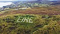 EIRE Sign Glengad Head near LOP 81.jpg 1,920 × 1,080; 2.12 MB
-
 Enjoying the view at Carrigan Head - geograph.org.uk - 2523819.jpg 640 × 480; 40 KB
-
 Entrance to Trawmore Strand - geograph.org.uk - 1161330.jpg 640 × 426; 250 KB
-
 Eroding drumlin - geograph.org.uk - 2553736.jpg 640 × 480; 95 KB
-

-

-
 Fairy bridge, Bundoran, Ireland.jpg 4,128 × 2,322; 4.55 MB
-
 Falcarragh Pelite - geograph.org.uk - 3993662.jpg 427 × 640; 489 KB
-
 Farm near the Shore, Rossmore - geograph.org.uk - 5674285.jpg 640 × 427; 317 KB
-
 Fishfarm, Inniskil - geograph.org.uk - 2602902.jpg 640 × 480; 48 KB
-
 Fishing off St. John's Point - geograph.org.uk - 5500453.jpg 640 × 480; 147 KB
-
 Fishing on a sunbeam - geograph.org.uk - 1025528.jpg 640 × 480; 61 KB
-
 Five Fingers - geograph.org.uk - 3551054.jpg 640 × 480; 68 KB
-
 Folded Rocks (3) - geograph.org.uk - 4013825.jpg 640 × 427; 527 KB
-
 Folded strata - geograph.org.uk - 2553754.jpg 640 × 480; 98 KB
-

-
 Former Coastguard Station at Summerhill - geograph.org.uk - 5672632.jpg 640 × 480; 385 KB
-
 From the viewpoint looking along a rugged coast - geograph.org.uk - 6475135.jpg 4,000 × 3,000; 1.95 MB
-
 Gate to farmland near the sea - geograph.org.uk - 910132.jpg 640 × 448; 93 KB
-
 Geo near Downies - geograph.org.uk - 3994426.jpg 427 × 640; 410 KB
-
 Geo near Downies - geograph.org.uk - 3994498.jpg 415 × 640; 429 KB
-
 Giants Chair and Table rocks beneath the cliffs (2) - geograph.org.uk - 6475150.jpg 4,000 × 3,000; 3.48 MB
-
 Giants Chair and Table rocks beneath the cliffs - geograph.org.uk - 6475146.jpg 4,000 × 3,000; 3.99 MB
-
 Glashagh Bay - geograph.org.uk - 1918586.jpg 640 × 480; 52 KB
-
 Glashagh Bay - geograph.org.uk - 1918591.jpg 640 × 480; 57 KB
-
 Glashedy Island - geograph.org.uk - 3668127.jpg 640 × 480; 40 KB
-
 Glen Head from Skelpoonagh Bay - geograph.org.uk - 4013818.jpg 640 × 425; 413 KB
-
 Glencolumbkille - 1992 - geograph.org.uk - 3551536.jpg 2,271 × 1,514; 593 KB
-
 Glencolumbkille - 1992 - geograph.org.uk - 3553335.jpg 2,271 × 1,514; 472 KB
-
 Glencolumbkille - 1992 - geograph.org.uk - 3553382.jpg 2,270 × 1,514; 649 KB
-
 Gobrinatroirk, the west extremity of Inishbofin - geograph.org.uk - 5015145.jpg 1,024 × 674; 136 KB
-
 Gortnasate, Kincasslagh - geograph.org.uk - 2426018.jpg 640 × 480; 43 KB
-

-
 Grianán Ailigh - geograph.org.uk - 4022770.jpg 640 × 480; 252 KB
-

-
 Gweedore Bay inlet near Bun Beg Harbour - geograph.org.uk - 1338486.jpg 640 × 426; 116 KB
-
 Headland at Kildoney - geograph.org.uk - 1241810.jpg 640 × 427; 107 KB
-
 Horse, Tramore Strand - geograph.org.uk - 4533550.jpg 640 × 480; 34 KB
-
 Hotel view (2) - geograph.org.uk - 5512007.jpg 4,320 × 3,240; 2.58 MB
-
 Hotel view (3) - geograph.org.uk - 5512054.jpg 4,320 × 3,240; 3.63 MB
-
 Illanaran, Co. Donegal, Ireland - panoramio.jpg 2,355 × 1,598; 823 KB
-
 Inch Level - geograph.org.uk - 1030592.jpg 640 × 479; 61 KB
-
 Information plaque at Portcille - geograph.org.uk - 909105.jpg 640 × 480; 88 KB
-
 Inis Bó Finne (Inisbofin) - geograph.org.uk - 5015117.jpg 1,024 × 679; 97 KB
-
 Inis Caoil (Inniskeel Island) - geograph.org.uk - 4533572.jpg 640 × 480; 132 KB
-
 Inniskeel Island - geograph.org.uk - 4533533.jpg 640 × 480; 88 KB
-
 Inniskeel Island, County Donegal - geograph.org.uk - 4538085.jpg 640 × 480; 132 KB
-
 Jetty on rock outcrop - geograph.org.uk - 2553671.jpg 640 × 480; 93 KB
-
 Kilbarron Castle Wall on Cliffs - geograph.org.uk - 942879.jpg 480 × 640; 105 KB
-
 Kildoney Fields and Tullan Strand - geograph.org.uk - 943265.jpg 480 × 640; 69 KB
-
 Kinnagoe Bay - geograph.org.uk - 4605357.jpg 3,648 × 2,736; 5.13 MB
-
 Large rock on the foreshore - geograph.org.uk - 1382966.jpg 640 × 480; 113 KB
-
 Leat More - geograph.org.uk - 1928988.jpg 640 × 480; 43 KB
-
 Leckpeggy - geograph.org.uk - 943112.jpg 640 × 480; 93 KB
-
 Lehan Bay - geograph.org.uk - 6312466.jpg 1,600 × 900; 453 KB
-
 Lenan Fort from Mamore Hills 1991.jpg 4,190 × 2,767; 2.66 MB
-
 Lengthy sloping grassland running to the sea - geograph.org.uk - 2527176.jpg 1,111 × 833; 472 KB
-
 Limestone pavement - geograph.org.uk - 2553684.jpg 640 × 480; 89 KB
-
 Looking at the Foyle estuary - geograph.org.uk - 5507283.jpg 2,000 × 1,333; 2.69 MB
-
 Looking Northwest near Doagh Village - geograph.org.uk - 6174261.jpg 768 × 1,024; 91 KB
-
 Looking over Gleann Colm Cille from Dooey Hostel - geograph.org.uk - 5933979.jpg 1,024 × 576; 100 KB
-

-
 Lough Foyle - geograph.org.uk - 4025011.jpg 640 × 480; 308 KB
-

-

-
 Loughros More Bay - geograph.org.uk - 2419169.jpg 640 × 480; 70 KB
-
 Lower Town, Meenaclady - geograph.org.uk - 2437058.jpg 640 × 480; 55 KB
-
 Malin Head (1) - geograph.org.uk - 5507996.jpg 4,320 × 3,240; 1.76 MB
-
 Malin Head (2019).jpg 5,405 × 3,601; 15.22 MB
-
 Malin Head to the Wild Atlantic - geograph.org.uk - 4605459.jpg 3,648 × 2,736; 4.6 MB
-
 Mannequins on the Lough - geograph.org.uk - 5679908.jpg 640 × 480; 392 KB
-
 Marble Arch - geograph.org.uk - 3994035.jpg 640 × 421; 381 KB
-
 Marble Arch - geograph.org.uk - 3994041.jpg 595 × 640; 495 KB
-
 Marble Arch on Horn Head - geograph.org.uk - 2525976.jpg 640 × 480; 125 KB
-
 Marble Hill Strand (8) - geograph.org.uk - 774547.jpg 640 × 480; 323 KB
-
 McSwyne's Bay, County Donegal - geograph.org.uk - 2530426.jpg 640 × 480; 48 KB
-
 McSwyne's Gun - geograph.org.uk - 1427223.jpg 640 × 480; 83 KB
-

-
 Meenaclady - East of Bloody Foreland - geograph.org.uk - 1180586.jpg 639 × 426; 341 KB
-

-
 Mini beach, Ned's Point - geograph.org.uk - 4576927.jpg 640 × 480; 184 KB
-
 Moanrealtagh Point - geograph.org.uk - 1359739.jpg 640 × 479; 60 KB
-
 Mooring bollard, Downings - geograph.org.uk - 4453435.jpg 640 × 612; 111 KB
-
 Muckros shore - geograph.org.uk - 2565809.jpg 640 × 480; 99 KB
-
 Muckross head - geograph.org.uk - 4509291.jpg 2,592 × 1,944; 683 KB
-
 Natural Arch, Donegal Coast - geograph.org.uk - 6555714.jpg 2,592 × 1,936; 1.11 MB
-
 Natural arch, White Vein - geograph.org.uk - 1051335.jpg 640 × 480; 89 KB
-
 Near Ballyhooriskey harbour - geograph.org.uk - 1919991.jpg 640 × 480; 67 KB
-
 Near Cavan Point - geograph.org.uk - 4956695.jpg 640 × 480; 160 KB
-
 Near Clonmass Point - geograph.org.uk - 774548.jpg 640 × 480; 435 KB
-
 Near Rough Point - geograph.org.uk - 2568249.jpg 640 × 480; 55 KB
-
 Net Veining - geograph.org.uk - 3996496.jpg 640 × 422; 417 KB
-
 North coast of Tory - geograph.org.uk - 3902908.jpg 640 × 427; 38 KB
-
 North end of Five Fingers Strand - geograph.org.uk - 3551057.jpg 640 × 480; 95 KB
-
 Old boats at Ballyness Bay - geograph.org.uk - 5014810.jpg 1,024 × 675; 217 KB
-
 Old jetty - geograph.org.uk - 2554492.jpg 640 × 480; 91 KB
-
 On the cliffs near Crockaclogher - geograph.org.uk - 1051323.jpg 640 × 480; 96 KB
-
 Owey Island harbour - geograph.org.uk - 2987317.jpg 640 × 480; 160 KB


_-_geograph.org.uk_-_2517761.jpg)


_-_geograph.org.uk_-_5512685.jpg)


_-_geograph.org.uk_-_4013825.jpg)


_-_geograph.org.uk_-_6475150.jpg)


_-_geograph.org.uk_-_5512007.jpg)
_-_geograph.org.uk_-_5512054.jpg)


_-_geograph.org.uk_-_5015117.jpg)
_-_geograph.org.uk_-_4533572.jpg)


_-_geograph.org.uk_-_3025712.jpg)


_-_geograph.org.uk_-_5507996.jpg)
.jpg)


_-_geograph.org.uk_-_774547.jpg)


