Category:Coastal fortifications of World War II in the United Kingdom
Jump to navigation
Jump to search

Subcategories
This category has the following 9 subcategories, out of 9 total.
Media in category "Coastal fortifications of World War II in the United Kingdom"
The following 50 files are in this category, out of 50 total.
-
 Allen-Williams turret near Worbarrow Bay - geograph.org.uk - 1632424.jpg 640 × 480; 125 KB
-
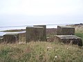
 Anti-tank blocks Chesil Beach.jpg 2,848 × 2,136; 1.49 MB
-
 Anti-Tank Concrete Blocks, Findhorn - geograph.org.uk - 550321.jpg 640 × 427; 254 KB
-
 Anti-Tank Concrete Blocks, Findhorn Beach - geograph.org.uk - 550088.jpg 640 × 376; 212 KB
-

-
 Anti-Tank Cubes in Higham Creek - geograph.org.uk - 1087763.jpg 640 × 481; 67 KB
-
 Beach huts at Charmouth - geograph.org.uk - 886449.jpg 640 × 426; 82 KB
-
 Beacon Hill Battery Harwich XDO Post 2020.png 2,560 × 1,536; 3.6 MB
-

-
 Britain's Coastal Defences 1939-45 H7918.jpg 2,356 × 1,772; 1.03 MB
-

-
 Coastal defenses WWII - geograph.org.uk - 640812.jpg 500 × 333; 212 KB
-

-
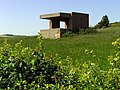
 Emergency Coastal Battery, Freiston Shore.JPG 1,280 × 960; 323 KB
-
 Firth of Tay - geograph.org.uk - 1764532.jpg 640 × 480; 102 KB
-

-
 Former coastal lookout post, Upton - geograph.org.uk - 1322216.jpg 640 × 480; 117 KB
-
 Guarding the High Light - geograph.org.uk - 978616.jpg 640 × 458; 154 KB
-
 Gun emplacement on Chapel Hill - geograph.org.uk - 438059.jpg 640 × 477; 109 KB
-
 Kimmeridge, crocodile teeth - geograph.org.uk - 1411427.jpg 640 × 480; 105 KB
-
 Pill Box - geograph.org.uk - 580975.jpg 417 × 640; 240 KB
-
 Pill box at Porlock Weir - geograph.org.uk - 20099.jpg 640 × 512; 106 KB
-
 Pill Box on Mersea Island - geograph.org.uk - 5347.jpg 640 × 426; 40 KB
-
 Pill box remnant - geograph.org.uk - 1766371.jpg 1,024 × 683; 407 KB
-
 Section post (partial), Cayton Bay (rear).JPG 1,600 × 1,200; 630 KB
-
 Severn Estuary lookout point.jpg 1,280 × 960; 221 KB
-
 Sheppey Shell Ness 9177.JPG 2,592 × 1,944; 1.18 MB
-
 South Inch old gun implacement, Chapelton Shore, Seamill, North Ayrshire. Detail.jpg 4,875 × 2,281; 3.51 MB
-
 South Inch old gun implacement, Chapelton Shore, Seamill, North Ayrshire. View west.jpg 4,896 × 2,752; 3.55 MB
-
 South Inch old gun implacement, Chapelton Shore, Seamill, North Ayrshire.jpg 4,429 × 1,875; 2.03 MB
-
 Souvenirs of WW2 - geograph.org.uk - 1560449.jpg 640 × 480; 75 KB
-
 Steel turret overlooking Seacombe - geograph.org.uk - 1026142.jpg 640 × 480; 124 KB
-
 SWCP Lelant Towans.jpg 800 × 600; 182 KB
-
-
 Tank traps, Tentsmuir - geograph.org.uk - 8706.jpg 640 × 448; 96 KB
-
 Tank Traps,Tentsmuir Sands - geograph.org.uk - 408982.jpg 640 × 492; 182 KB
-
 Tentsmuir defences - geograph.org.uk - 764065.jpg 640 × 480; 65 KB
-
 Tentsmuir Sands - geograph.org.uk - 6478.jpg 640 × 480; 51 KB
-
 World War 2 beach defences - geograph.org.uk - 175018.jpg 640 × 480; 93 KB
-

-
 WW2 Anti-submarine fence - geograph.org.uk - 365678.jpg 640 × 480; 89 KB
-
 WW2 Buildings, Greatham Creek - geograph.org.uk - 118916.jpg 640 × 482; 71 KB
-
 WW2 circular pillbox, Sudbrook.jpg 2,848 × 2,136; 1.48 MB
-

-
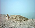
 WW2 coastal defence site, cramond island. - geograph.org.uk - 365890.jpg 640 × 480; 107 KB
-

-

-
-
 Porlock Weir pillbox - geograph.org.uk - 349349.jpg 640 × 480; 102 KB
-
 WW2 Pill box in Runswick Bay - geograph.org.uk - 439312.jpg 640 × 480; 123 KB


,_Cayton_Bay_(rear).JPG)


