Category:Clyst Honiton
Jump to navigation
Jump to search
village in the United Kingdom  | |||||
| Upload media | |||||
| Instance of | |||||
|---|---|---|---|---|---|
| Location | East Devon, Devon, South West England, England | ||||
| Population |
| ||||
| Area |
| ||||
 | |||||
Subcategories
This category has the following 4 subcategories, out of 4 total.
Media in category "Clyst Honiton"
The following 200 files are in this category, out of 214 total.
(previous page) (next page)-

-
 A30 approaches interchange serving Exeter Airport - geograph.org.uk - 3876731.jpg 3,866 × 2,364; 1.12 MB
-
 A30 approaching Exeter - geograph.org.uk - 2788388.jpg 640 × 463; 41 KB
-
 A30 approaching Exeter Airport - geograph.org.uk - 4757304.jpg 640 × 435; 46 KB
-
 A30 by Exeter Airport - geograph.org.uk - 3092473.jpg 640 × 453; 31 KB
-
 A30 eastbound - geograph.org.uk - 3620963.jpg 1,797 × 1,042; 969 KB
-
 A30 eastbound - geograph.org.uk - 3641292.jpg 1,788 × 1,113; 1.03 MB
-
 A30 heading west - geograph.org.uk - 6262998.jpg 1,024 × 684; 159 KB
-
 A30 heading west - geograph.org.uk - 6263004.jpg 1,024 × 684; 154 KB
-
 A30 junction for Exeter Airport - geograph.org.uk - 136975.jpg 640 × 480; 77 KB
-
 A30 near Exeter Airport - geograph.org.uk - 1001258.jpg 640 × 455; 48 KB
-
 A30 near Exeter Airport - geograph.org.uk - 4765488.jpg 640 × 319; 50 KB
-
 A30 near Exeter Airport - geograph.org.uk - 747105.jpg 640 × 480; 76 KB
-
 A30 overbridge carries B3184 - geograph.org.uk - 3876726.jpg 3,501 × 2,519; 1.13 MB
-
 A30 passing Clyst Honiton - geograph.org.uk - 2275419.jpg 800 × 600; 321 KB
-

-
 A30 passing Exeter Airport - geograph.org.uk - 3016747.jpg 640 × 430; 38 KB
-
 A30 passing Exeter Airport - geograph.org.uk - 3092478.jpg 640 × 430; 37 KB
-
 A30, Clyst Honiton - geograph.org.uk - 1001264.jpg 640 × 455; 49 KB
-
 A30, Clyst Valley - geograph.org.uk - 1001303.jpg 640 × 425; 47 KB
-
 A30, eastbound - geograph.org.uk - 4770121.jpg 640 × 397; 43 KB
-
 A38 heading east - geograph.org.uk - 3016741.jpg 640 × 430; 39 KB
-
 Advertisements for the Skypark by B3174 - geograph.org.uk - 6535800.jpg 1,600 × 952; 560 KB
-

-

-
 B3174 south-west of Cranbrook - geograph.org.uk - 6535794.jpg 1,600 × 912; 501 KB
-
 B3184 at Exeter Airport Business Park - geograph.org.uk - 1904298.jpg 640 × 480; 260 KB
-
 B3184 turn off the A30 - geograph.org.uk - 3016744.jpg 640 × 430; 39 KB
-
 B3184 turning, A30 - geograph.org.uk - 3092468.jpg 640 × 384; 35 KB
-
 Barns at Holbrook Farm - geograph.org.uk - 2275432.jpg 800 × 600; 394 KB
-
 Bishop's Court Lane - geograph.org.uk - 4958847.jpg 1,920 × 1,280; 907 KB
-
 Blocked road at Clyst Honiton - geograph.org.uk - 5995749.jpg 640 × 480; 70 KB
-
 Bombardier Dash 8 Q400 G-FLBE - geograph.org.uk - 4309289.jpg 3,264 × 2,448; 3.88 MB
-
 Boundary Stone by River Clyst - geograph.org.uk - 2275417.jpg 800 × 600; 517 KB
-
 Boundary Stone by River Clyst bridge - geograph.org.uk - 6816866.jpg 3,200 × 2,400; 3.53 MB
-
 Building by Westcott Lane - geograph.org.uk - 3783410.jpg 1,870 × 1,238; 357 KB
-
 Bus shelter and milestone, B3174, Clyst Honiton - geograph.org.uk - 6535866.jpg 1,600 × 1,200; 1,014 KB
-
 Bus shelter by B3174 between Cranbrook and Clyst Honiton - geograph.org.uk - 6535792.jpg 1,600 × 1,200; 791 KB
-
 Bus stop by B3174, Clyst Honiton - geograph.org.uk - 6535861.jpg 1,600 × 960; 626 KB
-
 Business premises, Westcott Lane - geograph.org.uk - 3091511.jpg 640 × 474; 70 KB
-
 Cats Protection Centre, Clyst St Mary - geograph.org.uk - 1069244.jpg 640 × 480; 150 KB
-
 Cats Protection Centre, Clyst St Mary - geograph.org.uk - 1069248.jpg 640 × 480; 156 KB
-

-
 Circle Express warehouse at Lancaster Court - geograph.org.uk - 5782091.jpg 1,600 × 1,200; 574 KB
-
 Clyst Honiton (2020-09-26) 01.jpg 5,568 × 3,712; 14.57 MB
-
 Clyst Honiton (2020-09-26) 02.jpg 5,568 × 3,712; 13.83 MB
-
 Clyst Honiton (2020-09-26) 03.jpg 3,712 × 5,568; 15.19 MB
-
 Clyst Honiton (2020-09-26) 04.jpg 3,712 × 5,568; 18.78 MB
-
 Clyst Honiton (2020-09-26) 05.jpg 3,712 × 5,568; 17.47 MB
-
 Clyst Honiton (2020-09-26) 06.jpg 5,568 × 3,712; 12.77 MB
-
 Clyst Honiton (2020-09-26) 07.jpg 5,568 × 3,712; 12.57 MB
-
 Clyst Honiton (2020-09-26) 08.jpg 5,568 × 3,712; 14.8 MB
-
 Clyst Honiton (2020-09-26) 09.jpg 5,568 × 3,712; 15.14 MB
-
 Clyst Honiton (2020-09-26) 27.jpg 3,712 × 5,568; 17.02 MB
-
 Clyst Honiton (2020-09-26) 28.jpg 5,568 × 3,712; 14.26 MB
-
 Clyst Honiton (2020-09-26) 29.jpg 5,568 × 3,712; 15.16 MB
-
 Clyst Honiton , Construction Site - geograph.org.uk - 4625461.jpg 4,288 × 2,848; 5.6 MB
-
 Clyst Honiton , Honiton Road - geograph.org.uk - 4625460.jpg 4,105 × 2,727; 7.2 MB
-
 Clyst Honiton , The Exeter Inn - geograph.org.uk - 4625463.jpg 4,288 × 2,848; 5.78 MB
-
 Clyst Honiton Primary School - geograph.org.uk - 1411381.jpg 640 × 480; 225 KB
-
 Clyst Hydon , Honiton Road - geograph.org.uk - 4625465.jpg 4,288 × 2,848; 5.53 MB
-

-
 Construction site for Exeter Skypark - geograph.org.uk - 2880207.jpg 800 × 600; 297 KB
-
 Cottage, near Holbrook Bridge - geograph.org.uk - 1156390.jpg 640 × 450; 74 KB
-
 Cottages, near Clyst Honiton - geograph.org.uk - 1156041.jpg 640 × 480; 114 KB
-
 Cranbrook , London Road, B3174 - geograph.org.uk - 4625530.jpg 4,288 × 2,848; 5.36 MB
-
 Cranbrook , London Road, B3174 - geograph.org.uk - 4625547.jpg 4,288 × 2,848; 6.3 MB
-
 Cranbrook , Roundabout - geograph.org.uk - 4625533.jpg 4,288 × 2,848; 5.89 MB
-
 Cranbrook , Roundabout - geograph.org.uk - 4625551.jpg 4,288 × 2,848; 5.71 MB
-
 Cranbrook , Treasbeare Lane - geograph.org.uk - 4625521.jpg 4,288 × 2,848; 6.22 MB
-
 Cranbrook , Willow Horse - geograph.org.uk - 4625537.jpg 4,288 × 2,848; 6.21 MB
-
 Cranbrook roundabout. New Town rising (1) - geograph.org.uk - 3092299.jpg 1,024 × 768; 100 KB
-
 Cranbrook visitors centre. New Town rising (2) - geograph.org.uk - 3092309.jpg 1,024 × 768; 105 KB
-
 Danger, straying cats - geograph.org.uk - 4951978.jpg 3,072 × 2,048; 1.31 MB
-
 Depot for Amazon distribution - geograph.org.uk - 6535802.jpg 1,600 × 785; 460 KB
-
 DPD warehouse, Clyst Honiton - geograph.org.uk - 6535245.jpg 1,600 × 801; 572 KB
-
 Dymond's Bridge - geograph.org.uk - 5995762.jpg 640 × 480; 110 KB
-
 Dymond's Bridge and Dymond's Farm - geograph.org.uk - 2275423.jpg 800 × 600; 483 KB
-
 E-ON building with ventilator fins - geograph.org.uk - 6535250.jpg 1,600 × 800; 492 KB
-
 East Devon , Bishop's Court Lane - geograph.org.uk - 5708405.jpg 5,764 × 3,843; 6.16 MB
-
 East Devon , Clyst Honiton Bypass B3174 - geograph.org.uk - 4625470.jpg 4,288 × 2,848; 5.04 MB
-
 East Devon , Construction Site - geograph.org.uk - 4625425.jpg 4,288 × 2,848; 5.85 MB
-
 East Devon , Country Lane - geograph.org.uk - 5708401.jpg 6,000 × 4,000; 5.57 MB
-
 East Devon , Country Lane - geograph.org.uk - 5708404.jpg 4,000 × 6,000; 5.92 MB
-
 East Devon , Countryside Scenery - geograph.org.uk - 4625599.jpg 4,288 × 2,848; 5.57 MB
-
 East Devon , Crop Field - geograph.org.uk - 4625592.jpg 4,288 × 2,848; 6.19 MB
-
 East Devon , Crop Field - geograph.org.uk - 4625594.jpg 4,288 × 2,848; 6.09 MB
-
 East Devon , E.ON Energy Centre - geograph.org.uk - 4625478.jpg 4,288 × 2,848; 5.07 MB
-
 East Devon , Exeter Skypark - geograph.org.uk - 4625475.jpg 4,288 × 2,848; 5.17 MB
-
 East Devon , Exeter Skypark Development - geograph.org.uk - 4625472.jpg 4,288 × 2,848; 5.96 MB
-
 East Devon , Grassy Field ^ Cattle - geograph.org.uk - 4625600.jpg 4,288 × 2,848; 6.66 MB
-
 East Devon , Grassy Field ^ Construction - geograph.org.uk - 4625422.jpg 4,288 × 2,848; 5.58 MB
-
 East Devon , Grassy Field ^ Cranbrook Development - geograph.org.uk - 4625598.jpg 4,288 × 2,848; 6.58 MB
-
 East Devon , Honiton Road - geograph.org.uk - 4625467.jpg 4,288 × 2,848; 4.94 MB
-
 East Devon , Marlborough Cross - geograph.org.uk - 5708395.jpg 6,000 × 4,000; 6.06 MB
-
 East Devon , Marlborough Cross - geograph.org.uk - 5708403.jpg 6,000 × 4,000; 5.15 MB
-
 East Devon , Parsons Lane - geograph.org.uk - 4625593.jpg 4,288 × 2,848; 6.35 MB
-
 East Devon , Parsons Lane - geograph.org.uk - 4625604.jpg 4,288 × 2,848; 5.77 MB
-
 East Devon , Parsons Lane - geograph.org.uk - 4625610.jpg 4,288 × 2,848; 6.28 MB
-
 East Devon , Road Construction - geograph.org.uk - 4625468.jpg 4,288 × 2,848; 5.81 MB
-
 East Devon , Road Construction - geograph.org.uk - 4625471.jpg 4,288 × 2,848; 5.36 MB
-
 East Devon , The A30 - geograph.org.uk - 3373917.jpg 4,288 × 2,848; 5.07 MB
-
 East Devon , The A30 - geograph.org.uk - 3373920.jpg 4,288 × 2,848; 4.43 MB
-
 East Devon , The B3174 - geograph.org.uk - 4625488.jpg 4,288 × 2,848; 4.73 MB
-
 East Devon , The B3174 - geograph.org.uk - 5708383.jpg 5,566 × 3,710; 6.76 MB
-
 East Devon , The B3174 - geograph.org.uk - 5708384.jpg 6,000 × 4,000; 5.08 MB
-
 East Devon , The B3184 - geograph.org.uk - 5066255.jpg 6,000 × 4,000; 6.74 MB
-
 East Devon , Westcott Road - geograph.org.uk - 5066261.jpg 6,000 × 4,000; 5.74 MB
-
 East Devon , Westcott Road - geograph.org.uk - 6254396.jpg 3,648 × 2,736; 7.34 MB
-
 East Devon arable - geograph.org.uk - 1815591.jpg 640 × 481; 247 KB
-
 Entrance to Camping and Caravan site - geograph.org.uk - 1069241.jpg 640 × 480; 176 KB
-
 Entrance to Lidl distribution building, Clyst Honiton - geograph.org.uk - 6535840.jpg 1,600 × 1,200; 938 KB
-
 Entrance to McBains business park - geograph.org.uk - 1590483.jpg 640 × 480; 119 KB
-
 Equipment yard by B3174, Clyst Honiton - geograph.org.uk - 6535859.jpg 1,600 × 1,143; 709 KB
-
 Exeter Airport Business park - geograph.org.uk - 3091582.jpg 640 × 480; 84 KB
-
 Exeter Airport Business Park, details - geograph.org.uk - 5782085.jpg 3,906 × 2,808; 5.76 MB
-
 Exeter Axhayes Cat Adoption Centre - geograph.org.uk - 1155359.jpg 640 × 431; 68 KB
-

-
 Farmland east of Holbrook Farm - geograph.org.uk - 4959269.jpg 1,920 × 911; 389 KB
-
 Farmland near Hill Barton - geograph.org.uk - 4951961.jpg 1,920 × 1,280; 711 KB
-
 Farmland northeast of Holbrook Farm - geograph.org.uk - 4959440.jpg 1,720 × 730; 293 KB
-
 Field by Dymond's Bridge - geograph.org.uk - 4958888.jpg 1,920 × 1,280; 709 KB
-
 Field by Marlborough Farm - geograph.org.uk - 4958594.jpg 1,920 × 882; 380 KB
-
 Field by Marlborough Farm - geograph.org.uk - 4958711.jpg 1,978 × 922; 440 KB
-
 Field by Marlborough Farm - geograph.org.uk - 4958750.jpg 1,920 × 1,094; 312 KB
-
 Field by Marlborough Farm - geograph.org.uk - 4958802.jpg 1,920 × 1,181; 851 KB
-
 Field by Marlborough Farm - geograph.org.uk - 4958821.jpg 1,920 × 1,037; 523 KB
-
 Field near Holbrook Farm - geograph.org.uk - 5995757.jpg 640 × 480; 57 KB
-

-
 Fields near Hill Barton Farm - geograph.org.uk - 1516262.jpg 640 × 480; 143 KB
-
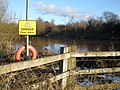
 Floods in Clyst valley at Clyst Honiton - geograph.org.uk - 6710592.jpg 3,200 × 2,400; 2.64 MB
-
 Footpath to Mill Lane from Clyst Honiton - geograph.org.uk - 6537052.jpg 1,200 × 1,600; 1.07 MB
-
 Green lane near Holbrook Farm - geograph.org.uk - 1302442.jpg 640 × 480; 152 KB
-
 Green lane near Holbrook Farm - geograph.org.uk - 2275431.jpg 800 × 600; 417 KB
-
 Green lane near Holbrook Farm - geograph.org.uk - 2275436.jpg 800 × 600; 457 KB
-
 Hampton by Hilton, Exeter Airport - geograph.org.uk - 3705311.jpg 1,920 × 1,342; 300 KB
-
 Hayes Farm - geograph.org.uk - 2312841.jpg 800 × 600; 408 KB
-
 Hill Pond Caravan and Camping Site - geograph.org.uk - 1155221.jpg 640 × 480; 64 KB
-
 Holbrook Bridge - geograph.org.uk - 2275427.jpg 800 × 600; 468 KB
-
 Holbrook Bridge - geograph.org.uk - 5995755.jpg 640 × 480; 140 KB
-
 Houses in Clyst Honiton - geograph.org.uk - 1435129.jpg 640 × 480; 153 KB
-

-
 Houses on London Road - geograph.org.uk - 1623224.jpg 640 × 480; 72 KB
-
 Junction for Clyst Honiton bypass - geograph.org.uk - 6535831.jpg 1,600 × 1,200; 746 KB
-
 Junction for Exeter Airport B3184 - geograph.org.uk - 4043797.jpg 640 × 479; 51 KB
-
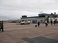 Just arrived at Exeter International Airport - geograph.org.uk - 4309278.jpg 3,264 × 2,448; 3.77 MB
-

-
 Lane at Holbrook Bridge - geograph.org.uk - 2275430.jpg 800 × 600; 487 KB
-
 Lane junction near Westpoint - geograph.org.uk - 140771.jpg 640 × 480; 129 KB
-
 Lane near Holbrook Bridge - geograph.org.uk - 1302441.jpg 640 × 480; 149 KB
-
 Lane near Wroford Manor - geograph.org.uk - 1081754.jpg 640 × 480; 177 KB
-
 Lane past Exeter Airport - geograph.org.uk - 3091467.jpg 640 × 359; 44 KB
-
 Lane to Holbrook Bridge - geograph.org.uk - 140784.jpg 640 × 480; 106 KB
-
 Lidl distribution block and flooded valley - geograph.org.uk - 6710562.jpg 4,676 × 3,507; 5.58 MB
-
 Lidl distribution building, Clyst Honiton (2) - geograph.org.uk - 6535851.jpg 1,600 × 1,200; 944 KB
-
 Lidl distribution building, Clyst Honiton - geograph.org.uk - 6535834.jpg 1,600 × 1,200; 951 KB
-
 Long stay car park at Exeter Airport - geograph.org.uk - 2396259.jpg 640 × 480; 62 KB
-

-
 Marlborough Cross - geograph.org.uk - 1842835.jpg 640 × 480; 45 KB
-
 Marlborough Cross - geograph.org.uk - 2275421.jpg 800 × 600; 396 KB
-
 Marlborough Farm - geograph.org.uk - 2275426.jpg 800 × 600; 368 KB
-
 Marlborough Farm, near Clyst Honiton - geograph.org.uk - 1156035.jpg 640 × 480; 96 KB
-
 Minor road alongside Exeter Airport - geograph.org.uk - 2396270.jpg 640 × 480; 99 KB
-

-
 Minor road to Rockbeare - geograph.org.uk - 1623239.jpg 640 × 480; 112 KB
-
 Muddy road near Holbrook Farm - geograph.org.uk - 2275434.jpg 800 × 600; 398 KB
-
 New business units near Exeter Airport - geograph.org.uk - 3705661.jpg 1,920 × 1,482; 341 KB
-
 New Flybe building at Exeter Airport - geograph.org.uk - 136976.jpg 640 × 480; 73 KB
-
 Oak near Dymond's Bridge - geograph.org.uk - 4958913.jpg 1,920 × 2,880; 1.6 MB
-
 Old A30 passing Exeter Airport - geograph.org.uk - 1435515.jpg 640 × 480; 148 KB
-
 Outbuildings of Marlborough Farm - geograph.org.uk - 2275422.jpg 800 × 600; 417 KB
-
 Overbridge, A30 - geograph.org.uk - 4757315.jpg 640 × 342; 30 KB
-
 Parsons Lane to Rockbeare - geograph.org.uk - 1603487.jpg 640 × 480; 86 KB
-
 Parsons Lane, leading towards Rockbeare - geograph.org.uk - 1411396.jpg 640 × 480; 241 KB
-
 Path, Silverdown Business Park - geograph.org.uk - 3705717.jpg 1,920 × 1,440; 619 KB
-

-
 Pond, near Clyst Honiton - geograph.org.uk - 1156046.jpg 640 × 480; 109 KB
-
 River Clyst - geograph.org.uk - 1540284.jpg 640 × 480; 83 KB
-
 Road junction near Holbrook Farm - geograph.org.uk - 2275435.jpg 800 × 600; 465 KB
-

-

-
 Road to Marlborough - geograph.org.uk - 2275420.jpg 800 × 600; 364 KB
-
 Road to Marlborough from Exeter Airport - geograph.org.uk - 1904293.jpg 640 × 480; 213 KB
-
 Rough ground bordering a field of maize by B3174 - geograph.org.uk - 6535810.jpg 1,600 × 1,200; 1,021 KB
-
 Rough ground in front of Amazon depot - geograph.org.uk - 6535812.jpg 1,600 × 800; 589 KB
-
 Roundabout, Pound Corner - geograph.org.uk - 3783209.jpg 2,048 × 1,098; 331 KB
-
 Scrub north of Clyst Honiton - geograph.org.uk - 6535857.jpg 1,600 × 1,200; 964 KB
-

-
 Slip road, A30 - geograph.org.uk - 3783321.jpg 2,043 × 1,418; 534 KB
-

-

-
 Stream at Holbrook Bridge - geograph.org.uk - 2275429.jpg 800 × 600; 522 KB
-
 Stream running through Exeter Airport - geograph.org.uk - 2312821.jpg 800 × 600; 410 KB
-
 The A30 near Exeter Airport - geograph.org.uk - 5782096.jpg 1,600 × 1,564; 635 KB
-
 The Black Horse Inn at Blackhorse - geograph.org.uk - 2275407.jpg 800 × 600; 381 KB
-
 The end of Parsons Lane - geograph.org.uk - 2365153.jpg 800 × 600; 360 KB
-
 The Exeter Inn, Clyst Honiton - geograph.org.uk - 1807126.jpg 1,600 × 1,200; 338 KB
-
 The old A30 passing Exeter Airport - geograph.org.uk - 2312825.jpg 800 × 600; 375 KB
-
 The overgrown stream north of Coach Bridge on B3174 - geograph.org.uk - 6535797.jpg 1,200 × 1,600; 1.11 MB
-
 The River Clyst, near Clyst Honiton - geograph.org.uk - 1540256.jpg 640 × 480; 100 KB


_01.jpg)
_02.jpg)
_03.jpg)
_04.jpg)
_05.jpg)
_06.jpg)
_07.jpg)
_08.jpg)
_09.jpg)
_27.jpg)
_28.jpg)
_29.jpg)


_-_geograph.org.uk_-_3092299.jpg)
_-_geograph.org.uk_-_3092309.jpg)


_-_geograph.org.uk_-_1517229.jpg)


_-_geograph.org.uk_-_6535851.jpg)


