Category:Cloughton
Jump to navigation
Jump to search
village in North Yorkshire, England, UK  | |||||
| Upload media | |||||
| Instance of | |||||
|---|---|---|---|---|---|
| Location | Scarborough, North Yorkshire, Yorkshire and the Humber, England | ||||
| Population |
| ||||
| Said to be the same as | Cloughton (Wikimedia duplicated page, civil parish) | ||||
 | |||||
English: Cloughton is a small village and civil parish in the Scarborough district of North Yorkshire, England. It is situated approximately north of Scarborough town centre.
Subcategories
This category has the following 7 subcategories, out of 7 total.
B
C
- Cloughton Newlands (14 F)
- Cloughton railway station (10 F)
H
- Hayburn Wyke railway station (5 F)
S
- St Mary's church, Cloughton (4 F)
T
- The Red Lion, Cloughton (3 F)
Media in category "Cloughton"
The following 200 files are in this category, out of 358 total.
(previous page) (next page)-
 -Possible lynchets near Salt pans, Cloughton - geograph.org.uk - 5409048.jpg 2,000 × 1,500; 1.03 MB
-
 A building dated 1899 at Cober Hill, Cloughton - geograph.org.uk - 5408379.jpg 1,740 × 1,448; 743 KB
-

-
 A Little Ford - geograph.org.uk - 1162235.jpg 640 × 480; 89 KB
-
 A trig point off Gowland Lane - geograph.org.uk - 2327373.jpg 800 × 600; 232 KB
-
 A very fine bull - geograph.org.uk - 5817517.jpg 640 × 480; 238 KB
-
 A very muddy right of way - geograph.org.uk - 4278125.jpg 2,816 × 2,112; 1.16 MB
-
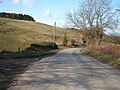
 A171 bend on Cloughton Moor - geograph.org.uk - 4732775.jpg 640 × 480; 75 KB
-

-
 A171 northbound at Gowland Lane End - geograph.org.uk - 4732776.jpg 640 × 480; 81 KB
-

-
 A171, Cloughton - geograph.org.uk - 2100609.jpg 640 × 480; 78 KB
-
 Approaching descent on Hodgson Hill - geograph.org.uk - 4846220.jpg 640 × 480; 66 KB
-
 Approaching Gowland Lane - geograph.org.uk - 2574658.jpg 640 × 427; 265 KB
-
 Back of Hayburn Wyke Inn - geograph.org.uk - 5906932.jpg 640 × 360; 106 KB
-
 Beach at Hayburn Wyke - geograph.org.uk - 6004966.jpg 800 × 600; 133 KB
-
 Beck Lane, Cloughton - geograph.org.uk - 3544666.jpg 4,608 × 3,456; 5.9 MB
-
 Bench on National Cycle Route 1 - geograph.org.uk - 4848346.jpg 640 × 421; 71 KB
-
 Boggy grazing, Cober Hill - geograph.org.uk - 4844845.jpg 640 × 480; 108 KB
-
 Bridge crossing the Cinder Track - geograph.org.uk - 6008724.jpg 800 × 614; 215 KB
-
 Bridge over the cinder path-Hayburn Wyke - geograph.org.uk - 2886888.jpg 3,264 × 2,448; 3.39 MB
-

-

-
 Bridge over Thorny Beck - geograph.org.uk - 3910735.jpg 2,730 × 1,950; 1.03 MB
-
 Bridleway north of Hayburn Wyke Hotel - geograph.org.uk - 3788083.jpg 3,262 × 2,330; 2.77 MB
-

-
 Bridleway under former railway line at Hayburn Wyke - geograph.org.uk - 3788077.jpg 3,176 × 2,269; 2.78 MB
-

-
 Bryherstones Public House - geograph.org.uk - 1717204.jpg 640 × 480; 84 KB
-
 Buildings at Cloughton Moor House - geograph.org.uk - 5011476.jpg 1,600 × 1,200; 573 KB
-
 Bull and cows - geograph.org.uk - 5817518.jpg 640 × 480; 233 KB
-
 Bus stop on High Street, Cloughton - geograph.org.uk - 4846893.jpg 640 × 480; 69 KB
-
 Bus stop on High Street, Cloughton - geograph.org.uk - 4846900.jpg 640 × 480; 98 KB
-
 Cattle feeding at The Hulleys - geograph.org.uk - 3787730.jpg 2,993 × 2,138; 2.74 MB
-
 Cinder Track at Newlands Dale - geograph.org.uk - 6008737.jpg 800 × 600; 228 KB
-
 Cleveland Way - geograph.org.uk - 3902636.jpg 1,600 × 1,200; 478 KB
-
 Cleveland Way above Hayburn Wyke - geograph.org.uk - 5817010.jpg 480 × 640; 373 KB
-
 Cleveland Way above Little Cliff - geograph.org.uk - 2786148.jpg 3,264 × 2,448; 2.03 MB
-
 Cleveland Way above Little Cliff - geograph.org.uk - 4153833.jpg 2,706 × 1,933; 969 KB
-
 Cleveland Way along Rodger Trod - geograph.org.uk - 4651998.jpg 640 × 373; 71 KB
-
 Cleveland Way at Hayburn Wyke Wood - geograph.org.uk - 6004954.jpg 800 × 623; 172 KB
-
 Cleveland Way at Hun Dale - geograph.org.uk - 6004256.jpg 800 × 531; 128 KB
-
 Cleveland Way at Hundale Point - geograph.org.uk - 6004248.jpg 800 × 524; 136 KB
-
 Cleveland Way at Little Cliff - geograph.org.uk - 6004945.jpg 800 × 515; 126 KB
-
 Cleveland Way at Rodger Trod - geograph.org.uk - 2933213.jpg 1,200 × 1,600; 449 KB
-
 Cleveland Way at Rodger Trod - geograph.org.uk - 5817521.jpg 480 × 640; 265 KB
-

-
 Cleveland Way in Sycarham Wood - geograph.org.uk - 6004471.jpg 800 × 701; 243 KB
-
 Cleveland Way in Sycarham Wood - geograph.org.uk - 6004472.jpg 800 × 524; 157 KB
-
 Cleveland Way near Hayburn Wyke - geograph.org.uk - 6004940.jpg 800 × 600; 121 KB
-
 Cleveland Way near Hundale Point - geograph.org.uk - 2786056.jpg 3,264 × 2,448; 2.4 MB
-
 Cleveland Way near Hundale Point - geograph.org.uk - 3766081.jpg 3,240 × 4,320; 2.33 MB
-
 Cleveland Way near Hundale Point - geograph.org.uk - 659310.jpg 640 × 480; 135 KB
-
 Cleveland Way near Sycarham Wood - geograph.org.uk - 6004469.jpg 800 × 560; 106 KB
-
 Cleveland Way north of Cloughton Wyke - geograph.org.uk - 217931.jpg 640 × 480; 100 KB
-
 Cleveland Way north of Cloughton Wyke - geograph.org.uk - 217933.jpg 640 × 480; 64 KB
-
 Cleveland Way to Cloughton Wyke - geograph.org.uk - 3976953.jpg 3,264 × 2,448; 2.38 MB
-
 Cleveland Way towards Cloughton Wyke - geograph.org.uk - 6004478.jpg 800 × 507; 129 KB
-
 Cleveland Way towards Hayburn Wyke - geograph.org.uk - 6004923.jpg 800 × 479; 109 KB
-
 Cliff above Hundale Scar. Cloughton - geograph.org.uk - 5789865.jpg 2,000 × 1,500; 842 KB
-
 Cliff Top Bracken - geograph.org.uk - 1473281.jpg 640 × 480; 116 KB
-
 Cliffs at Cloughton Wyke - geograph.org.uk - 6004260.jpg 800 × 476; 112 KB
-
 Cliffs at Cloughton Wyke - geograph.org.uk - 6754856.jpg 1,590 × 1,105; 447 KB
-
 Cliffs at Cloughton Wyke - geograph.org.uk - 6754870.jpg 1,600 × 1,037; 426 KB
-
 Cliffs at Hundale - geograph.org.uk - 5019440.jpg 640 × 427; 397 KB
-
 Cliffs at Hundale Point - geograph.org.uk - 5786337.jpg 800 × 637; 145 KB
-
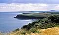
 Cliffs North of Cloughton Wyke - geograph.org.uk - 5019389.jpg 640 × 448; 418 KB
-
 Cliffs, Cloughton - geograph.org.uk - 786880.jpg 640 × 480; 127 KB
-
 Close up, Elizabeth II postbox on Station Road, Cloughton - geograph.org.uk - 4846442.jpg 1,414 × 2,860; 1.66 MB
-
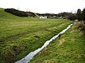 Cloughton Beck and Fields - geograph.org.uk - 1162454.jpg 640 × 480; 97 KB
-
 Cloughton Ford - geograph.org.uk - 3808605.jpg 3,872 × 2,592; 4.62 MB
-
 Cloughton Hall - geograph.org.uk - 1547094.jpg 640 × 480; 94 KB
-
 Cloughton Moor Forest - geograph.org.uk - 2574646.jpg 640 × 427; 280 KB
-
 Cloughton Moor Forest - geograph.org.uk - 2574652.jpg 427 × 640; 298 KB
-
 Cloughton Moor House - geograph.org.uk - 1162523.jpg 640 × 480; 87 KB
-
 Cloughton Station - geograph.org.uk - 3811316.jpg 1,600 × 1,289; 741 KB
-
 Cloughton UK parish locator map.svg 1,425 × 1,037; 4.3 MB
-
 Cloughton Woods - geograph.org.uk - 1547202.jpg 640 × 480; 47 KB
-
 Cloughton Wyke - geograph.org.uk - 1473286.jpg 640 × 480; 89 KB
-
 Cloughton Wyke - geograph.org.uk - 2933176.jpg 1,600 × 1,200; 476 KB
-
 Cloughton Wyke - geograph.org.uk - 339833.jpg 640 × 457; 64 KB
-
 Cloughton Wyke - geograph.org.uk - 456733.jpg 640 × 480; 71 KB
-
 Cloughton Wyke - geograph.org.uk - 5019370.jpg 468 × 640; 442 KB
-
 Cloughton Wyke - geograph.org.uk - 5019378.jpg 640 × 475; 458 KB
-
 Cloughton Wyke - geograph.org.uk - 5019422.jpg 640 × 470; 465 KB
-
 Cloughton Wyke - geograph.org.uk - 877299.jpg 640 × 386; 74 KB
-
 Cloughton Wyke in North Yorkshire - geograph.org.uk - 6004467.jpg 800 × 550; 136 KB
-
 Coast, Gallery and Tea Rooms, Cloughton - geograph.org.uk - 2178389.jpg 800 × 600; 261 KB
-
 Coastal path, Cloughton Wyke - geograph.org.uk - 4364276.jpg 640 × 480; 74 KB
-
 Coastal rocks near Sycarham Farm - geograph.org.uk - 5817537.jpg 640 × 480; 273 KB
-
 Cober Hill, Cloughton - geograph.org.uk - 511072.jpg 515 × 640; 57 KB
-
 Converted Chapel, Cloughton - geograph.org.uk - 1547093.jpg 640 × 476; 129 KB
-
 Cornfields near Cloughton - geograph.org.uk - 217929.jpg 640 × 480; 110 KB
-
 Cottages on High Street, Cloughton - geograph.org.uk - 4846896.jpg 640 × 412; 51 KB
-
 Cottages, Cloughton - geograph.org.uk - 4844838.jpg 640 × 480; 68 KB
-
 Court Green, Salt Pans Road,Cloughton - geograph.org.uk - 3952221.jpg 2,816 × 2,112; 2.78 MB
-
 Craven's Hill - geograph.org.uk - 4846198.jpg 640 × 480; 80 KB
-
 Craven's Hill - geograph.org.uk - 4846200.jpg 640 × 480; 81 KB
-
 Craven's Hill - geograph.org.uk - 4846210.jpg 640 × 480; 86 KB
-
 Cycle Trail near Hayburn Wyke Hotel - geograph.org.uk - 1547098.jpg 640 × 480; 154 KB
-
 Descending Hodgson Hill - geograph.org.uk - 4846224.jpg 640 × 480; 93 KB
-
 Elizabeth II postbox on High Street, Cloughton - geograph.org.uk - 4847736.jpg 1,205 × 2,403; 626 KB
-
 Elizabeth II postbox on Station Road, Cloughton - geograph.org.uk - 4846440.jpg 2,590 × 2,558; 3.08 MB
-
 England Coast Path at Hayburn Wyke Wood - geograph.org.uk - 5786347.jpg 553 × 800; 213 KB
-
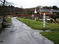
 Entering Cloughton - geograph.org.uk - 4846881.jpg 640 × 480; 82 KB
-
 Entering Staintondale - geograph.org.uk - 4846545.jpg 640 × 480; 109 KB
-
 Entering Staintondale, North Yorkshire - geograph.org.uk - 2327203.jpg 800 × 600; 329 KB
-
-
 Entrance to Trattles Hall - geograph.org.uk - 4844859.jpg 640 × 480; 103 KB
-
-

-
 Farm buildings, Hayburn Beck Farm - geograph.org.uk - 4846540.jpg 640 × 480; 58 KB
-
 Farmland near Cleveland Way - geograph.org.uk - 1473271.jpg 640 × 480; 52 KB
-

-
 Farmland north of Burniston - geograph.org.uk - 3544656.jpg 3,490 × 2,167; 2.21 MB
-
 Farmland off Mill Lane, Cloughton - geograph.org.uk - 4846882.jpg 640 × 480; 88 KB
-
 Farmland off National Cycle Route 1 - geograph.org.uk - 4848107.jpg 640 × 480; 93 KB
-
 Farmland towards Westfield Farm - geograph.org.uk - 4848342.jpg 640 × 393; 38 KB
-
 Farmland, Cloughton - geograph.org.uk - 786902.jpg 640 × 480; 135 KB
-
 Farmland, Cloughton Moor - geograph.org.uk - 1547197.jpg 640 × 480; 34 KB
-
 Field entrance off Craven's Hill - geograph.org.uk - 4846202.jpg 640 × 480; 97 KB
-

-
 Field entrance, Cober - geograph.org.uk - 4844850.jpg 640 × 480; 95 KB
-
 Field entrance, Nab End - geograph.org.uk - 4846221.jpg 640 × 480; 99 KB
-
 Field of Barley - geograph.org.uk - 5019430.jpg 640 × 427; 449 KB
-
 Field Terraces - geograph.org.uk - 5019459.jpg 640 × 427; 420 KB
-
 Fields near Hayburn Beck - geograph.org.uk - 2775542.jpg 1,024 × 768; 197 KB
-
 Fields near Sycarham Farm - geograph.org.uk - 6008743.jpg 800 × 525; 116 KB
-
 Fields near Town Farm - geograph.org.uk - 4848318.jpg 640 × 480; 60 KB
-

-
 Flooding at Cloughton Moor - geograph.org.uk - 5537825.jpg 1,024 × 768; 156 KB
-
 Footbridge across the Hayburn Beck - geograph.org.uk - 6005116.jpg 712 × 800; 201 KB
-

-
 Footpath and steps to Salt Pans Road - geograph.org.uk - 5011549.jpg 1,600 × 1,200; 718 KB
-
 Footpath at Calfthwaite Farm - geograph.org.uk - 3787681.jpg 3,116 × 2,226; 2.8 MB
-
 Footpath Cloughton Fields - geograph.org.uk - 4034289.jpg 2,814 × 2,010; 1.03 MB
-
 Footpath from the coast path to Salt Pans Road - geograph.org.uk - 5789838.jpg 2,000 × 1,500; 1.17 MB
-
 Footpath from the coast path to Salt Pans Road - geograph.org.uk - 5789851.jpg 2,000 × 1,500; 1.24 MB
-
 Footpath into the Woods at Hayburn Wyke - geograph.org.uk - 2786272.jpg 3,264 × 2,448; 2.33 MB
-
 Footpath junction at Rodger Trod - geograph.org.uk - 5011519.jpg 1,600 × 1,200; 509 KB
-
 Footpath off Hodgson Hill - geograph.org.uk - 4846223.jpg 640 × 480; 79 KB
-
 Footpath off Salt Pans Road - geograph.org.uk - 5817515.jpg 480 × 640; 287 KB
-
 Footpath off Salt Pans Road, Cloughton - geograph.org.uk - 5789856.jpg 2,000 × 1,500; 1.03 MB
-
 Footpath to Cloughton Moor House - geograph.org.uk - 5011471.jpg 1,600 × 1,200; 1.16 MB
-
 Footpath to Cloughton Wyke and Cleveland Way - geograph.org.uk - 2786080.jpg 3,264 × 2,448; 1.71 MB
-
 Footpath to Hodgson Hill, west of Moor Lodge - geograph.org.uk - 5011486.jpg 1,600 × 1,200; 776 KB
-
 Footpath to Salt Pans Road - geograph.org.uk - 5011555.jpg 1,600 × 1,200; 551 KB
-
 Forest Floor Litter - geograph.org.uk - 2411065.jpg 427 × 640; 302 KB
-
 Forest track - geograph.org.uk - 4734492.jpg 640 × 480; 82 KB
-

-
 Former station, Cloughton 1992 - geograph.org.uk - 5410213.jpg 1,631 × 2,228; 2.3 MB
-
 Fossil Ripples - geograph.org.uk - 5019398.jpg 463 × 640; 458 KB
-
 Fossil Ripples - geograph.org.uk - 5019402.jpg 480 × 640; 511 KB
-
 From Cinder Track to Hoods Lane - geograph.org.uk - 2786124.jpg 3,264 × 2,448; 2.07 MB
-
 Gate on Little Moor Road, Cloughton - geograph.org.uk - 5789823.jpg 2,000 × 1,500; 1,002 KB
-
 Gated farm track near Hayburn Beck Farm - geograph.org.uk - 4846543.jpg 640 × 480; 122 KB
-
 Gowland Farm - geograph.org.uk - 1547200.jpg 640 × 480; 55 KB
-
 Gowland Lane - geograph.org.uk - 1547195.jpg 640 × 480; 62 KB
-
 Gowland Lane - geograph.org.uk - 1547199.jpg 640 × 480; 57 KB
-
 Gowland Lane - geograph.org.uk - 1547201.jpg 640 × 480; 74 KB
-
 Gowland Lane - geograph.org.uk - 1547203.jpg 640 × 480; 41 KB
-
 Gowland Lane - geograph.org.uk - 2574665.jpg 640 × 427; 258 KB
-
 Gowland Lane End - geograph.org.uk - 5011466.jpg 1,600 × 1,200; 427 KB
-
 Gowland Lane joins Harwood Dale Road - geograph.org.uk - 2327409.jpg 800 × 600; 218 KB
-
 Gowland Lane near Cloughton Moor - geograph.org.uk - 1968920.jpg 3,088 × 2,056; 2.83 MB
-
 Gowland Lane near Linglands Cottage - geograph.org.uk - 1968931.jpg 3,088 × 2,056; 2.91 MB
-
 Gowland Lane off the A171 - geograph.org.uk - 2327364.jpg 800 × 600; 270 KB
-
 Grassy track to the southwest of the A171 - geograph.org.uk - 3544693.jpg 4,492 × 3,296; 3.7 MB
-
 Grazing and woodland, Newlands Dale - geograph.org.uk - 4848096.jpg 640 × 480; 95 KB
-
 Grazing near Wyke Haven - geograph.org.uk - 4846212.jpg 640 × 480; 101 KB
-
 Grazing off Craven's Hill - geograph.org.uk - 4846203.jpg 640 × 480; 66 KB
-
 Grazing off National Cycle Route 1 - geograph.org.uk - 4848076.jpg 640 × 480; 102 KB
-
 Grazing, Cober Hill - geograph.org.uk - 4844848.jpg 640 × 480; 112 KB
-
 Grazing, Greystone Farm - geograph.org.uk - 4844863.jpg 640 × 480; 64 KB
-
 Greystone Farm - geograph.org.uk - 4844864.jpg 640 × 480; 77 KB
-
 Harwood Dale Road - geograph.org.uk - 1547206.jpg 640 × 480; 69 KB
-
 Hay Lane Terrace, Cloughton - geograph.org.uk - 2100604.jpg 640 × 480; 87 KB
-
 Hayburn Beck - geograph.org.uk - 5817013.jpg 640 × 480; 339 KB
-
 Hayburn Beck Farm - geograph.org.uk - 4846539.jpg 640 × 480; 62 KB
-
 Hayburn Wyke - geograph.org.uk - 6648540.jpg 2,000 × 1,420; 3.48 MB
-
 Hayburn Wyke Wood - geograph.org.uk - 5906943.jpg 640 × 427; 177 KB
-
 Hayburn Wyke wood - geograph.org.uk - 6004962.jpg 800 × 523; 177 KB
-
 Hayburn Wyke Wood - geograph.org.uk - 6005110.jpg 800 × 578; 215 KB
-
 Heading east on National Cycle Route 1 - geograph.org.uk - 4848070.jpg 640 × 480; 139 KB
-
 High Street, Cloughton - geograph.org.uk - 2178380.jpg 800 × 600; 347 KB
-
 High Street, Cloughton - geograph.org.uk - 3698374.jpg 800 × 800; 652 KB
-
 High Street, Cloughton - geograph.org.uk - 4847740.jpg 640 × 435; 79 KB
-
 Hillside grazing, Newlands Dale - geograph.org.uk - 4848090.jpg 640 × 480; 78 KB
-
 Hood Lane bridge - geograph.org.uk - 5842060.jpg 2,048 × 1,536; 1.33 MB
-
 Hood Lane near Cloughton - geograph.org.uk - 2178327.jpg 800 × 600; 316 KB
-
 Hood Lane Rly Bridge - geograph.org.uk - 3726120.jpg 3,920 × 2,204; 2.78 MB
-
 Hood Lane to Sycarham Farm - geograph.org.uk - 2786131.jpg 3,264 × 2,448; 2.04 MB
-
 Horse Grazing Meadows - geograph.org.uk - 1162222.jpg 640 × 480; 89 KB
-

-
 House on Hodgson Hill - geograph.org.uk - 4846218.jpg 640 × 480; 93 KB
-
 House on Newlands Road, Cober - geograph.org.uk - 4844854.jpg 640 × 480; 114 KB
-
 Houses on Mill Lane, Burniston - geograph.org.uk - 4846879.jpg 640 × 480; 66 KB
-
 Houses on Newlands Road, Cloughton - geograph.org.uk - 5817009.jpg 640 × 480; 226 KB
-
 Hun Dale - geograph.org.uk - 4034280.jpg 2,814 × 2,010; 1.03 MB
-
 Hundale Cliffs - geograph.org.uk - 5019435.jpg 506 × 640; 477 KB


