Category:Clouds in New Zealand
Jump to navigation
Jump to search
Countries of Oceania: Australia · Fiji · Federated States of Micronesia · Marshall Islands · New Zealand · Papua New Guinea · Tonga · Vanuatu
Other areas: Guam · Hawaii · Wallis and Futuna – Partly: Indonesia
Other areas: Guam · Hawaii · Wallis and Futuna – Partly: Indonesia
Subcategories
This category has the following 7 subcategories, out of 7 total.
Media in category "Clouds in New Zealand"
The following 67 files are in this category, out of 67 total.
-
 A tree crown before storm, square format, New Zealand.jpg 3,648 × 3,648; 9.68 MB
-
 AC45-TNZ (13).jpg 3,648 × 2,736; 4.63 MB
-
 Airport Queenstown2.jpg 3,648 × 2,736; 4.7 MB
-
 Angelus Hut in the winter, Nelson Lakes National Park, New Zealand.jpg 7,357 × 3,437; 5.13 MB
-
 Arrowsmith Range from Mt Taylor, Taylor Range, Canterbury, New Zealand.jpg 5,061 × 2,630; 6.66 MB
-
 Auckland Alien Landing Zone.jpg 1,600 × 1,200; 406 KB
-
 Baldy Hill from Snowslide Valley, Craigieburn Range, Canterbury, New Zealand.jpg 9,664 × 4,157; 29.53 MB
-
 Blowhard Track under Mt Richardson, New Zealand.jpg 5,341 × 3,561; 15.05 MB
-
 Boundary Creek, Canterbury, New Zealand.jpg 5,179 × 3,465; 10.91 MB
-
 Bridge over Waimakariri River, New Zealand 02.jpg 5,417 × 3,648; 14.72 MB
-
 Bridge over Waimakariri River, New Zealand 03.jpg 4,733 × 2,843; 7.86 MB
-
 Bridge over Waimakariri River, New Zealand 04.jpg 5,432 × 2,843; 8.69 MB
-
 Bridge over Waimakariri River, New Zealand 05.jpg 4,265 × 2,843; 6.17 MB
-
 Bridge over Waimakariri River, New Zealand 06.jpg 4,265 × 2,843; 8.76 MB
-
 Bridge over Waimakariri River, New Zealand 07.jpg 4,265 × 2,843; 6.89 MB
-
 Bridge over Waimakariri River, New Zealand 08.jpg 4,265 × 2,843; 6.41 MB
-
 Bridge over Waimakariri River, New Zealand 09.jpg 5,343 × 3,005; 9.15 MB
-
 Bridge over Waimakariri River, New Zealand 10.jpg 5,160 × 3,146; 7.36 MB
-
 Broken River down main tow Stevage.jpg 2,000 × 1,500; 702 KB
-
 Bush in Victoria Forest Park, West Coast, New Zealand 02.jpg 5,472 × 3,648; 9.93 MB
-
 Cass Peak, Port Hills, New Zealand 01.jpg 5,472 × 3,648; 8.47 MB
-
 Christchurch skies (49280224608).jpg 4,032 × 3,024; 2.12 MB
-
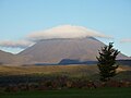
 Clouds around Mount Taranaki.jpg 1,231 × 774; 857 KB
-
 Clouds into mountains (Unsplash).jpg 2,496 × 1,664; 210 KB
-
 Cloudy Skies. - panoramio.jpg 3,264 × 2,448; 2.58 MB
-
 Commercial Fishing Boats In Pohara.jpg 1,600 × 1,200; 1.29 MB
-
 Dadfo (202760127).jpeg 2,048 × 1,357; 857 KB
-
 Deloitte Building, Christchurch, New Zealand.jpg 4,502 × 5,391; 12.67 MB
-
 Desert Road, Tongariro National Park.jpg 2,973 × 2,060; 1.18 MB
-
 Forest atmospheric moisture.jpg 4,608 × 3,456; 2.26 MB
-
 Hollyford Valley, Routeburn Track (16538776052).jpg 5,989 × 3,369; 9.55 MB
-
 IrisationCloudsPICT4884crop640x480.jpg 640 × 339; 100 KB
-
 Lake Heron, Canterbury, New Zealand 01.jpg 5,472 × 2,516; 10.23 MB
-
 Lake Wakatipu, New Zealand (7187558802).jpg 4,608 × 3,072; 3.39 MB
-
 Landscape around Lake Heron, Canterbury, New Zealand 02.jpg 5,472 × 3,211; 12.59 MB
-
 Makarora River, Otago, New Zealand.jpg 15,351 × 3,174; 26.79 MB
-
 Mitre Peak sunny.JPG 1,944 × 2,592; 756 KB
-
 Mount Doom.jpg 3,648 × 2,736; 4.62 MB
-
 Mount Tasman.jpg 683 × 1,024; 559 KB
-
 Purakanui, Dunedin, New Zealand.jpg 3,264 × 1,832; 445 KB
-
 Rainbow on Routeburn Track (16513844686).jpg 5,980 × 3,364; 7.55 MB
-
 Rainbow over Waimakariri River, New Zealand.jpg 10,685 × 3,332; 11.95 MB
-

-
 Ridges of Taylor Range, Canterbury, New Zealand 06.jpg 5,472 × 3,648; 14.88 MB
-
 Road in Southland, New Zealand.jpg 5,292 × 3,388; 14.76 MB
-
 Sky in Palmerston North, 25 July 2012.JPG 4,288 × 3,216; 3.75 MB
-
 Storm clouds in Melling, Lower Hutt.jpg 5,002 × 3,334; 1.85 MB
-
 Storm Wellington Harbour.JPG 800 × 600; 129 KB
-
 Stormy sunset over Waimakariri River basin, New Zealand.jpg 12,951 × 4,890; 21.35 MB
-
 Sun over Lake Hawea, New Zealand.jpg 7,784 × 3,236; 7.16 MB
-
 Swin River South Branch, Canterbury, New Zealand.jpg 5,472 × 3,648; 20.22 MB
-
 Taupo (6878831535).jpg 675 × 900; 526 KB
-
 Taupo Lake Cafe (6907622041).jpg 675 × 900; 563 KB
-
 Taupo Sailor (6428599971).jpg 750 × 1,000; 502 KB
-
 Taupo Sunset (6556083713).jpg 675 × 900; 639 KB
-
 Taupo Sunset (6556084827).jpg 675 × 900; 354 KB
-
 Taupo Waterfront (6556084539).jpg 900 × 675; 561 KB
-
 Taupo Yachts (6907619245).jpg 675 × 900; 388 KB
-
 Turoa, Mt Ruapehu, New Zealand (48246803821).jpg 4,032 × 1,960; 1.18 MB
-
 Upper Hollyford Valley 2.jpg 4,132 × 2,764; 10.26 MB
-
 View from pt 1854, Black Range, New Zealand.jpg 11,329 × 4,616; 41.29 MB
-
 View towards Lookout Range from John Reid Hut, Kahurangi, New Zealand.jpg 5,397 × 3,036; 8.51 MB
-
 Waikato cricket ground.jpg 3,112 × 2,076; 1.17 MB
-
 Wellington Port before storm.jpg 640 × 480; 34 KB
-
 Whangamata Harbour (5910953813).jpg 900 × 675; 170 KB
-
 Winterslow Range, Canterbury, New Zealand.jpg 10,559 × 3,133; 20.67 MB
-
 Woodend Beach, Canterbury, New Zealand (6).jpg 5,287 × 3,525; 15.31 MB

.jpg)


.jpg)

.jpg)


.jpeg)


.jpg)


.jpg)


.jpg)


.jpg)
.jpg)
.jpg)
.jpg)
.jpg)
.jpg)
.jpg)
.jpg)


.jpg)
.jpg)