Category:Clontarf, Dublin
Appearance
Brezhoneg: Cluain Tarbh (Clontarf e saozneg) zo ur fabourzh e norzh Dulenn en Iwerzhon. Brudet eo en abeg da Emgann Cluain Tarbh e 1014 ma voe trec'h Brian Boru war an alouberien viking. Sellet e vez ouzh Emgann Cluain Tarbh evel an hini lakaas penn d'ar brezelioù etre Iwerzhon hag ar Vikinged.
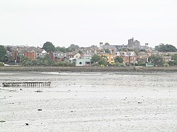
English: Clontarf is a coastal suburb on the northside of Dublin, Ireland. It is most famous for giving the name to the Battle of Clontarf in 1014 during which Brian Boru, High King of Ireland defeated the Viking invaders. This battle, which extended to districts over several miles, is seen as marking an end to the Irish-Viking Wars.
Español: Clontarf (Cluain Tarbh en Irlandés) es un área residencial de clase media al norte de la ciudad de Dublín, Irlanda. Es famosa por la Batalla de Clontarf de 1014 donde Brian Boru, Alto Rey de Irlanda derrotó a los invasores vikingos. Esta batalla representó el final de las guerras Irlando-Vikingas.
Euskara: Clontarf edo Cluain Tarbh Irlandako Errepublikako Dublin hiriburuko iparraldean dagoen langile auzo bat da. 1014. urtean kokaleku honetan Clontarfeko gudua jazo zelako ospetsua da, bertan Brian Boru erregeak Bikingoak garaitu zituen. Gudu honek bikingoek Irlandan zuten nagusitasunari amaiera eman zion.
Français : Clontarf (Cluain Tarbh en irlandais) est une zone au nord de Dublin. Ce lieu est bien connu du fait de la bataille de Clontarf en 1014 par laquelle Brian Boru vainquit les envahisseurs vikings et mit ainsi fin aux guerres entre Irlandais et Vikings qui avaient pris pied en Irlande depuis 150 ans.
Norsk bokmål: Clontarf er en gammel kystlandsby i Republikken Irland som i moderne tid har blitt en forstad til Dublin. Stedet er mest kjent for slaget ved Clontarf i 1014, der Brian Boru og Máel Sechnaill vant et avgjørende slag mot vikingene fra Dublin og deres allierte.
coastal suburb on the northside of Dublin | |||||
| Upload media | |||||
| Instance of | |||||
|---|---|---|---|---|---|
| Location | Dublin, Dublin City, Leinster, Ireland | ||||
| Different from | |||||
 | |||||
Subcategories
This category has the following 20 subcategories, out of 20 total.
B
- Battle of Clontarf (16 F)
C
- Clontarf Castle, Dublin (18 F)
- Clontarf Cricket Club (2 F)
- Clontarf Railway Bridge (3 F)
D
E
G
- Ghost leaves in Clontarf (18 F)
H
- Harry Byrnes (6 F)
S
W
- Wind sculpture (3 F)
Media in category "Clontarf, Dublin"
The following 45 files are in this category, out of 45 total.
-
A creek in the Tolka Estuary - geograph.org.uk - 2220028.jpg 1,024 × 566; 64 KB
-
Bus stop, Clontarf - geograph.org.uk - 2564703.jpg 640 × 480; 98 KB
-
Cartell bilingüe.jpg 2,322 × 4,128; 3.87 MB
-
CLASAĊ Traditional Arts Centre On Alfie Byrne Road - panoramio.jpg 2,048 × 1,365; 1.06 MB
-
Clontarf Garda Station, Dublin 3 - geograph.org.uk - 2216242.jpg 1,024 × 767; 94 KB
-
Clontarf July 2009 - photographed by Infomatique (3741586277).jpg 5,616 × 3,744; 10.2 MB
-
Clontarf July 2009 - photographed by Infomatique (3741588141).jpg 5,616 × 3,744; 10.43 MB
-
Clontarf Pumphouse.jpg 2,657 × 1,879; 1,023 KB
-
Clontarf Road, Fairview End - geograph.org.uk - 13837.jpg 640 × 480; 119 KB
-
Clontarf shelter over mine (sunny).jpg 1,600 × 1,200; 478 KB
-
Clontarf shore.jpg 2,048 × 1,536; 566 KB
-
Clontarf shoreline.jpg 5,616 × 3,744; 17.63 MB
-
Clontarf Yacht and Boat Club - geograph.org.uk - 13839.jpg 640 × 480; 119 KB
-
Clontarf, Clontarf Castle - geograph.org.uk - 13557.jpg 640 × 480; 126 KB
-
Clontarf, Dublin Bay (507228) (32607943630).jpg 3,734 × 1,867; 2.29 MB
-
Clontarrf view towards Poolbeg.jpg 5,184 × 3,456; 4.72 MB
-
Collectio, battle loss in clontarf 090ttt.jpg 2,304 × 3,072; 2.11 MB
-
Dublin - Dublin Bus Clontarf Garage - 20230827175200.jpg 4,896 × 3,672; 6.75 MB
-
Dublin - Hedigan's - 20220911153355.jpeg 3,024 × 4,032; 3.72 MB
-
Final voyage of the sailing yacht Carina on October 2, 1944.png 620 × 539; 78 KB
-
Hollybrook Road, Clontarf - geograph.org.uk - 687999.jpg 640 × 480; 72 KB
-
Methodist Church, Clontarf - geograph.org.uk - 695959.jpg 640 × 480; 70 KB
-
MilestoneDublin3Howth6.jpg 1,944 × 2,592; 1.08 MB
-
Moored yachts south of Clontarf - geograph.org.uk - 2078261.jpg 1,024 × 768; 195 KB
-
MountTempleClock.jpg 2,013 × 1,509; 595 KB
-
MountTempleYard.jpg 1,280 × 960; 706 KB
-
Partial Solar Eclipse at Sunrise over Tolka Esturary 01.jpg 2,592 × 1,944; 325 KB
-
Partial Solar Eclipse at Sunrise over Tolka Esturary 02.jpg 2,592 × 1,944; 259 KB
-
Pat Ingoldsby Box Art.jpg 3,024 × 4,032; 5.17 MB
-
Podge Hughes Hockey Pitch Plaque.jpg 4,032 × 3,024; 3.86 MB
-
Rugby match,.jpg 3,072 × 2,304; 1.47 MB
-
St. Anthony's, Clontarf Road - geograph.org.uk - 695984.jpg 640 × 480; 65 KB
-
St.Lawrence Road, Clontarf - geograph.org.uk - 695950.jpg 640 × 480; 87 KB
-
Sun Set - geograph.org.uk - 3808846.jpg 574 × 1,024; 57 KB
-
The Portrait Studio, Clontarf - geograph.org.uk - 688040.jpg 640 × 480; 65 KB
-
The Royal Charter School, Clontarf near Dublin.jpg 4,000 × 2,235; 908 KB
-
The Royal Charter School, Clontarf, County Dublin .PNG 689 × 378; 485 KB
-
The Yacht, Clontarf Road - geograph.org.uk - 695990.jpg 640 × 480; 66 KB
-
Under the Wooden Bridge (14301715530).jpg 4,794 × 3,186; 4.27 MB
-
Wong's Chinese Restaurant In Clontarf (6837524951).jpg 3,560 × 2,912; 8.13 MB
-
Wong's Chinese Restaurant In Clontarf (6837531005).jpg 4,161 × 2,774; 9.49 MB
-
Yachts off Clontarf - geograph.org.uk - 2077772.jpg 1,024 × 538; 113 KB


