Category:Clonsilla (townland)
Jump to navigation
Jump to search
Clonsilla is a townland in the eponymous civil parish of Clonsilla, in the ancient barony of Castleknock. It is not co-terminous with the informal residential area known as Clonsilla. Clonsilla railway station is located in the southeastern corner of the townland. Clonsilla is bounded to the north by Hartstown, to the east by Coolmine, to the southeast by Kellystown, to the southwest by Barberstown and to the northwest by Hansfiled. It is bisected from west to east by the Ongar Distributor Road. A small parcel of land - the Beechpark allotments - lies south of the Royal Canal.
Media in category "Clonsilla (townland)"
The following 13 files are in this category, out of 13 total.
-
 Baron Clanmoris tombstones Clonsilla.jpg 3,264 × 1,836; 4.05 MB
-
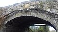 Callaghan Bridge 13th lock Royal Canal.jpg 3,264 × 1,836; 2.62 MB
-
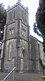 Church of Ireland Clonsilla spire.jpg 1,836 × 3,264; 2.78 MB
-
 County Dublin - St Mary's Church (Clonsilla) - 20141127141809.jpg 5,184 × 3,456; 5.79 MB
-
 Empty playground at Beechpark - geograph.org.uk - 3331713.jpg 1,024 × 704; 166 KB
-
-
 Mormon Chapel, Clonsilla - geograph.org.uk - 613304.jpg 640 × 474; 50 KB
-
 Park in clonsilla.JPG 2,160 × 3,840; 2.4 MB
-
 Royal Canal near Clonsilla - geograph.org.uk - 857741.jpg 640 × 480; 143 KB
-
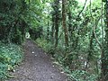
 Royal Canal Way - panoramio - Voytazz86.jpg 3,648 × 2,736; 2.62 MB
-
 St Mary's Church Clonsilla - geograph.org.uk - 546391.jpg 640 × 480; 107 KB
-
 Weavers Hall, Clonsilla, Dublin (2006).jpg 862 × 553; 88 KB
-
 Welcome to Clonsilla Village Bilingual Sign (2018).jpg 2,586 × 1,454; 1.37 MB


_-_20141127141809.jpg)


.jpg)
.jpg)