Category:Clonmore, County Armagh
Jump to navigation
Jump to search
English: Clonmore is a hamlet and townland of 348 acres in the Electoral Division of Killyman, in Civil Parish of Killyman, in the Barony of Oneilland West, in the County of Armagh
village in County Armagh, Northern Ireland, UK  | |||||
| Upload media | |||||
| Instance of | |||||
|---|---|---|---|---|---|
| Location | Northern Ireland | ||||
 | |||||
Subcategories
This category has only the following subcategory.
V
Media in category "Clonmore, County Armagh"
The following 13 files are in this category, out of 13 total.
-
 Blackwater River - geograph.org.uk - 814604.jpg 640 × 480; 63 KB
-
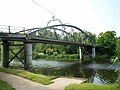
 Bond's Bridge - geograph.org.uk - 531634.jpg 640 × 480; 97 KB
-
 Bond's Bridge, Derrygally Road - geograph.org.uk - 814616.jpg 640 × 480; 73 KB
-
 Clonmore AOH Hall - geograph.org.uk - 600470.jpg 640 × 479; 45 KB
-
 Clonmore RC Church - geograph.org.uk - 2532595.jpg 640 × 480; 51 KB
-
 Clonmore RC Church - geograph.org.uk - 279147.jpg 640 × 479; 47 KB
-
 Clonmore Road - geograph.org.uk - 2532576.jpg 640 × 480; 54 KB
-
 Clonmore Road - geograph.org.uk - 279144.jpg 640 × 273; 35 KB
-
 Clonmore Road - geograph.org.uk - 279152.jpg 640 × 479; 64 KB
-
 Clonmore Townland - geograph.org.uk - 279149.jpg 640 × 479; 48 KB
-
 M1 eastbound towards junction 13 - geograph.org.uk - 4781931.jpg 1,200 × 799; 239 KB
-
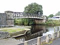 Verner's Bridge - geograph.org.uk - 563146.jpg 640 × 480; 101 KB
-
 View from Clonmore Road - geograph.org.uk - 600468.jpg 640 × 479; 68 KB


