Category:Clonmany
Jump to navigation
Jump to search
English: Clonmany is a village in north-west Inishowen, in County Donegal, Ireland. The area has many local beauty spots, and the Ballyliffin area is famous for its golf course. The Urris area to the west of Clonmany village was the last bastion of the Irish language in Inishowen. In the 19th century, the area was a frequent location of poitín distillation (a strong Irish spirit).
Gaeilge: Is sráidbhaile é Cluain Maine ( Béarla: Clonmany) atá suite i gContae Dhún na nGall, Poblacht na hÉireann.
Italiano: Clonmany è un discreto centro abitato del Donegal, nella Repubblica d'Irlanda. È situato nella parte nord-occidentale di Inishowen ed è stato a suo tempo una delle zone che più ha resistito alla decadenza nella regione della lingua irlandese a dispetto di quella inglese.
Nederlands: Clonmany is een plaats in het Ierse graafschap County Donegal. De plaats telt 303 inwoners.
village in Ulster, Ireland  | |||||
| Upload media | |||||
| Instance of | |||||
|---|---|---|---|---|---|
| Location | County Donegal, Ulster, Ireland | ||||
| Population |
| ||||
| Area |
| ||||
 | |||||
Subcategories
This category has only the following subcategory.
Media in category "Clonmany"
The following 37 files are in this category, out of 37 total.
-
 Annabella's, Clonmany - geograph.org.uk - 1391608.jpg 640 × 479; 40 KB
-
 Annagh Upper - geograph.org.uk - 1405907.jpg 640 × 479; 66 KB
-
 Annagh Upper - geograph.org.uk - 1405908.jpg 640 × 479; 71 KB
-
 Anne-Marie's - Movie Drome, Clonmany - geograph.org.uk - 1391593.jpg 640 × 479; 53 KB
-
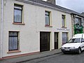
 Brennan's Pharmacy, Clonmany - geograph.org.uk - 1391605.jpg 640 × 479; 45 KB
-
 Briney's, Clonmaney - geograph.org.uk - 1391589.jpg 640 × 479; 58 KB
-
 Catriona's - Toland's Bar, Clonmany - geograph.org.uk - 1391590.jpg 640 × 479; 56 KB
-
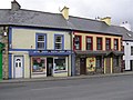
 Centra, Clonmany - geograph.org.uk - 1391614.jpg 640 × 479; 46 KB
-
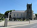 Clonmany R C Church - geograph.org.uk - 1384906.jpg 640 × 480; 60 KB
-
 Clonmany R C Church, Co. Donegal - geograph.org.uk - 1384910.jpg 640 × 480; 63 KB
-
 Clonmany, County Donegal - geograph.org.uk - 1391017.jpg 640 × 479; 38 KB
-
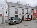
 Comisky's Bar, Clonmany - geograph.org.uk - 1391591.jpg 640 × 479; 47 KB
-
 Diffley Garden, Clonmany - geograph.org.uk - 1391598.jpg 640 × 479; 64 KB
-
 Doherty's Butcher Shop, Clonmany - geograph.org.uk - 2596706.jpg 640 × 480; 46 KB
-
 Main Street, Clonmany - geograph.org.uk - 1391609.jpg 640 × 479; 47 KB
-
 McCauleys, Clonmany - geograph.org.uk - 1391596.jpg 640 × 479; 50 KB
-
 McFeeley's Bar, Clonmany - geograph.org.uk - 1391601.jpg 640 × 479; 48 KB
-
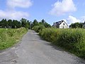
 Near Clonmany - geograph.org.uk - 1405911.jpg 640 × 479; 67 KB
-
 Near Clonmany - geograph.org.uk - 1405913.jpg 640 × 479; 55 KB
-
 Near Clonmany - geograph.org.uk - 1405916.jpg 640 × 479; 59 KB
-
 RC Church, Clonmany - geograph.org.uk - 1391615.jpg 640 × 479; 49 KB
-
 Road at Glebe - geograph.org.uk - 1405868.jpg 640 × 479; 59 KB
-
 Road near Clonmany - geograph.org.uk - 1405915.jpg 640 × 479; 56 KB
-
 Roxtown beach clonmany (photo by Mark McGaughey).jpg 4,000 × 2,250; 3.81 MB
-
 Shop 4 Less, Clonmany - geograph.org.uk - 1391604.jpg 640 × 479; 54 KB
-
 Snowflake, Clonmany - geograph.org.uk - 1391610.jpg 640 × 479; 58 KB
-
 St Mary's Hall, Clonmany - geograph.org.uk - 1391612.jpg 640 × 479; 52 KB
-
 Stone, Diffley Garden - geograph.org.uk - 1391600.jpg 479 × 640; 133 KB
-
 The High Stool, Clonmany - geograph.org.uk - 1391595.jpg 640 × 479; 42 KB
-
 The Square Bar, Clonmany - geograph.org.uk - 1391603.jpg 640 × 479; 48 KB
-
 The Square, Clonmany - geograph.org.uk - 1391607.jpg 640 × 479; 68 KB
-
 Clonmany Glebe - geograph.org.uk - 1405890.jpg 640 × 479; 69 KB
-
 Clonmany Glebe - geograph.org.uk - 1405894.jpg 640 × 479; 61 KB
-
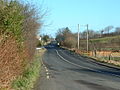 R238 between Clonmany and Ballyliffin - geograph.org.uk - 125285.jpg 640 × 480; 122 KB
-
 The Square, Clonmany, Inishowen - geograph.org.uk - 125283.jpg 640 × 480; 78 KB
-
 Tullagh Bay - geograph.org.uk - 400420.jpg 640 × 480; 70 KB
-
 Tullagh Bay - geograph.org.uk - 400427.jpg 640 × 480; 110 KB


.jpg)


