Category:Clocks in West Sussex
Jump to navigation
Jump to search
Subcategories
This category has only the following subcategory.
C
- Clock towers in West Sussex (4 F)
Media in category "Clocks in West Sussex"
The following 45 files are in this category, out of 45 total.
-
 18th-century carriage arch in courtyard of Parham House, West Sussex, England.jpg 3,000 × 2,000; 4.45 MB
-
 18th-century cupola and clock turret in courtyard of Parham House, West Sussex, England.jpg 2,000 × 3,000; 3.28 MB
-
 Nuthurst CC v. Henfield CC at Mannings Heath, West Sussex, England 043.jpg 4,422 × 3,316; 9.05 MB
-
 Victory Hall Balcombe Club, Balcombe, West Sussex, England 02.jpg 4,160 × 6,240; 21.17 MB
-
 Victory Hall Balcombe Club, Balcombe, West Sussex, England 03.jpg 6,093 × 4,062; 24.07 MB
-
 Balcombe Church 2.JPG 1,280 × 960; 438 KB
-
 Hotham Park House.JPG 1,280 × 960; 449 KB
-
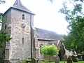
 St Pancras Church - geograph.org.uk - 666543.jpg 479 × 640; 93 KB
-
 St Pancras' Church, St Pancras, Chichester (NHLE Code 1354343).JPG 2,200 × 1,600; 1.21 MB
-
 Crawley Church tower - geograph.org.uk - 1446231.jpg 480 × 640; 69 KB
-
 St John the Baptist's Church, Crawley (October 2011).JPG 2,000 × 1,600; 699 KB
-
 East Street, Chichester, Sussex - geograph.org.uk - 1760461.jpg 2,592 × 3,872; 2.61 MB
-
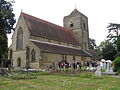
 St Wilfrid's Church, Haywards Heath.jpg 2,000 × 1,400; 1.02 MB
-
 St. Wilfreds church, Haywards Heath (geograph 2456128).jpg 2,816 × 2,112; 1.74 MB
-
 St Giles Church, Horsted Keynes (1018430 7b5e818d-by-Kevin-Gordon).jpg 480 × 640; 119 KB
-
 St Giles' Church, Horsted Keynes (from WSW).JPG 1,800 × 2,000; 1.03 MB
-
 St Giles' Church, Horsted Keynes (IoE Code 302538).JPG 2,400 × 1,944; 1.04 MB
-
 St Giles' Church, Horsted Keynes (NHLE Code 1025684).JPG 2,400 × 1,900; 1.33 MB
-
 St Giles' Church, Horsted Keynes (Tower and Spire).JPG 1,800 × 2,200; 1.28 MB
-
 All Saints Church, Lindfield (NHLE Code 1025462).JPG 2,400 × 1,800; 611 KB
-
 St Mary's Church, Littlehampton (NHLE Code 1353769).JPG 2,592 × 1,800; 1.44 MB
-
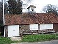 Lurgashall Cricket Club Pavilion - geograph.org.uk - 416011.jpg 640 × 480; 128 KB
-
 Church of St Michael and All Angels - geograph.org.uk - 41460.jpg 360 × 480; 29 KB
-

-
 Northchapel Church.JPG 2,400 × 3,200; 2.01 MB
-
 Stable Mews, Hall Avenue, Worthing - geograph.org.uk - 656643.jpg 640 × 480; 88 KB
-
 St Mary, Pulborough.JPG 2,048 × 1,536; 761 KB
-
 Tower of St Mary, Pulborough.JPG 1,536 × 2,048; 840 KB
-
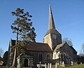
 St Mary Magdalene's Church, Rusper - from the southeast.jpg 2,560 × 1,920; 1.83 MB
-
 St Augustine of Canterbury Church, Scaynes Hill (033017 5ced43b3).jpg 640 × 480; 101 KB
-

-
 Shippam's old clock, East Street - geograph.org.uk - 813486.jpg 480 × 640; 45 KB
-
 St Peter's Church, Slinfold (IoE Code 299579).JPG 2,400 × 1,800; 954 KB
-
 South Harting Church 17.JPG 2,816 × 2,112; 1.46 MB
-
 South Harting Church5.JPG 1,280 × 960; 499 KB
-
-
 St Mary & St Gabriel, South Harting.jpg 1,920 × 1,839; 1,018 KB
-
 St Mary, Balcombe.JPG 1,536 × 2,048; 609 KB
-

-
 All Hallows Church, Tillington - geograph.org.uk - 353443.jpg 640 × 480; 87 KB
-
 Tillington Church 1.jpg 1,920 × 2,560; 2.32 MB
-
 Tower of St Mary de Haura, Shoreham - geograph.org.uk - 641416.jpg 640 × 480; 58 KB
-
 St. Margaret's church, Warnham - geograph.org.uk - 862172.jpg 640 × 480; 95 KB
-
 St Peter ad Vincula Church, Wisborough Green (July 2014) (Spire 2).JPG 2,600 × 3,600; 1.76 MB
-
 St. Peter ad Vincula - geograph.org.uk - 1433653.jpg 640 × 428; 67 KB


.JPG)

.JPG)


.jpg)
.jpg)
.JPG)
.JPG)
.JPG)
.JPG)
.JPG)
.JPG)


.jpg)
.jpg)

.JPG)


,_Crawley,_West_Sussex_-_geograph.org.uk_-_2751632.jpg)


,_Horsham,_West_Sussex_-_geograph.org.uk_-_649778.jpg)


_(Spire_2).JPG)
