Category:Climate maps of Europe
Jump to navigation
Jump to search
Subcategories
This category has the following 42 subcategories, out of 42 total.
Media in category "Climate maps of Europe"
The following 28 files are in this category, out of 28 total.
-
 154 of 'The International Geography. ... Edited by H. R. Mill' (11164152956).jpg 1,003 × 793; 256 KB
-
 2019-20 Dec-Feb CPC Europe percent of normal precipitation.png 2,700 × 2,700; 420 KB
-
 2019-20 Dec-Feb CPC Europe total precipitation.png 2,700 × 2,700; 323 KB
-
 2020-03 CPC Europe total precipitation.png 2,700 × 2,700; 351 KB
-
 2020-04 CPC Europe percent of normal precipitation.png 2,700 × 2,700; 405 KB
-
 2020-04 CPC Europe total precipitation.png 2,700 × 2,700; 359 KB
-
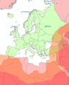
 Carte climats europe.gif 800 × 557; 83 KB
-
 Difference between high and low temperature records.png 4,592 × 3,196; 1.05 MB
-
 EuroMaxT21-27June2015.png 2,700 × 2,700; 304 KB
-
 EuroMaxTempearlyJuly2015.png 2,700 × 2,700; 308 KB
-
 Europa RD-stelsel met temperatuur met fouten.PNG 466 × 575; 18 KB
-
 Europa RD-stelsel met temperatuur.PNG 488 × 451; 22 KB
-
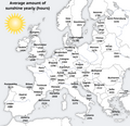
 Europe sunshine hours map.png 1,360 × 1,296; 1.18 MB
-
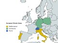 European Climate Zones.pdf 600 × 450; 1.19 MB
-
 Frost in Europe.png 1,218 × 1,137; 1,002 KB
-
 Karte mit Tiefsttemperatruren II.jpg 1,280 × 998; 878 KB
-
 Karte mit zu erwartenden Schneehöhen.jpg 1,024 × 1,407; 783 KB
-
 Koppen-Geiger Map Eastern Europe future.svg 1,619 × 850; 2.85 MB
-
 Koppen-Geiger Map Eastern Europe present.svg 1,619 × 850; 2.68 MB
-
 Koppen-Geiger Map GBR future.svg 1,480 × 850; 2.43 MB
-
 Koppen-Geiger Map Northern Europe present.svg 1,816 × 850; 4.31 MB
-
 Koppen-Geiger Map Southern Europe present.svg 1,816 × 850; 1.89 MB
-
 Koppen-Geiger Map Western Europe present.svg 1,674 × 850; 1.89 MB
-
 Lluvia-Europa-Rainfall.png 809 × 784; 228 KB
-
 Omegalage Russland Pakistan 2010.svg 941 × 415; 1.2 MB
-
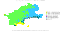
 SEUROPE3.jpg 807 × 561; 285 KB
-
 Sol-Europa-Sunshine.png 809 × 784; 238 KB
-
 Trend June max temp 1950 2009.svg 740 × 449; 1.76 MB
.jpg)


