Category:Climate diagrams of Bayreuth
Jump to navigation
Jump to search
Urban districts (cities): Ansbach · Augsburg · Bamberg · Bayreuth · Erlangen · Hof · Kaufbeuren · Kempten · Regensburg · Straubing · Weiden in der Oberpfalz · Würzburg
Deutsch: Klimadiagramme der Stadt Bayreuth.
Media in category "Climate diagrams of Bayreuth"
The following 3 files are in this category, out of 3 total.
-
 BAYREUTH nieder.png 480 × 360; 5 KB
-
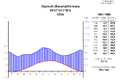 Climatediagram-metric-english-Bayreuth-Germany-1961-1990.png 1,000 × 685; 67 KB
-
 Klimadiagramm-metrisch-deutsch-Bayreuth-Deutschland-1961-1990.png 1,000 × 685; 67 KB


