Category:Clifton, Bedfordshire
Jump to navigation
Jump to search
village and civil parish in the English county of Bedfordshire  | |||||
| Upload media | |||||
| Instance of | |||||
|---|---|---|---|---|---|
| Location | Central Bedfordshire, Bedfordshire, East of England, England | ||||
| Population |
| ||||
 | |||||
English: Clifton is a village in the English county of Bedfordshire. It is historically one of the nine hundreds of Bedfordshire.
Subcategories
This category has the following 2 subcategories, out of 2 total.
Media in category "Clifton, Bedfordshire"
The following 85 files are in this category, out of 85 total.
-
 A bend in Shefford Road - geograph.org.uk - 4631833.jpg 640 × 480; 94 KB
-
 A bend in Stanford Lane - geograph.org.uk - 4630376.jpg 640 × 480; 122 KB
-
 A507 - geograph.org.uk - 2816867.jpg 4,000 × 3,000; 4.73 MB
-

-
 A507 roundabout with the A600 - geograph.org.uk - 2522730.jpg 640 × 480; 40 KB
-
 A507 towards Henlow - geograph.org.uk - 4615526.jpg 640 × 415; 54 KB
-
 A600 towards Hitchin - geograph.org.uk - 4618901.jpg 640 × 480; 76 KB
-
 All Saints church - geograph.org.uk - 2894243.jpg 480 × 640; 96 KB
-
 All Saints church, Clifton - geograph.org.uk - 4294494.jpg 2,592 × 1,944; 1.35 MB
-
 All Saints Church, Clifton - geograph.org.uk - 4630388.jpg 640 × 474; 111 KB
-
 All Saints Church, Clifton - geograph.org.uk - 5564691.jpg 1,600 × 1,065; 667 KB
-
 All Saints Church, Clifton - geograph.org.uk - 5566653.jpg 1,247 × 1,600; 802 KB
-
 All Saints Church, Clifton - geograph.org.uk - 5566655.jpg 1,532 × 1,340; 662 KB
-
 All Saints Church, Clifton - geograph.org.uk - 5566664.jpg 989 × 1,600; 524 KB
-
 All Saints Church, Clifton - geograph.org.uk - 5566722.jpg 1,600 × 1,065; 415 KB
-
 All Saints Church, Clifton - geograph.org.uk - 5566724.jpg 1,023 × 1,600; 762 KB
-
 All Saints Church, Clifton - geograph.org.uk - 5567578.jpg 1,600 × 1,065; 399 KB
-
 All Saints Church, Clifton - geograph.org.uk - 6046602.jpg 2,000 × 1,487; 755 KB
-
 All Saints Church, Clifton, Bedfordshire - geograph.org.uk - 3800808.jpg 4,320 × 3,240; 3.95 MB
-
 Bridleway towards Langford - geograph.org.uk - 2894158.jpg 640 × 428; 114 KB
-

-
 Bus stop on Church Street, Clifton - geograph.org.uk - 4631077.jpg 640 × 480; 101 KB
-
 Church Hall, Clifton - geograph.org.uk - 4630380.jpg 640 × 480; 85 KB
-
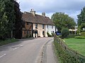
 Church Street, Clifton - geograph.org.uk - 6046580.jpg 2,000 × 1,287; 698 KB
-
 Clifton Chapel for Strict Baptists - geograph.org.uk - 2894267.jpg 640 × 427; 107 KB
-
 Clifton church - geograph.org.uk - 4863213.jpg 640 × 480; 138 KB
-
 Clifton Road, Shefford - geograph.org.uk - 4631841.jpg 640 × 480; 61 KB
-
 Clifton village pond - geograph.org.uk - 2894265.jpg 640 × 426; 84 KB
-
 Clifton War Memorial - geograph.org.uk - 4294502.jpg 2,592 × 1,944; 1.09 MB
-
 Clifton, All Saints - geograph.org.uk - 4424511.jpg 3,264 × 2,448; 1.51 MB
-
 Conservation walk to the Ivel Weir - geograph.org.uk - 2894172.jpg 640 × 426; 86 KB
-
 Disused lock in River Ivel Navigation - geograph.org.uk - 138288.jpg 482 × 640; 130 KB
-
 Downstream of the weir - geograph.org.uk - 2936359.jpg 881 × 661; 371 KB
-
 Farmland near Henlow Airfield - geograph.org.uk - 4615528.jpg 640 × 480; 57 KB
-
 Field off Pedley Lane, Clifton - geograph.org.uk - 6046432.jpg 2,000 × 1,500; 1.09 MB
-

-
 Footpath to Henlow - geograph.org.uk - 4294519.jpg 2,592 × 1,944; 1.24 MB
-
 Harrow Gate on the bridleway to Clifton - geograph.org.uk - 2894165.jpg 640 × 428; 117 KB
-
 Hedgerow and field margin - geograph.org.uk - 4618890.jpg 640 × 460; 106 KB
-
 Hill Farm hides behind trees - geograph.org.uk - 2935295.jpg 1,142 × 857; 335 KB
-
 Holly cottage - geograph.org.uk - 2894244.jpg 640 × 426; 106 KB
-
 House on Shefford Road - geograph.org.uk - 4631836.jpg 640 × 455; 46 KB
-
 Houses on Knolls Way, Clifton - geograph.org.uk - 4631827.jpg 640 × 480; 62 KB
-
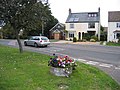
 Houses on Shefford Road - geograph.org.uk - 4626478.jpg 640 × 480; 73 KB
-
 Houses on Shefford Road - geograph.org.uk - 6598842.jpg 1,920 × 1,280; 1.18 MB
-
 Looking down Hitchin Hill towards Shefford - geograph.org.uk - 3787269.jpg 4,320 × 3,240; 5.34 MB
-
 New Road - geograph.org.uk - 4615532.jpg 640 × 480; 77 KB
-
 Path by the sewage works - geograph.org.uk - 2894150.jpg 480 × 640; 141 KB
-
 Path into Clifton - geograph.org.uk - 2894198.jpg 640 × 426; 92 KB
-
 Pedley Lane at Manor Close, Clifton - geograph.org.uk - 6046333.jpg 2,000 × 1,480; 940 KB
-
 Pedley Lane, Clifton - geograph.org.uk - 6046294.jpg 2,000 × 1,439; 772 KB
-
 Post Office and stores, Clifton - geograph.org.uk - 4631086.jpg 640 × 480; 65 KB
-
 Providence Baptist Chapel, Shefford Road, Clifton - geograph.org.uk - 6046291.jpg 2,000 × 1,491; 953 KB
-
 Providence Baptist Church, Clifton - geograph.org.uk - 4631831.jpg 640 × 480; 96 KB
-
 River Ivel - geograph.org.uk - 3485844.jpg 1,600 × 1,068; 553 KB
-
 River Ivel navigation - geograph.org.uk - 2894191.jpg 640 × 429; 92 KB
-
 Roadside nature reserve - geograph.org.uk - 4869508.jpg 1,600 × 1,065; 525 KB
-

-
 Shefford Road, Clifton - geograph.org.uk - 6046286.jpg 2,000 × 1,500; 1.11 MB
-
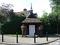
 Shelter by the village pond - geograph.org.uk - 2894262.jpg 640 × 428; 90 KB
-
 Sign for the Admiral, Clifton - geograph.org.uk - 4631084.jpg 527 × 640; 44 KB
-
 Sign for the Airrman at Meppershall - geograph.org.uk - 4618897.jpg 800 × 464; 96 KB
-
 Sign for the Golden Lion, Clifton - geograph.org.uk - 4626464.jpg 484 × 640; 49 KB
-
 Sign for Whiston Crescent, Clifton - geograph.org.uk - 6621272.jpg 1,872 × 1,206; 1.55 MB
-
 Spring Road, Clifton - geograph.org.uk - 4863221.jpg 640 × 480; 110 KB
-
 Stanford River disused lock - geograph.org.uk - 3631373.jpg 640 × 480; 74 KB
-
 Steam Lorry visits The Admiral PH - geograph.org.uk - 1015150.jpg 640 × 480; 55 KB
-
 The Admiral, Clifton - geograph.org.uk - 4631082.jpg 640 × 480; 64 KB
-
 The Airman Hotel - geograph.org.uk - 3787256.jpg 4,320 × 3,240; 3.63 MB
-
 The Airrman at Meppershall - geograph.org.uk - 4618896.jpg 640 × 480; 66 KB
-
 The Alms Cottages, Clifton - geograph.org.uk - 6046316.jpg 2,000 × 1,500; 1.06 MB
-
 The duckpond and Grange Street, Clifton - geograph.org.uk - 6046325.jpg 2,000 × 1,500; 905 KB
-
 The Golden Lion, Clifton - geograph.org.uk - 4626461.jpg 640 × 481; 54 KB
-
 The River Ivel and part of the Stanford Lane bridge - geograph.org.uk - 6046707.jpg 2,128 × 2,208; 1.37 MB
-
 The River Ivel from the Stanford Lane Bridge, Clifton - geograph.org.uk - 6046461.jpg 2,000 × 1,500; 1.04 MB
-
 The River Ivel Navigation near Stanford - geograph.org.uk - 2936389.jpg 1,077 × 808; 353 KB
-
 Tree lined drive - geograph.org.uk - 2894206.jpg 480 × 640; 115 KB
-
 Upstream towards Clifton ^ Shefford - geograph.org.uk - 2936364.jpg 979 × 734; 385 KB
-
 War Memorial on Church Street, Clifton - geograph.org.uk - 5567591.jpg 1,075 × 1,600; 400 KB
-
 War Memorial, Church Street, Clifton - geograph.org.uk - 5564695.jpg 1,600 × 1,065; 986 KB
-
 War Memorial, Clifton - geograph.org.uk - 4631079.jpg 640 × 480; 93 KB
-
 Watercourse near Clifton - geograph.org.uk - 4630379.jpg 480 × 640; 128 KB
-
 Whiston Crescent, Clifton - geograph.org.uk - 6598642.jpg 1,898 × 1,244; 1.67 MB
-
 Clifton Chapel, Beds - geograph.org.uk - 63241.jpg 600 × 450; 302 KB
-
 Village scene, Clifton, Beds - geograph.org.uk - 53270.jpg 640 × 480; 255 KB


