Category:Cliffs of Ontario
Jump to navigation
Jump to search
Provinces and territories of Canada: Alberta · British Columbia · Manitoba · New Brunswick · Newfoundland and Labrador · Nova Scotia · Ontario · Prince Edward Island · Quebec · Saskatchewan · Northwest Territories · Nunavut · Yukon
Subcategories
This category has the following 9 subcategories, out of 9 total.
Media in category "Cliffs of Ontario"
The following 49 files are in this category, out of 49 total.
-
 200 Foot Cliffs in North Bay.JPG 3,072 × 2,304; 2.99 MB
-
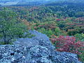
 Algoma autumn 1.JPG 2,560 × 1,920; 806 KB
-
 Algoma autumn 2.JPG 2,560 × 1,920; 819 KB
-
 Algoma autumn 3.JPG 2,560 × 1,920; 799 KB
-
 Algoma autumn 4.JPG 2,560 × 1,920; 808 KB
-
 Algoma autumn 5.JPG 2,560 × 1,920; 817 KB
-
 Algoma autumn 6.JPG 2,560 × 1,920; 811 KB
-
 Algoma, Gabrielle Rock (I0012362).jpg 6,160 × 3,686; 8.64 MB
-
 Atop Ripple Rock, Desbarats.JPG 3,264 × 2,448; 3.78 MB
-
 Barron Canyon cliff.jpg 2,543 × 5,000; 5.94 MB
-
 Bruce Peninsula Nat'l Park (31034751048).jpg 4,272 × 2,848; 4.77 MB
-
 Canoe lesson, George Lake (3882237631).jpg 3,648 × 2,736; 4.76 MB
-
 Canoe lesson, George Lake (3883034998).jpg 3,648 × 2,736; 4.57 MB
-
 Clarington, Ontario till 1.jpg 4,406 × 2,155; 3.51 MB
-
 Clarington, Ontario Till 2.jpg 3,072 × 2,304; 3.62 MB
-
 Cliff at Faerie Lake.jpg 3,648 × 2,736; 2.61 MB
-
 Cliff face in Duncan Escarpment.jpg 3,356 × 4,324; 4.38 MB
-
 Cliff near Ripple Rock, Desbarats 1.JPG 3,264 × 2,448; 3.82 MB
-
 Cliff near Ripple Rock, Desbarats 2.JPG 3,264 × 2,448; 3.2 MB
-
 Cliff on Faerie Lake. 2.jpg 3,648 × 2,736; 1.95 MB
-
 Cliffs 2.JPG 3,264 × 2,448; 3.81 MB
-
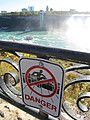 Danger at the falls (15110663633).jpg 2,736 × 3,648; 2 MB
-
 Drummer Lake Algonquin Park.jpg 4,843 × 3,632; 4.97 MB
-
 Georgian Bay, Georgian Bay-Marr Lake Trail (3882964492).jpg 3,648 × 2,736; 4.51 MB
-
 Georgian Bay, Georgian Bay-Marr Lake Trail (3882966106).jpg 2,736 × 3,648; 4.31 MB
-
 Georgian Bay-Marr Lake Trail (3882183819).jpg 2,736 × 3,648; 5.22 MB
-
 Georgian Bay-Marr Lake Trail (3882186083).jpg 2,736 × 3,648; 5.01 MB
-
 Kawartha (9775594703).jpg 3,780 × 2,520; 5.23 MB
-
 Kelso Conservation Area.jpg 1,024 × 680; 694 KB
-
 Lake Erie Viewed from Hawk Cliff.jpg 4,288 × 3,216; 7.3 MB
-
 Lake Superior in the Winter.JPG 4,320 × 3,240; 3.49 MB
-
 Lake Superior Provincial Park cliff 1.JPG 3,264 × 2,448; 3.85 MB
-
 Lake Superior Provincial Park cliff 2.JPG 3,264 × 2,448; 3.85 MB
-
 Lake Superior Provincial Park cliff 3.JPG 3,264 × 2,448; 3.87 MB
-
 Limestone Cliff (1166822815).jpg 1,200 × 1,800; 1.73 MB
-
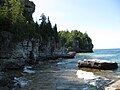
 Looking Back to the Grotto (6118043259).jpg 4,000 × 3,000; 2.99 MB
-
 Parliament Hillー Parliament Building ー Parliament of Canada - panoramio.jpg 1,600 × 889; 312 KB
-
 Rock Diving in North Bay.jpg 640 × 480; 116 KB
-
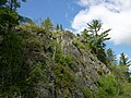
 Rocky bluff, Garden River.JPG 2,560 × 1,920; 805 KB
-
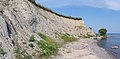
 Sand banks and Lake Erie (I0015533).jpg 1,968 × 2,485; 3.29 MB
-
 Sand banks and Lake Erie (I0015534).jpg 1,959 × 2,482; 3.32 MB
-
 Superior Lake Coast (229464331).jpeg 1,366 × 2,048; 1.7 MB
-
 This old heart gonna take them away (3766831263).jpg 3,117 × 1,946; 3.87 MB
-
 Turtle Rock.jpg 3,192 × 2,395; 1.06 MB
-
 Twin Sister Falls, Agawa Canyon (I0012363).jpg 4,765 × 4,504; 8.48 MB
-
 Upper Mazinaw Lake facing Mazinaw Rock.jpg 10,404 × 1,996; 3.72 MB
-
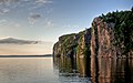
 Water, Sky, Cliff.jpg 3,264 × 2,448; 1.72 MB
-
 Wetland near Ripple Rock 1.JPG 3,264 × 2,448; 3.74 MB
-
 Woodland Caribou Provincial Park.jpg 4,607 × 2,966; 11.12 MB


.jpg)


.jpg)
.jpg)
.jpg)


.jpg)

.jpg)
.jpg)
.jpg)
.jpg)
.jpg)


.jpg)
.jpg)


.jpg)
.jpg)
.jpeg)
.jpg)

.jpg)


