Category:Cliffs of Cornwall
Jump to navigation
Jump to search
Ceremonial counties of England: Cornwall · Cumbria · Derbyshire · Devon · Dorset · Durham · East Riding of Yorkshire · East Sussex · Essex · Gloucestershire · Hampshire · Isle of Wight · Kent · Merseyside · Norfolk · North Yorkshire · Northumberland · Somerset · Suffolk · Tyne and Wear · West Sussex ·
City-counties:
Former historic counties: Sussex ·
Other former counties:
City-counties:
Former historic counties: Sussex ·
Other former counties:
Subcategories
This category has the following 64 subcategories, out of 64 total.
B
- Barrett's Zawn (7 F)
- Beeny Cliff, Cornwall (3 F)
- Black Cliffs, Hayle (8 F)
- Blackbottle Rock (5 F)
- Bodigga Cliff, Cornwall (4 F)
- Boscawen Point (8 F)
- Butter Hole, Cornwall (10 F)
C
- Carn Barra (12 F)
- Carn Gowla, St Agnes Head (5 F)
- Carn Leskys, Cornwall (4 F)
- Carn Lês Boel (16 F)
- Chynhalls Point (20 F)
D
- Droskyn Point (18 F)
F
- Fox Cove, Porthcothan (16 F)
- Freathy Cliff (4 F)
G
- Gew-graze, The Lizard (13 F)
- Grower Rock and Gut (7 F)
H
- Hell's Mouth, Cornwall (41 F)
- High Cliff, Cornwall (10 F)
- Higher Sharpnose Point (9 F)
- Hoe Point, Cornwall (5 F)
K
- Kelsey Head (16 F)
- Kenidjack (36 F)
L
- Lower Longbeak, Cornwall (11 F)
M
- Mullion Cliff, Cornwall (10 F)
N
- North Cliff, Cornwall (32 F)
P
- Pencarrow Head, Cornwall (20 F)
- Penhallic Point (10 F)
- Penhalt Cliff, Cornwall (12 F)
- Pepper Cove, Treyarnon (6 F)
Q
- Queener Point, Cornwall (8 F)
R
S
T
- The Criggars (5 F)
- The Rill, Cornwall (7 F)
- Treen Cliff (7 F)
- Tregonhawke Cliff (17 F)
- Treligga Cliff, Cornwall (5 F)
- Tremearne Cliff, Cornwall (8 F)
- Trevone Bay (39 F)
V
- Varley Head, Cornwall (9 F)
W
- Warren Cove, Treyarnon (6 F)
- Wine Cove, Treyarnon (6 F)
Media in category "Cliffs of Cornwall"
The following 188 files are in this category, out of 188 total.
-
-
 Across Trewellard Zawn - geograph.org.uk - 486179.jpg 640 × 427; 95 KB
-
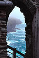
 Arches at Perranporth.jpg 4,032 × 2,720; 2.93 MB
-
 Beyond the Harbour Wall at Boscastle - geograph.org.uk - 101358.jpg 640 × 480; 86 KB
-
 Boscastle Harbour (1).jpg 5,312 × 2,988; 2.01 MB
-
 Boscastle Harbour (2).jpg 5,312 × 2,988; 2.62 MB
-
 Boswednack Cliff - geograph.org.uk - 1241812.jpg 480 × 640; 115 KB
-

-
 Bynorth Cliff - geograph.org.uk - 1558102.jpg 640 × 480; 80 KB
-
 Carn Boel and Carn Sperm from Carn Vean - geograph.org.uk - 936643.jpg 640 × 427; 112 KB
-
 Carn Gloose - geograph.org.uk - 1110257.jpg 427 × 640; 94 KB
-
 Carn Moyle cliff at Porthmeor Cove - geograph.org.uk - 1408993.jpg 640 × 480; 85 KB
-
 Carn Sperm - geograph.org.uk - 933150.jpg 640 × 427; 122 KB
-
 Carn Sperm - geograph.org.uk - 935928.jpg 640 × 427; 92 KB
-
 Carn Vean from Carn Sperm - geograph.org.uk - 936683.jpg 640 × 480; 113 KB
-
 Cliff above Cleave Strand - geograph.org.uk - 1559280.jpg 480 × 640; 108 KB
-
 Cliff at Polkerris - geograph.org.uk - 1238537.jpg 640 × 480; 92 KB
-
 Cliff at Porthbeor Beach - geograph.org.uk - 29108.jpg 636 × 640; 238 KB
-

-

-
 Cliff fall, Watergate Beach - geograph.org.uk - 936660.jpg 480 × 640; 200 KB
-
 Cliff path at Polbream Cove - geograph.org.uk - 1705837.jpg 1,024 × 768; 335 KB
-
 Cliff top above Gamper - geograph.org.uk - 1468968.jpg 640 × 480; 94 KB
-
-
 Cliffs - geograph.org.uk - 253177.jpg 640 × 426; 47 KB
-
 Cliffs Above Cancleave Strand - geograph.org.uk - 1494800.jpg 640 × 426; 100 KB
-
 Cliffs above Cleave Strand.jpg 4,028 × 2,848; 4.75 MB
-
 Cliffs Above Hole Beach - geograph.org.uk - 1493436.jpg 640 × 426; 105 KB
-
 Cliffs above Polbream Cove - geograph.org.uk - 1705865.jpg 1,024 × 684; 259 KB
-
 Cliffs Above The Strangles - geograph.org.uk - 1490530.jpg 640 × 426; 93 KB
-
 Cliffs above The Strangles - geograph.org.uk - 1560973.jpg 480 × 640; 98 KB
-
 Cliffs and Quarry near Porthoustock - geograph.org.uk - 171424.jpg 640 × 465; 62 KB
-
 Cliffs at Botallack - geograph.org.uk - 1723228.jpg 640 × 480; 80 KB
-
 Cliffs at cligga head - geograph.org.uk - 80429.jpg 480 × 640; 128 KB
-
 Cliffs at Pedn Crifton - geograph.org.uk - 925944.jpg 640 × 480; 84 KB
-
 Cliffs at the Carn Sperm headland - geograph.org.uk - 935931.jpg 480 × 640; 113 KB
-
 Cliffs at Tintagel - geograph.org.uk - 217089.jpg 450 × 574; 89 KB
-
 Cliffs at Tintagel - geograph.org.uk - 217095.jpg 640 × 480; 141 KB
-
 Cliffs at Zawn Kellys - geograph.org.uk - 850820.jpg 480 × 640; 94 KB
-
 Cliffs below Efford Down - geograph.org.uk - 1549232.jpg 640 × 480; 87 KB
-
 Cliffs below Levant Mine - geograph.org.uk - 1389606.jpg 480 × 640; 114 KB
-
 Cliffs below Wheal Coates - geograph.org.uk - 999541.jpg 640 × 591; 96 KB
-
 Cliffs east of Carn Boel - geograph.org.uk - 936671.jpg 480 × 640; 111 KB
-
 Cliffs from above Polberro Cove - geograph.org.uk - 23533.jpg 640 × 479; 85 KB
-
 Cliffs near Newquay.jpg 1,600 × 1,200; 530 KB
-
 Cliffs near Polridmouth - geograph.org.uk - 29716.jpg 640 × 480; 179 KB
-
 Cliffs near Port Isaac.jpg 3,322 × 2,215; 1.67 MB
-
 Cliffs on the North Cornish Coast (2785112128).jpg 1,712 × 2,560; 3.04 MB
-
 Cliffs rising near Com Head - geograph.org.uk - 955529.jpg 480 × 640; 108 KB
-
 Cliffs west of Stepper Point - geograph.org.uk - 1466326.jpg 640 × 426; 95 KB
-
 Clifftop above Polberro Cove - geograph.org.uk - 998268.jpg 640 × 607; 158 KB
-
 Clifftop Cave - geograph.org.uk - 933244.jpg 427 × 640; 149 KB
-
 Clifftop Slippage - geograph.org.uk - 1494789.jpg 640 × 426; 102 KB
-
 Clifftops at Watergate Bay, Cornwall - geograph.org.uk - 346926.jpg 640 × 434; 59 KB
-
 Climate history revealed^ - geograph.org.uk - 71736.jpg 2,048 × 1,536; 1.53 MB
-
 Coast above Cleave Strand - geograph.org.uk - 1559283.jpg 640 × 480; 80 KB
-
 Coast above Kennack Sands East.jpg 5,312 × 2,988; 1.42 MB
-
 Coast path DSC 8896.jpg 2,848 × 4,288; 7.4 MB
-
 Coast path DSC 8907.jpg 4,169 × 2,769; 6.6 MB
-
 Coast path near Towanroath shaft, St Agnes, Cornwall - 2 (14776820968).jpg 5,000 × 3,312; 16.92 MB
-
 Coastal Path - geograph.org.uk - 253727.jpg 640 × 426; 65 KB
-

-
 Coastpath south of Treyarnon (3) - geograph.org.uk - 1473710.jpg 640 × 439; 90 KB
-
 Coastpath south of Treyarnon (4) - geograph.org.uk - 1473712.jpg 640 × 426; 97 KB
-
 Collapsing cliff - geograph.org.uk - 797312.jpg 640 × 480; 105 KB
-
 Cornakey Cliff - geograph.org.uk - 1567943.jpg 640 × 480; 72 KB
-
 Cornakey Cliff - geograph.org.uk - 1567945.jpg 480 × 640; 87 KB
-
 Cornakey Cliff - geograph.org.uk - 572369.jpg 640 × 379; 47 KB
-
 Cornwall banner Porthtowan.jpg 4,288 × 613; 1.33 MB
-
 Covered Mine Shafts on the Cliff Top - geograph.org.uk - 472206.jpg 640 × 427; 104 KB
-
 Cracked cliff near Bedruthan Steps - geograph.org.uk - 224329.jpg 480 × 640; 144 KB
-
 Crackington Haven (2069178632).jpg 3,296 × 2,472; 4.16 MB
-
 Crackington Haven cliffs and beach.jpg 3,623 × 2,731; 4.85 MB
-
 Crooklets from Compass Point - geograph.org.uk - 130827.jpg 640 × 424; 120 KB
-
 Down the Cliff Slope - geograph.org.uk - 203666.jpg 640 × 427; 133 KB
-
 Duckpool and Warren Point.jpg 4,064 × 2,816; 4.59 MB
-
 Fold in Cliffs at Porthtowan.jpg 3,796 × 2,800; 4.63 MB
-
 From Pine Haven to Varley Head - geograph.org.uk - 105023.jpg 640 × 460; 67 KB
-
 Godrevy Point, cove on, seals basking - geograph.org.uk - 310037.jpg 640 × 480; 120 KB
-
 Great Britain^^^^^^^^ - geograph.org.uk - 343469.jpg 486 × 640; 146 KB
-

-
 Just a cliff - geograph.org.uk - 23541.jpg 640 × 479; 103 KB
-
 Landewednack TR12, UK - panoramio (9).jpg 3,216 × 1,832; 1.84 MB
-
 Landslip above Dizzard Point.jpg 3,616 × 2,765; 5.03 MB
-
 Lesceave Cliff and Rinsey Head - geograph.org.uk - 336992.jpg 640 × 474; 66 KB
-
 Levant Zawn - geograph.org.uk - 488453.jpg 640 × 427; 101 KB
-
 Little Hell - geograph.org.uk - 293596.jpg 480 × 640; 143 KB
-

-
 Looking out to sea near Sharrow Point - geograph.org.uk - 82841.jpg 640 × 480; 91 KB
-
 Looking south towards the cliffs from Cape Cornwall (21838777589).jpg 4,000 × 2,667; 1.66 MB
-
 Looking towards Merthen Point - geograph.org.uk - 36529.jpg 640 × 480; 115 KB
-
 Low cliffs at Harlyn Bay - geograph.org.uk - 1285780.jpg 640 × 426; 92 KB
-
 Low cliffs at Harlyn Bay - geograph.org.uk - 1294335.jpg 640 × 425; 135 KB
-
 Low Cliffs, Praa Sands - geograph.org.uk - 231908.jpg 640 × 480; 62 KB
-
 Low tide, Treyarnon Bay - geograph.org.uk - 72747.jpg 640 × 409; 135 KB
-
 Maer Cliffs - panoramio - Jynto.jpg 2,379 × 3,248; 4.22 MB
-
 Maer Cliffs - panoramio.jpg 3,170 × 2,371; 2.68 MB
-
 MaerCliffNearBudeCornwallUK.jpg 640 × 426; 115 KB
-
 Marble Cliffs - geograph.org.uk - 720454.jpg 480 × 640; 90 KB
-
 Maury Geography 010A Cornwall.jpg 1,885 × 782; 185 KB
-
 Men-a-Vaur - geograph.org.uk - 15249.jpg 640 × 425; 164 KB
-
 Millbrook Haven Cornwall England Uk Cornish.jpg 1,920 × 1,280; 849 KB
-
 Mine shaft at Wheal Edward - geograph.org.uk - 1723248.jpg 640 × 480; 104 KB
-
 Mine shaft near Tubby's Head (6316).jpg 4,288 × 2,848; 6.65 MB
-
 N Cornwall coast and GCHQ Bude.jpg 2,800 × 1,863; 2.33 MB
-
 Natural rock arch at Stamps An Jowl Zawn - geograph.org.uk - 1000709.jpg 640 × 427; 110 KB
-
 Near Cavehole Point - geograph.org.uk - 794641.jpg 640 × 412; 118 KB
-
 Northern Door, Crackington Haven.jpg 4,038 × 2,692; 5.49 MB
-
 Not a Beach - geograph.org.uk - 553759.jpg 640 × 427; 121 KB
-
-
 On Cornakey Cliff - geograph.org.uk - 1567928.jpg 640 × 480; 85 KB
-
 On Glebe Cliff - geograph.org.uk - 1493399.jpg 640 × 426; 107 KB
-
 On the eastern side of Porthglaze Cove - geograph.org.uk - 47718.jpg 640 × 461; 93 KB
-
 On Vicarage Cliff, Morwenstow - geograph.org.uk - 1369029.jpg 640 × 480; 97 KB
-
 Pellitras Point - geograph.org.uk - 1404802.jpg 640 × 480; 88 KB
-
 Pendeen cliff.jpg 1,704 × 2,272; 809 KB
-
 Pillbox at St. Michael's Mount.jpg 5,152 × 3,864; 4.89 MB
-
 Piskies Cove - geograph.org.uk - 23628.jpg 640 × 480; 93 KB
-
 Rocks above Zawn Rinny - geograph.org.uk - 1404793.jpg 640 × 480; 99 KB
-

-

-
 Sea Cliffs at Downderry - geograph.org.uk - 201527.jpg 640 × 480; 110 KB
-
 Seal Cove Cliff.jpg 403 × 583; 41 KB
-
 Sennen Cliffs - panoramio.jpg 3,888 × 2,592; 1.14 MB
-
 Sloping rock face, Maer Cliff - geograph.org.uk - 411049.jpg 640 × 480; 220 KB
-
 Splash (2316239883).jpg 2,458 × 1,455; 2.35 MB
-
 St Endellion, near Welshman's Quarry - geograph.org.uk - 850871.jpg 640 × 427; 194 KB
-
 Subsiding cliff, Park Head - geograph.org.uk - 224547.jpg 640 × 480; 99 KB
-
 Talland Bay - panoramio.jpg 3,008 × 2,256; 4.36 MB
-
 The cliff tops on The Island - Tintagel - geograph.org.uk - 599012.jpg 640 × 426; 116 KB
-

-
 The Eastern Rampart of Penberth Cove - geograph.org.uk - 319237.jpg 640 × 428; 103 KB
-
 The School - geograph.org.uk - 92115.jpg 640 × 480; 55 KB
-
 Tintagel.jpg 386 × 580; 160 KB
-
 Top of Tregaminion Cliff - geograph.org.uk - 914908.jpg 640 × 427; 132 KB
-
 Tregurnow Cliff - geograph.org.uk - 781877.jpg 480 × 640; 204 KB
-
 Tremedda cliffs and Gala Rocks - geograph.org.uk - 912884.jpg 640 × 480; 257 KB
-
 Trethias Island south of Treyarnon (1) - geograph.org.uk - 1473736.jpg 640 × 426; 109 KB
-
 Trethias Island south of Treyarnon (2) - geograph.org.uk - 1473737.jpg 600 × 399; 113 KB
-
 Trethill Cliffs (0006).jpg 4,288 × 2,848; 5.06 MB
-
 Trevedran Cliff - geograph.org.uk - 912389.jpg 640 × 480; 328 KB
-
 Treyarnon Bay - geograph.org.uk - 975585.jpg 640 × 480; 58 KB
-
 Treyarnon beach at low water (2) - geograph.org.uk - 1473762.jpg 640 × 416; 82 KB
-
 Treyarnon beach at low water (5) - geograph.org.uk - 1473767.jpg 640 × 426; 76 KB
-
 Treyarnon beach at low water (6) - geograph.org.uk - 1473769.jpg 640 × 448; 110 KB
-
 Treyarnon Point - geograph.org.uk - 482916.jpg 640 × 480; 115 KB
-
 Treyarnon.JPG 2,048 × 1,536; 947 KB
-
-
 Vicarage Cliff - geograph.org.uk - 1567950.jpg 640 × 480; 87 KB
-
 Vicarage Cliff, Morwenstow.jpg 3,996 × 2,804; 5.81 MB
-
 View across High Cove - geograph.org.uk - 1252466.jpg 640 × 426; 92 KB
-
 View from clifftop near Morwenstow - geograph.org.uk - 1471019.jpg 640 × 480; 135 KB
-
 View from Marsland Cliff - geograph.org.uk - 1567924.jpg 640 × 480; 76 KB
-
 View of cliffs at Lands End, Cornwall (2175675044).jpg 1,536 × 2,048; 946 KB
-
 View of cliffs at Lands End, Cornwall (2175675048).jpg 2,048 × 1,536; 1.07 MB
-
 View of cliffs at Lands End, Cornwall (2175675058) (2).jpg 1,536 × 2,048; 1 MB
-
 View of cliffs at Lands End, Cornwall (2175675086).jpg 2,048 × 1,536; 979 KB
-
 View west from Treleaver Cliff - geograph.org.uk - 2096548.jpg 1,024 × 768; 252 KB
-
 Wheal Coates from Chapel Porth.jpg 3,544 × 2,744; 4.16 MB
-
 Wicca Pool - geograph.org.uk - 32660.jpg 640 × 405; 70 KB
-

-
 Zawn at Pen Enys - geograph.org.uk - 1449093.jpg 640 × 480; 113 KB
-
 Zawn in Hellesveor Cliff - geograph.org.uk - 1448925.jpg 640 × 480; 108 KB
-
 Zawn on Wicca Cliff - geograph.org.uk - 1459102.jpg 640 × 480; 94 KB
-
 Zawn Pedn Kei - geograph.org.uk - 1459482.jpg 640 × 480; 107 KB
-
 Zawn Reeth - geograph.org.uk - 1406126.jpg 640 × 480; 103 KB
-
 Cliffs adjacent to Castle Rock - geograph.org.uk - 216978.jpg 640 × 480; 194 KB
-
 Cliffs below Drake's Downs - geograph.org.uk - 325686.jpg 640 × 426; 106 KB
-
 Cliffs under Pentire Point - geograph.org.uk - 63475.jpg 467 × 640; 158 KB
-
 Coast South of Bude - geograph.org.uk - 130838.jpg 640 × 424; 115 KB
-
 Coastline north of Pentewan - geograph.org.uk - 295832.jpg 640 × 480; 91 KB
-
 Duckpool - geograph.org.uk - 254725.jpg 640 × 480; 75 KB
-
 Fishing Cove - geograph.org.uk - 35183.jpg 640 × 480; 110 KB
-
 Halzephron Cove - geograph.org.uk - 186557.jpg 640 × 480; 83 KB
-
 Hendersick Cliff - geograph.org.uk - 32760.jpg 640 × 480; 78 KB
-
 Jagged Coastline - geograph.org.uk - 310684.jpg 513 × 640; 111 KB
-

-
 Lesceave Cliff - geograph.org.uk - 230986.jpg 640 × 480; 70 KB
-
 Lion's Den - geograph.org.uk - 271679.jpg 640 × 480; 73 KB
-
 Looking over the cliffs - geograph.org.uk - 254726.jpg 640 × 480; 97 KB
-
 Nealand Point - geograph.org.uk - 32782.jpg 640 × 452; 84 KB
-
 Parc Bean Cove - geograph.org.uk - 266461.jpg 640 × 480; 93 KB
-
 Rocky cliffs on "The Island", St Ives - geograph.org.uk - 346885.jpg 640 × 440; 75 KB
-
 Sea Cliffs at Downderry - geograph.org.uk - 201512.jpg 640 × 480; 148 KB
-
 Sunlight on the Cliffs - geograph.org.uk - 266417.jpg 640 × 480; 85 KB
-
 The Chair - geograph.org.uk - 251554.jpg 640 × 453; 96 KB
-
 The Chair, Whale Rock and Polbarrow - geograph.org.uk - 250822.jpg 640 × 425; 65 KB
-
 Tregaminion Cliff near Greeb Point - geograph.org.uk - 82928.jpg 640 × 480; 126 KB


.jpg)
.jpg)


.jpg)


.jpg)


_-_geograph.org.uk_-_1473710.jpg)
_-_geograph.org.uk_-_1473712.jpg)


.jpg)


.jpg)


.jpg)


.jpg)


.jpg)


_-_geograph.org.uk_-_1473736.jpg)
_-_geograph.org.uk_-_1473737.jpg)
.jpg)


_-_geograph.org.uk_-_1473762.jpg)
_-_geograph.org.uk_-_1473767.jpg)
_-_geograph.org.uk_-_1473769.jpg)


.jpg)
.jpg)
_(2).jpg)
.jpg)


