Category:Cliffs of Angus
Jump to navigation
Jump to search
Council areas (municipalities) of Scotland: Aberdeenshire · Angus · Argyll and Bute · Dumfries and Galloway · East Ayrshire · Fife · Highland · Inverclyde · Moray · North Ayrshire · Outer Hebrides · Orkney Islands · Scottish Borders · Shetland Islands · West Dunbartonshire ·
Subcategories
This category has the following 7 subcategories, out of 7 total.
A
- Auchmithie Cliffs (6 F)
C
- Craig Damff (2 F)
- Craig Haig (2 F)
- Craig Soales (8 F)
- Craigie Doubs (3 F)
L
R
Media in category "Cliffs of Angus"
The following 84 files are in this category, out of 84 total.
-
 'Coast Wise' cliff safety - geograph.org.uk - 753338.jpg 441 × 640; 89 KB
-
 Arbroath Cliff Panorama.JPG 12,319 × 998; 2.67 MB
-
 Arbroath Clifftop Walk - geograph.org.uk - 648064.jpg 640 × 425; 97 KB
-
 Auchmithie bay and cliffs - geograph.org.uk - 1096205.jpg 640 × 427; 207 KB
-
 Auchmithie pebble beach - geograph.org.uk - 1096212.jpg 427 × 640; 225 KB
-
 Auchmithie-cliffs.jpg 800 × 599; 146 KB
-
 Bombing - geograph.org.uk - 1144024.jpg 480 × 640; 76 KB
-
 Boulders under cliffs, Auchmithie - geograph.org.uk - 527405.jpg 640 × 434; 115 KB
-
 Calm place 0.jpg 3,024 × 4,032; 2.37 MB
-
 Calm place 1.jpg 3,024 × 4,032; 2.48 MB
-
 Calm place 2.jpg 4,032 × 3,024; 4.9 MB
-
 Calm place 3.jpg 3,024 × 4,032; 2.32 MB
-
 Calm place 4.jpg 3,024 × 4,032; 3.81 MB
-
 Calm place 5.jpg 3,024 × 4,032; 4.5 MB
-
 Calm place.jpg 3,024 × 4,032; 5.58 MB
-
 Cliff and stacks - geograph.org.uk - 1478059.jpg 640 × 427; 54 KB
-
 Cliffs at Arbroath looking south.jpg 1,600 × 1,200; 1 MB
-
 Cliffs at North end of Lunan Bay - geograph.org.uk - 13817.jpg 640 × 480; 159 KB
-
 Cliffs near Arbroath a.jpg 4,850 × 3,199; 11.11 MB
-
 Cliffs near Arbroath b.jpg 4,882 × 3,140; 1.89 MB
-
 Cliffs near Arbroath c.jpg 3,250 × 2,127; 4.4 MB
-
 Cliffs near Arbroath d.JPG 1,840 × 1,232; 916 KB
-
 Cliffs near Arbroath e The Deil's Heid.jpg 4,918 × 3,197; 6.49 MB
-
 Cliffs near Arbroath f.jpg 4,889 × 3,162; 5.67 MB
-
 Cliffs near Arbroath g The Three Sisters.jpg 4,896 × 3,140; 3.27 MB
-
 Cliffs near Arbroath h.jpg 4,918 × 3,176; 4.94 MB
-
 Cliffs near Arbroath i Seaton Cliffs Wildlife Reserve sign.jpg 2,448 × 1,581; 1.38 MB
-
 Cliffs near Arbroath j The Needle E'e.jpg 4,889 × 3,169; 3.66 MB
-
 Cliffs near Arbroath k.JPG 1,840 × 1,232; 734 KB
-
 Cliffs near Arbroath l.jpg 4,748 × 3,000; 7.43 MB
-
 Cliffs near Arbroath m1.jpg 4,800 × 3,118; 4.91 MB
-
 Cliffs near Arbroath m2.jpg 1,810 × 1,193; 1.27 MB
-
 Cliffs near Arbroath n 1988.jpg 2,445 × 1,616; 4.33 MB
-
 Cliffs near Arbroath o 1988 Gone Fishing.jpg 4,891 × 3,221; 9.29 MB
-
 Cliffs near Arbroath p 1988 Dickmont's Den.jpg 4,904 × 3,187; 14.66 MB
-
 Cliffs on the north side of Lunan Bay - geograph.org.uk - 196079.jpg 633 × 368; 236 KB
-
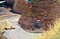
 Coastal Erosion North of Arbroath - geograph.org.uk - 948188.jpg 640 × 436; 72 KB
-
 Craig Soales and Craigangower - geograph.org.uk - 1223006.jpg 640 × 481; 75 KB
-
 Creag an Torraidh - geograph.org.uk - 167360.jpg 640 × 480; 72 KB
-
 Creag Caorach from Druim Mor - geograph.org.uk - 1349452.jpg 480 × 640; 116 KB
-
 Dickmont's Den - geograph.org.uk - 354000.jpg 640 × 480; 89 KB
-
 Dickmont's Den - geograph.org.uk - 580876.jpg 640 × 409; 240 KB
-
 Diel's Heid through damp haar - geograph.org.uk - 1461873.jpg 480 × 640; 22 KB
-
 Doo Cove - geograph.org.uk - 1460889.jpg 640 × 480; 303 KB
-
 Dunninald - geograph.org.uk - 215932.jpg 422 × 640; 249 KB
-
 East Comb - geograph.org.uk - 1465647.jpg 640 × 406; 252 KB
-
 East Comb and Auld Mains - geograph.org.uk - 1458664.jpg 640 × 427; 258 KB
-
 HM Coastguard cliff rescue of dog at Arbroath 1.JPG 4,256 × 2,832; 2.7 MB
-
 HM Coastguard cliff rescue of dog at Arbroath 2.JPG 4,256 × 2,832; 5.96 MB
-
 HM Coastguard cliff rescue of dog at Arbroath 3.jpg 2,832 × 4,256; 4.39 MB
-
 HM Coastguard cliff rescue of dog at Arbroath 4.JPG 4,256 × 2,832; 3.59 MB
-
 Hunt Hill. - geograph.org.uk - 76746.jpg 640 × 461; 104 KB
-
 Kirk Loch - geograph.org.uk - 1458645.jpg 640 × 415; 251 KB
-
-
 Masons' Cave, Cove Haven - geograph.org.uk - 74089.jpg 640 × 480; 98 KB
-
 Maw Skelly - geograph.org.uk - 195874.jpg 421 × 640; 259 KB
-
 Needle E'e - geograph.org.uk - 3184.jpg 517 × 621; 215 KB
-
 Needles E'e - geograph.org.uk - 905275.jpg 640 × 480; 111 KB
-
 Old Red Sandstone, close up - geograph.org.uk - 496665.jpg 640 × 480; 77 KB
-
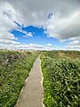
 Path above Victoria Park - geograph.org.uk - 950861.jpg 640 × 480; 67 KB
-
 Prail Castle - geograph.org.uk - 1465467.jpg 480 × 640; 289 KB
-
 Prail Castle - geograph.org.uk - 3213.jpg 430 × 640; 60 KB
-
 Red Head - geograph.org.uk - 1461173.jpg 640 × 400; 262 KB
-
 Red Head - geograph.org.uk - 3218.jpg 640 × 413; 37 KB
-
 Red Head trig - geograph.org.uk - 150654.jpg 640 × 427; 116 KB
-
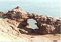
 Rock arch - geograph.org.uk - 1478068.jpg 640 × 427; 57 KB
-
 Rock Face - geograph.org.uk - 1465637.jpg 456 × 640; 146 KB
-
 Sandstone Cliffs Arbroath - geograph.org.uk - 353989.jpg 640 × 480; 72 KB
-
 Seaton Cliffs - geograph.org.uk - 228240.jpg 640 × 480; 93 KB
-
 Seaton Cliffs from the west - geograph.org.uk - 354005.jpg 640 × 480; 93 KB
-
 The "Flairs" - geograph.org.uk - 13867.jpg 640 × 480; 123 KB
-
 The De'ei's Head - geograph.org.uk - 919449.jpg 640 × 480; 62 KB
-
 The Deil's Heid, Arbroath Cliffs - geograph.org.uk - 647943.jpg 640 × 425; 72 KB
-
 The Mermaid's Kirk - geograph.org.uk - 580851.jpg 427 × 640; 259 KB
-
 The Needle E'e - geograph.org.uk - 580844.jpg 431 × 640; 224 KB
-
 The Needle E'e - geograph.org.uk - 580860.jpg 640 × 427; 220 KB
-
 View from Rickle Craig - geograph.org.uk - 531135.jpg 640 × 407; 227 KB
-
 View from Rickle Craig - geograph.org.uk - 531145.jpg 430 × 640; 258 KB
-

-
 Arbroath Cliffs - geograph.org.uk - 580839.jpg 425 × 640; 245 KB
-
 Cart ruts at the foot of the cliffs - geograph.org.uk - 496653.jpg 480 × 640; 95 KB
-
 Erosion at Whiting Ness. - geograph.org.uk - 496670.jpg 480 × 640; 86 KB
-
 Red Head - geograph.org.uk - 395178.jpg 640 × 412; 236 KB
-
 Rickle Craig - geograph.org.uk - 529776.jpg 640 × 427; 271 KB


