Category:Cliffe, Selby
Jump to navigation
Jump to search
village and civil parish near Selby, in North Yorkshire, England, United Kingdom  | |||||
| Upload media | |||||
| Instance of | |||||
|---|---|---|---|---|---|
| Location | Selby, North Yorkshire, Yorkshire and the Humber, England | ||||
| Population |
| ||||
 | |||||
English: Cliffe is a small village and civil parish in the Selby district of North Yorkshire, England. It lies on the A63 trunk road from Selby to Hull and the railway line which also goes to and from those destinations. The railway was opened in 1863 (as the Hull and Selby railway company) and there was a station at Cliffe although it was named after the nearby (larger) village of Hemingbrough. The station, like many others in the area closed in 1967.
Subcategories
This category has the following 6 subcategories, out of 6 total.
Media in category "Cliffe, Selby"
The following 200 files are in this category, out of 320 total.
(previous page) (next page)-
 A bend in the River Ouse - geograph.org.uk - 5351916.jpg 1,024 × 768; 179 KB
-
 A fishing pond in the making^ - geograph.org.uk - 3903387.jpg 4,000 × 3,000; 2.41 MB
-
 A footpath to Hemingbrough - geograph.org.uk - 2510092.jpg 800 × 600; 229 KB
-
 A Letterbox no More - geograph.org.uk - 2605830.jpg 2,448 × 3,264; 2.25 MB
-
 A piggery no more - geograph.org.uk - 2511785.jpg 800 × 600; 268 KB
-

-
 A road off Hagg Lane to Woodall - geograph.org.uk - 2510169.jpg 800 × 600; 237 KB
-
 A straight stretch of the River Ouse - geograph.org.uk - 6131553.jpg 1,024 × 768; 128 KB
-
 A163 Market Weighton Road - geograph.org.uk - 5952967.jpg 1,024 × 683; 586 KB
-
 A163 towards Barlby - geograph.org.uk - 5952968.jpg 1,024 × 683; 533 KB
-
 A63 towards Selby - geograph.org.uk - 2324691.jpg 1,600 × 1,200; 270 KB
-
 A63 towards Selby - geograph.org.uk - 2324726.jpg 640 × 480; 42 KB
-
 All Tracks Point to Drax - geograph.org.uk - 200532.jpg 640 × 480; 90 KB
-
 Along the A163 - geograph.org.uk - 5952970.jpg 1,024 × 683; 490 KB
-
 Approaching Goule Hall Farm - geograph.org.uk - 6205267.jpg 1,600 × 1,200; 447 KB
-
 Approaching Lara Bridge on Lowmoor Road - geograph.org.uk - 5397377.jpg 1,798 × 1,275; 1.07 MB
-
 Approaching Newlands Farm from the east - geograph.org.uk - 6205193.jpg 1,600 × 1,200; 468 KB
-
 Approaching the barn at Cleek Hall - geograph.org.uk - 6205199.jpg 1,600 × 1,200; 451 KB
-
 Barlow Lane End Farm - geograph.org.uk - 4916185.jpg 1,200 × 799; 531 KB
-
 Barn and covered pit at Cleek Hall - geograph.org.uk - 6131560.jpg 1,024 × 768; 99 KB
-
 Barn at Barlow Lane End Farm - geograph.org.uk - 5133786.jpg 1,024 × 768; 125 KB
-
 Barn at Cleek Hall - geograph.org.uk - 4916188.jpg 1,200 × 799; 341 KB
-
 Barn at Newlands Farm - geograph.org.uk - 4917924.jpg 1,200 × 799; 424 KB
-
 Barn at Newlands Farm - geograph.org.uk - 4917937.jpg 1,200 × 799; 407 KB
-
 Barn by Barlow Reach - geograph.org.uk - 6131568.jpg 1,024 × 768; 158 KB
-
 Barn near to Barlow Reach - geograph.org.uk - 5691688.jpg 1,500 × 864; 593 KB
-
 Beech Tree Farm, York Road, Cliffe - geograph.org.uk - 5882908.jpg 1,600 × 1,065; 461 KB
-
 Behind the floodbank - geograph.org.uk - 5351955.jpg 1,024 × 768; 168 KB
-
 Bend in the drain - geograph.org.uk - 5253206.jpg 1,024 × 768; 202 KB
-
 Big blue sky over the River Ouse - geograph.org.uk - 5099168.jpg 800 × 600; 88 KB
-
 Blackwood Lane towards North Duffield - geograph.org.uk - 5883749.jpg 1,600 × 1,065; 485 KB
-
 Blackwood Lane towards North Duffield - geograph.org.uk - 5883751.jpg 1,600 × 1,065; 556 KB
-
 Blackwood Lane towards North Duffield - geograph.org.uk - 5883752.jpg 1,600 × 1,065; 544 KB
-
 Blackwood Lane towards North Duffield - geograph.org.uk - 5883769.jpg 1,600 × 1,065; 754 KB
-
 Boundary fence, Skipwith Common - geograph.org.uk - 5336626.jpg 1,024 × 768; 329 KB
-
 Bridleway cut through oil seed rape - geograph.org.uk - 420432.jpg 640 × 480; 182 KB
-
 Bridleway off North Toft Lane - geograph.org.uk - 5253362.jpg 1,024 × 768; 184 KB
-
 Calf beside the River Ouse - geograph.org.uk - 4503329.jpg 800 × 533; 171 KB
-
 Carr Lane (Track) - geograph.org.uk - 2605831.jpg 3,264 × 2,448; 2.37 MB
-
 Cattle grazing by Marrowbone Reach - geograph.org.uk - 6205257.jpg 1,600 × 1,200; 494 KB
-
 Cattle on the riverbank at Newhay Farm - geograph.org.uk - 5133690.jpg 1,024 × 614; 105 KB
-
 Chapel Lane, South Duffield - geograph.org.uk - 2510209.jpg 800 × 600; 225 KB
-
 Clay Lane on Cliffe Common - geograph.org.uk - 1551884.jpg 640 × 480; 47 KB
-
 Cleaned out field drain - geograph.org.uk - 3900396.jpg 4,000 × 3,000; 3.68 MB
-
 Cleek Hall - geograph.org.uk - 615626.jpg 640 × 463; 59 KB
-
 Cliffe 1.JPG 3,264 × 2,448; 2.63 MB
-
 Cliffe 2.JPG 3,264 × 2,448; 2.49 MB
-
 Cliffe 3.JPG 2,448 × 3,264; 2.96 MB
-
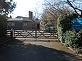
 Cliffe Common Gate - geograph.org.uk - 5278760.jpg 1,024 × 768; 150 KB
-
 Cliffe Fields from Carr Lane (Track) - geograph.org.uk - 2627817.jpg 640 × 480; 71 KB
-
 Cliffe Level Crossing - geograph.org.uk - 1551890.jpg 640 × 480; 65 KB
-
 Cliffe Primary School 1.JPG 3,264 × 2,448; 3.09 MB
-
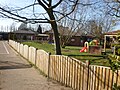 Cliffe Primary School 2.JPG 3,264 × 2,448; 3.12 MB
-
 Cliffe Village Institute, Cliffe - geograph.org.uk - 2511774.jpg 800 × 600; 231 KB
-
 Cliffe Village Street - geograph.org.uk - 2605825.jpg 3,264 × 2,448; 1.87 MB
-
 CM-Flag-Feb-2014.jpg 881 × 529; 167 KB
-
 Corner of a field - geograph.org.uk - 5254381.jpg 1,024 × 768; 230 KB
-
 Cottage Farm, Turnhill Lane, Cliffe - geograph.org.uk - 2510670.jpg 800 × 600; 287 KB
-
 Cottage Farm, Turnhill Lane, Cliffe - geograph.org.uk - 2511754.jpg 800 × 600; 248 KB
-
 Country road and big skies on a flat landscape - geograph.org.uk - 5397380.jpg 1,852 × 1,339; 1 MB
-
 Cut cornfield - geograph.org.uk - 5101182.jpg 3,064 × 1,714; 3.91 MB
-
 Derelict farm buildings near Turnham Hall - geograph.org.uk - 2324703.jpg 1,600 × 1,200; 454 KB
-
 Disused water pump on Moor Lane, South Duffield - geograph.org.uk - 5883064.jpg 1,065 × 1,600; 788 KB
-
 Drain flowing into the River Ouse - geograph.org.uk - 4917794.jpg 1,200 × 799; 472 KB
-
 Drain near Turnham Hall - geograph.org.uk - 5882212.jpg 1,600 × 1,065; 596 KB
-
 Drainage ditch - geograph.org.uk - 5101189.jpg 3,072 × 1,728; 4.75 MB
-
 Drainage ditch and farmland - geograph.org.uk - 4567433.jpg 640 × 426; 38 KB
-
 Driftwood in sunshine and shadow - geograph.org.uk - 3905456.jpg 4,000 × 3,000; 2.63 MB
-

-
 Dyon Bridge - geograph.org.uk - 5254182.jpg 1,024 × 768; 296 KB
-
 Dyon Bridge on Dyon Lane - geograph.org.uk - 3900274.jpg 4,000 × 3,000; 3.87 MB
-
 Dyon Drain above Dyon Bridge - geograph.org.uk - 5254177.jpg 1,024 × 768; 266 KB
-
 Dyon Drain below Dyon Bridge, - geograph.org.uk - 5253201.jpg 1,024 × 768; 247 KB
-
 Dyon Drain has Flooded - geograph.org.uk - 3900298.jpg 4,000 × 3,000; 2.85 MB
-
 Dyon Drain running east - geograph.org.uk - 3902228.jpg 4,000 × 3,000; 3.33 MB
-
 Dyon Lane toward North Duffield - geograph.org.uk - 3900256.jpg 4,000 × 3,000; 3.05 MB
-
 Dyon Lane towards Menthorpe - geograph.org.uk - 2324915.jpg 1,600 × 1,200; 508 KB
-
 East bank, River Ouse, near Cleek Hall barn - geograph.org.uk - 5134240.jpg 1,024 × 768; 125 KB
-
 Entering Cliffe - geograph.org.uk - 2510622.jpg 800 × 600; 214 KB
-
 Entering South Duffield - geograph.org.uk - 2510172.jpg 800 × 600; 276 KB
-
 Entrance to Hill Farm - geograph.org.uk - 5952969.jpg 1,024 × 683; 512 KB
-
 Entrance to North Tofts Farm - geograph.org.uk - 1552765.jpg 640 × 480; 64 KB
-
 Entrance to Whitemoor Business Park on Lowmoor Road - geograph.org.uk - 5400733.jpg 2,084 × 1,356; 954 KB
-
 Farm building, Wood End Farm - geograph.org.uk - 2324880.jpg 1,600 × 1,200; 284 KB
-
 Farm buildings, Cliffe Common - geograph.org.uk - 2324875.jpg 1,600 × 1,200; 309 KB
-
 Farm track and Pylon - geograph.org.uk - 4917797.jpg 799 × 1,200; 365 KB
-
 Farm track into arable land - geograph.org.uk - 660960.jpg 640 × 427; 54 KB
-
 Farm track leading to Cleek Hall - geograph.org.uk - 6205263.jpg 1,600 × 1,200; 699 KB
-
 Farm track off Greengate Lane - geograph.org.uk - 2359141.jpg 1,600 × 1,200; 410 KB
-
 Farm track off Woodhall Lane - geograph.org.uk - 5254326.jpg 1,024 × 768; 195 KB
-
 Farm track, South Duffield - geograph.org.uk - 2324894.jpg 1,600 × 1,200; 534 KB
-
 Farmland east of Selby - geograph.org.uk - 4571257.jpg 640 × 426; 45 KB
-
 Farmland near Becksyke Farm - geograph.org.uk - 4567855.jpg 640 × 422; 37 KB
-
 Farmland near Cliffe - geograph.org.uk - 2324686.jpg 1,600 × 1,200; 488 KB
-
 Farmland near Cliffe - geograph.org.uk - 4567217.jpg 640 × 426; 43 KB
-
 Farmland near Field House Farm - geograph.org.uk - 2324700.jpg 1,600 × 1,200; 286 KB
-
 Farmland near Newhay - geograph.org.uk - 2324683.jpg 1,600 × 1,200; 424 KB
-
 Farmland near South Duffield - geograph.org.uk - 2324904.jpg 1,600 × 1,200; 414 KB
-
 Farmland near Wood End Farm - geograph.org.uk - 2324882.jpg 640 × 480; 66 KB
-
 Farmland off Greengate Lane - geograph.org.uk - 2359139.jpg 1,600 × 1,200; 355 KB
-
 Farmland off Greengate Lane - geograph.org.uk - 2359144.jpg 1,600 × 1,200; 427 KB
-
 Farmland off North Toft Lane - geograph.org.uk - 2359153.jpg 1,600 × 1,200; 439 KB
-
 Farmland off Turnham Lane - geograph.org.uk - 6127799.jpg 1,024 × 683; 485 KB
-
 Farmland on the edge of Cliffe - geograph.org.uk - 4567190.jpg 640 × 426; 42 KB
-
 Field beside Turnham Lane - geograph.org.uk - 6127797.jpg 1,024 × 683; 732 KB
-
 Field boundary off North Toft Lane - geograph.org.uk - 2359152.jpg 1,600 × 1,200; 465 KB
-
 Field drain beside Newhay Lane - geograph.org.uk - 2324677.jpg 1,600 × 1,200; 559 KB
-
 Field drain near Goule Hall Farm - geograph.org.uk - 2324708.jpg 1,600 × 1,200; 730 KB
-
 Field edge and footpath - geograph.org.uk - 5253212.jpg 1,024 × 768; 295 KB
-
 Field footpath south to Oxen Lane (track) - geograph.org.uk - 3902245.jpg 4,000 × 3,000; 2.98 MB
-
 Field House Farm - geograph.org.uk - 2324697.jpg 1,600 × 1,200; 380 KB
-
 Field of oilseed rape, Cliffe Common - geograph.org.uk - 5280354.jpg 1,024 × 768; 179 KB
-
 Field off Cornelius Causeway - geograph.org.uk - 5952971.jpg 1,024 × 683; 479 KB
-
 Field track and footpath toward Cliffe - geograph.org.uk - 5398149.jpg 2,264 × 1,674; 1.59 MB
-
 Fields towards North Tofts Farm - geograph.org.uk - 1552778.jpg 640 × 480; 82 KB
-
 Fingerpost on Oxen Lane - geograph.org.uk - 5882989.jpg 1,600 × 1,065; 910 KB
-
 Flat farmland - geograph.org.uk - 4567155.jpg 640 × 426; 46 KB
-
 Floodwater has receded - geograph.org.uk - 3905409.jpg 4,000 × 3,000; 2.95 MB
-
 Footpath and Hemingbrough church - geograph.org.uk - 5351859.jpg 1,024 × 768; 206 KB
-
 Footpath leading to Moor Lane, South Duffield - geograph.org.uk - 5883003.jpg 1,600 × 1,065; 670 KB
-
 Footpath leading to South Duffield - geograph.org.uk - 5882996.jpg 1,600 × 1,065; 566 KB
-
 Footpath leading to the A63 at Lund - geograph.org.uk - 5882216.jpg 1,600 × 1,065; 934 KB
-
 Footpath south of Moor Lane, South Duffield - geograph.org.uk - 6252268.jpg 1,600 × 1,200; 870 KB
-
 Footpath through crop - geograph.org.uk - 3903324.jpg 4,000 × 3,000; 2.4 MB
-
 Footpath to Cliffe from Oxen Lane - geograph.org.uk - 6252105.jpg 1,600 × 1,200; 592 KB
-
 Footpath to Hemingbrough - geograph.org.uk - 2324910.jpg 1,600 × 1,200; 716 KB
-
 Footpath to Newhay Lane - geograph.org.uk - 5350934.jpg 1,024 × 768; 216 KB
-
 Footpath to Newhay Lane - geograph.org.uk - 5351245.jpg 1,024 × 768; 186 KB
-
 Footpath to North Duffield - geograph.org.uk - 5253361.jpg 1,024 × 768; 166 KB
-
 Footpath to North Duffield - geograph.org.uk - 5254738.jpg 1,024 × 768; 140 KB
-
 Footpath to North Duffield - geograph.org.uk - 5254745.jpg 1,024 × 768; 157 KB
-
 Footpath to North Duffield - geograph.org.uk - 6252269.jpg 1,600 × 1,200; 516 KB
-
 Footpath to North Duffield - geograph.org.uk - 6252272.jpg 1,600 × 1,200; 698 KB
-
 Footpath to South Duffield - geograph.org.uk - 3900371.jpg 4,000 × 3,000; 3.25 MB
-
 Former field boundary - geograph.org.uk - 5267631.jpg 1,024 × 768; 145 KB
-
 Gated farm track, Dyon House - geograph.org.uk - 2324913.jpg 640 × 480; 61 KB
-
 Gated field entrance off Greengate Lane - geograph.org.uk - 2359147.jpg 1,600 × 1,200; 684 KB
-
 Grazing land near Nevithorne - geograph.org.uk - 2324889.jpg 1,600 × 1,200; 394 KB
-
 Greengate Lane at Lodge Farm - geograph.org.uk - 2510319.jpg 800 × 600; 326 KB
-
 Greengate Lane at Lowmoor Road - geograph.org.uk - 2510325.jpg 800 × 600; 330 KB
-
 Greengate Lane from South Duffield - geograph.org.uk - 196624.jpg 640 × 480; 71 KB
-
 Greengate Lane towards South Duffield - geograph.org.uk - 2359149.jpg 1,600 × 1,200; 474 KB
-
 Greengate Lane towards the A163 - geograph.org.uk - 2359138.jpg 1,600 × 1,200; 571 KB
-
 Greengate Lane, South Duffield - geograph.org.uk - 2510264.jpg 800 × 600; 300 KB
-
 Hagg Lane Farm, Hemingbrough - geograph.org.uk - 616288.jpg 640 × 465; 55 KB
-
 Haymoors Wood - geograph.org.uk - 3900243.jpg 4,000 × 3,000; 3.14 MB
-
 Haymoors Wood - geograph.org.uk - 655896.jpg 640 × 427; 75 KB
-
 Hearing dogs for deaf people, Cliffe - geograph.org.uk - 2511768.jpg 800 × 600; 273 KB
-
 Hill Farm near Lund - geograph.org.uk - 5882903.jpg 1,600 × 1,065; 582 KB
-
 Horse passable gate on North Toft Lane - geograph.org.uk - 5254737.jpg 1,024 × 768; 325 KB
-
 Horses near Turnham Lane - geograph.org.uk - 6127794.jpg 1,024 × 683; 531 KB
-
 Houses at Ouse Bank near Newlands Farm - geograph.org.uk - 4917914.jpg 1,200 × 799; 481 KB
-
 Houses near Newlands Farm - geograph.org.uk - 4917806.jpg 1,200 × 799; 358 KB
-
 Houses near Newlands Farm - geograph.org.uk - 4917917.jpg 1,200 × 799; 324 KB
-
 Houses on Station Lane - geograph.org.uk - 4567157.jpg 640 × 426; 60 KB
-
 Hull Road at Cliffe - geograph.org.uk - 6131609.jpg 1,024 × 768; 237 KB
-
 Hull Road, Cliffe - geograph.org.uk - 196217.jpg 640 × 480; 74 KB
-
 Ings Lane - geograph.org.uk - 5652072.jpg 1,024 × 768; 162 KB
-
 Isolated tree - geograph.org.uk - 5267633.jpg 1,024 × 768; 128 KB
-
 It is a footpath, we detoured. - geograph.org.uk - 3903361.jpg 4,000 × 3,000; 5.56 MB
-
 Jacques' Lane, Cliffe - geograph.org.uk - 2510641.jpg 800 × 600; 316 KB
-
 Junction of A163 from Lowmoor Road - geograph.org.uk - 5397358.jpg 1,802 × 1,256; 1.05 MB
-
 Junction of Lowmoor Road and Greengate Lane - geograph.org.uk - 5400722.jpg 1,670 × 1,081; 844 KB
-
 Lake near Goule Hall Farm - geograph.org.uk - 4917761.jpg 1,200 × 799; 474 KB
-
 Lane to Kisima Farm from Clay Lane - geograph.org.uk - 6252096.jpg 1,600 × 1,200; 454 KB
-
 Lane towards River Ouse near Goule Hall Farm - geograph.org.uk - 2324712.jpg 1,600 × 1,200; 529 KB
-
 Lara Bridge on Lowmoor Road - geograph.org.uk - 2510332.jpg 800 × 600; 283 KB
-
 Large house on Lund Lane - geograph.org.uk - 5099813.jpg 800 × 600; 144 KB
-
 Line of dismantled railway - geograph.org.uk - 3900351.jpg 4,000 × 3,000; 2.67 MB
-
 Line of dismantled railway now ploughed out - geograph.org.uk - 3900359.jpg 4,000 × 3,000; 2.77 MB
-
 Line of former railway line - geograph.org.uk - 5883754.jpg 1,600 × 1,065; 662 KB
-
 Long barn on north bank of the Ouse - geograph.org.uk - 420832.jpg 640 × 480; 122 KB
-
 Lowmoor Drain - geograph.org.uk - 5254747.jpg 1,024 × 768; 228 KB
-
 Lowmoor Drain - geograph.org.uk - 5254750.jpg 1,024 × 768; 282 KB
-
 Lowmoor Moor Road at Cliffe Common Gate - geograph.org.uk - 2510607.jpg 800 × 600; 196 KB
-
 Lowmoor Road and Moor Lane junction - geograph.org.uk - 5397371.jpg 2,302 × 1,726; 1.53 MB
-
 Lowmoor Road approaching A163 junction - geograph.org.uk - 5397352.jpg 1,786 × 1,248; 988 KB
-
 Lowmoor Road toward A163 - geograph.org.uk - 5400735.jpg 1,749 × 1,174; 889 KB
-
 Lowmoor Road toward Moor Lane junction - geograph.org.uk - 5397368.jpg 2,206 × 1,588; 1.36 MB
-
 Lund Gate - geograph.org.uk - 4567861.jpg 640 × 384; 32 KB
-
 Lund Hull Road waste water pumping station - geograph.org.uk - 5882220.jpg 1,600 × 1,065; 758 KB
-
 Marrowbone Reach - geograph.org.uk - 2746619.jpg 1,280 × 956; 422 KB
-
 Marrowbone Reach, River Ouse - geograph.org.uk - 6131575.jpg 1,024 × 768; 120 KB
-
 Mill Lane, South Duffield - geograph.org.uk - 2510257.jpg 800 × 600; 316 KB
-
 Minor road towards Hemingbrough - geograph.org.uk - 2324901.jpg 1,600 × 1,200; 260 KB
-
 Minor road towards South Duffield - geograph.org.uk - 2324878.jpg 1,600 × 1,200; 537 KB
-
 Minor road towards Woodhall - geograph.org.uk - 2324907.jpg 1,600 × 1,200; 354 KB
-
 Minor road towards Woodhall - geograph.org.uk - 2324911.jpg 1,600 × 1,200; 514 KB
-
 Moor Lane South Duffield - geograph.org.uk - 3902240.jpg 4,000 × 3,000; 2.4 MB
-
 Moor Lane South Duffield - geograph.org.uk - 5883060.jpg 1,600 × 1,065; 522 KB
-
 Mossy roofed barn, Lund - geograph.org.uk - 5652310.jpg 1,024 × 768; 243 KB
-
 Muddy field near Larabridge Farm - geograph.org.uk - 5278768.jpg 1,024 × 768; 107 KB
-
 Muddy south bank, River Ouse - geograph.org.uk - 5133766.jpg 1,024 × 768; 101 KB
-
 Navigation light 21, River Ouse - geograph.org.uk - 5134424.jpg 1,024 × 768; 153 KB
-
 Navigation light 23, River Ouse - geograph.org.uk - 5134450.jpg 1,024 × 768; 125 KB
-
 New House on Oxen Lane, Cliffe - geograph.org.uk - 196195.jpg 640 × 480; 89 KB
-
 New pedestrian level crossing on Selby - Hull railway line - geograph.org.uk - 5101176.jpg 3,072 × 1,728; 4.69 MB
-
 Newhay Farm - geograph.org.uk - 4917569.jpg 1,200 × 799; 431 KB
-
 Newhay Farm - geograph.org.uk - 4917912.jpg 1,200 × 799; 472 KB
-
 Newhay Ferry Cottages, north bank, River Ouse - geograph.org.uk - 5133709.jpg 1,024 × 615; 121 KB


_-_geograph.org.uk_-_2605831.jpg)


_-_geograph.org.uk_-_2627817.jpg)


_-_geograph.org.uk_-_3902245.jpg)


