Category:Clermont Auvergne Métropole Library Maps
Jump to navigation
Jump to search
Media in category "Clermont Auvergne Métropole Library Maps"
The following 15 files are in this category, out of 15 total.
-
 Carte de Pont-du-Château (FR-631136102 CA 105).jpg 3,623 × 2,974; 4.95 MB
-
 Clermont-Ferrand Plan Sauty 1834 (FR-631136102 CA 82).jpg 1,889 × 1,470; 1.1 MB
-
 Clermont-Ferrand Plan Sauty 1846 (FR-631136102 CA 179).jpg 1,953 × 1,508; 1.44 MB
-
 Clermont-Ferrand Plan Sauty 1858 (631136102 CA 5009).jpg 2,306 × 1,681; 1.51 MB
-
 Clermont-Ferrand Plan Sauty 1863 (FR-631136102 CA 5010).jpg 2,726 × 1,710; 1.75 MB
-
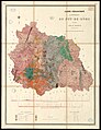
 FR-631136102 CA 173.jpg 15,063 × 3,362; 11.55 MB
-
 FR-631136102 CA 49.jpg 4,320 × 5,601; 4.07 MB
-
 FR-631136102 CA Del 1743.jpg 2,122 × 1,670; 1.57 MB
-
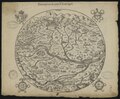 Gabriel Simeoni - Description du Pays d'Auvergne (FR-631136102 CA 131).tif 4,155 × 3,420; 40.7 MB
-
 La Jonchère - Carte de la ville et des environs de Clairmont-Ferrand (FR-631136102 CA DEL 1951).tif 11,341 × 7,707; 250.35 MB
-
 Plan Sauty 631136102 CA 5008 édition 1850.jpg 1,994 × 1,578; 1.45 MB
-
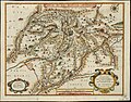
 Plan Sauty 631136102 CA 81.jpg 10,264 × 7,885; 20.67 MB
-
 Plan Sauty 631136102 CA DEL 1949 édition 1856.jpg 9,796 × 7,029; 33.03 MB
-
 Plan Sauty copie 631136102 CA 158.jpg 2,148 × 1,893; 1.06 MB
-
 Ville et cité de Clermont en Auvergne avant 1570 (FR-631136102 GRA 5521).jpg 4,592 × 3,600; 2.16 MB
.jpg)
.jpg)
.jpg)
.jpg)
.jpg)


.jpg)