Category:Cleasby
Jump to navigation
Jump to search
village in United Kingdom  | |||||
| Upload media | |||||
| Instance of | |||||
|---|---|---|---|---|---|
| Location | Richmondshire, North Yorkshire, Yorkshire and the Humber, England | ||||
| Population |
| ||||
| Said to be the same as | Cleasby (Wikimedia duplicated page, civil parish) | ||||
 | |||||
Media in category "Cleasby"
The following 66 files are in this category, out of 66 total.
-
 A hillside copse, near Cleasby - geograph.org.uk - 2017334.jpg 1,296 × 972; 382 KB
-

-
 A1(M) near Cleasby, looking south. - geograph.org.uk - 89626.jpg 640 × 480; 101 KB
-
 A1(M) North of Blackwell Spur - geograph.org.uk - 6444548.jpg 800 × 533; 205 KB
-
 A1(M) north of Junction 57 - geograph.org.uk - 5828151.jpg 1,024 × 768; 82 KB
-
 A1(M) northbound - geograph.org.uk - 6671734.jpg 640 × 397; 31 KB
-
 A1(M) northbound - geograph.org.uk - 6671736.jpg 640 × 437; 62 KB
-
 A1(M) northbound - geograph.org.uk - 6671739.jpg 640 × 447; 65 KB
-
 A1(M) southbound near Cleasby - geograph.org.uk - 4724867.jpg 640 × 480; 54 KB
-

-
 A66(M) road bridge near Stapleton - geograph.org.uk - 2017318.jpg 1,296 × 972; 246 KB
-
 Boathouse Lane, Cleasby - geograph.org.uk - 4724872.jpg 640 × 480; 77 KB
-
 Bridge over the A1(M) near Cleasby - geograph.org.uk - 2575029.jpg 640 × 430; 61 KB
-
 Broken Scar dam in flood - geograph.org.uk - 2126288.jpg 640 × 480; 88 KB
-
 Cleasby , A1(M) - geograph.org.uk - 6639680.jpg 5,375 × 3,583; 4.6 MB
-
 Cleasby Lane towards Beck House - geograph.org.uk - 6614371.jpg 1,600 × 1,065; 496 KB
-
 Cottages in Cleasby - geograph.org.uk - 4724876.jpg 640 × 480; 75 KB
-
 Cottages on The Green, Cleasby - geograph.org.uk - 4724879.jpg 640 × 480; 87 KB
-
 Dog walker by the River Tees - geograph.org.uk - 5494503.jpg 640 × 480; 279 KB
-
 Drinking Fountain. - geograph.org.uk - 164118.jpg 640 × 479; 154 KB
-
 Entry into Cleasby - geograph.org.uk - 2017347.jpg 1,141 × 813; 239 KB
-
 Farmland and track, Cleasby - geograph.org.uk - 2721816.jpg 640 × 480; 148 KB
-
 Farmland, Cleasby - geograph.org.uk - 2721807.jpg 640 × 480; 120 KB
-
 Farmland, Cleasby - geograph.org.uk - 2721849.jpg 640 × 480; 153 KB
-
 Farmland, Cleasby - geograph.org.uk - 2721853.jpg 640 × 480; 158 KB
-
 Field gates to farmland north of Newton Morrell - geograph.org.uk - 2771988.jpg 3,648 × 2,736; 3.07 MB
-
 Flooded gravel quarry near Cleasby.jpg 640 × 480; 93 KB
-

-
 Gated access to Cleasby Quarry - geograph.org.uk - 2017322.jpg 1,296 × 972; 400 KB
-

-
 Grazing and woodland near Cleasby - geograph.org.uk - 4724891.jpg 640 × 480; 66 KB
-
 Grazing towards Jolby Grange Farm - geograph.org.uk - 4739732.jpg 640 × 480; 52 KB
-
 Heading south east from Cleasby - geograph.org.uk - 4724892.jpg 640 × 480; 53 KB
-
 Heading south west towards Barton - geograph.org.uk - 4739768.jpg 640 × 480; 53 KB
-
 House on village green, Cleasby - geograph.org.uk - 2017371.jpg 1,199 × 937; 257 KB
-
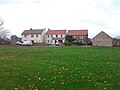 Houses on the Green, Cleasby - geograph.org.uk - 4724882.jpg 640 × 480; 68 KB
-
 Hummersknott School, Edinburgh Drive - geograph.org.uk - 137046.jpg 640 × 479; 83 KB
-
 Minor road towards Barton - geograph.org.uk - 4739774.jpg 640 × 480; 63 KB
-
 Moor Lane leading south from Cleasby - geograph.org.uk - 2632710.jpg 3,648 × 2,736; 3.67 MB
-
 New Willow Bridge - geograph.org.uk - 4452507.jpg 4,000 × 2,660; 5.04 MB
-
 Northbound A1(M), near Cleasby - geograph.org.uk - 2017432.jpg 2,592 × 1,944; 877 KB
-
 Old North Road Bridge, Willow Bridge - geograph.org.uk - 4452495.jpg 4,000 × 2,660; 4.86 MB
-

-
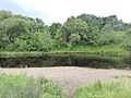 River Tees near Cleasby - geograph.org.uk - 5494495.jpg 640 × 480; 292 KB
-
 Road out of Cleasby to Manfield - geograph.org.uk - 2632698.jpg 3,648 × 2,736; 3.13 MB
-
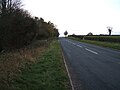
 Road south out of Cleasby - geograph.org.uk - 2017420.jpg 2,592 × 1,944; 764 KB
-
 Roadside Houses at Cleasby Grange - geograph.org.uk - 4481211.jpg 3,552 × 2,000; 2.42 MB
-

-
 Southbound A1(M), near Cleasby - geograph.org.uk - 2017427.jpg 2,592 × 1,944; 888 KB
-
 Stapleton Bank - geograph.org.uk - 4739730.jpg 640 × 480; 55 KB
-
 Stapleton Bank approaching Jolby Lane - geograph.org.uk - 6642020.jpg 1,024 × 683; 372 KB
-
 Stapleton Bank near Jolby Grange - geograph.org.uk - 6642016.jpg 1,024 × 683; 280 KB
-

-
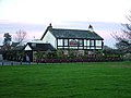 The Bridge Inn, Stapleton - geograph.org.uk - 81919.jpg 640 × 480; 57 KB
-
 The Green, Cleasby - geograph.org.uk - 4724886.jpg 640 × 480; 75 KB
-
 Village Green, Cleasby - geograph.org.uk - 2017362.jpg 2,592 × 1,944; 773 KB
-
 Village Green, Cleasby - geograph.org.uk - 4724889.jpg 640 × 480; 77 KB
-
 Village notice board ^ postbox, Cleasby - geograph.org.uk - 2017413.jpg 1,296 × 972; 518 KB
-
 Water pump on village green, Cleasby - geograph.org.uk - 2017401.jpg 1,296 × 972; 307 KB
-
 Water-well pump, Cleasby - geograph.org.uk - 2017405.jpg 2,592 × 1,944; 854 KB
-
 Weir at Broken Scar - geograph.org.uk - 5577818.jpg 4,000 × 3,000; 2.74 MB
-
-

-
 Cleasby Village Green - geograph.org.uk - 1402243.jpg 640 × 480; 69 KB
-
 High Linhams , Blackwell , Darlington - geograph.org.uk - 137125.jpg 640 × 479; 101 KB
-
 Old barn-shelter near Stapleton - geograph.org.uk - 89607.jpg 640 × 369; 60 KB

_Accommodation_Bridge,_High_House_Farm_-_geograph.org.uk_-_6444658.jpg)
_near_Cleasby,_looking_south._-_geograph.org.uk_-_89626.jpg)
_North_of_Blackwell_Spur_-_geograph.org.uk_-_6444548.jpg)
_north_of_Junction_57_-_geograph.org.uk_-_5828151.jpg)
_northbound_-_geograph.org.uk_-_6671734.jpg)
_northbound_-_geograph.org.uk_-_6671736.jpg)
_northbound_-_geograph.org.uk_-_6671739.jpg)
_southbound_near_Cleasby_-_geograph.org.uk_-_4724867.jpg)
_bridge_over_minor_road_near_Stapleton_-_geograph.org.uk_-_4724893.jpg)
_road_bridge_near_Stapleton_-_geograph.org.uk_-_2017318.jpg)

_near_Cleasby_-_geograph.org.uk_-_2575029.jpg)

_-_geograph.org.uk_-_6639680.jpg)


_near_High_House_-_geograph.org.uk_-_2575027.jpg)


,_near_Cleasby_-_geograph.org.uk_-_2017432.jpg)


,_near_Cleasby_-_geograph.org.uk_-_2017427.jpg)


_crosses_an_unclassified_road_near_Stapleton._-_geograph.org.uk_-_89614.jpg)


