Category:Clayton Heights
Jump to navigation
Jump to search
area in Bradford, West Yorkshire, UK | |||||
| Upload media | |||||
| Instance of | |||||
|---|---|---|---|---|---|
| Location | Bradford, West Yorkshire, Yorkshire and the Humber, England | ||||
 | |||||
Subcategories
This category has the following 7 subcategories, out of 7 total.
C
- Clayton Heights chapel (8 F)
- Clayton Heights War Memorial (3 F)
S
- Sheep Hill Lane (6 F)
V
- Views from Clayton Heights (17 F)
Media in category "Clayton Heights"
The following 30 files are in this category, out of 30 total.
-
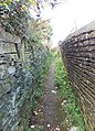
 A footpath off Baldwin Lane - geograph.org.uk - 2713018.jpg 800 × 600; 180 KB
-
 Asa Briggs Park - Play Area - geograph.org.uk - 3166127.jpg 640 × 480; 110 KB
-
 Asa Briggs Park - Playing Field - geograph.org.uk - 3166124.jpg 640 × 480; 51 KB
-
 Boar's Head (5224722774).jpg 2,452 × 1,592; 2.31 MB
-
 Bronte Way heading North off Back Lane - geograph.org.uk - 5095128.jpg 1,600 × 1,067; 600 KB
-

-
 Footpath - Dunnock Avenue - geograph.org.uk - 2955845.jpg 640 × 480; 121 KB
-
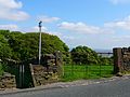
 Footpath - end of Holme Farm Close - geograph.org.uk - 2944501.jpg 480 × 640; 90 KB
-
 Footpath - end of Lingfield Terrace - geograph.org.uk - 2955833.jpg 480 × 640; 74 KB
-
 Footpath - end of Pintail Avenue - geograph.org.uk - 2943400.jpg 480 × 640; 122 KB
-
 Footpath - Fewston Avenue - geograph.org.uk - 2956018.jpg 480 × 640; 73 KB
-
 Footpath - New House Lane - geograph.org.uk - 3166054.jpg 462 × 640; 109 KB
-
 Footpath - off Highgate Road - geograph.org.uk - 3166044.jpg 480 × 640; 144 KB
-
 Footpath - Pintail Avenue - geograph.org.uk - 2943388.jpg 480 × 640; 91 KB
-
 Footpath - Pintail Avenue - geograph.org.uk - 2943392.jpg 640 × 480; 116 KB
-
 Footpath - Swift Drive - geograph.org.uk - 2943368.jpg 480 × 640; 62 KB
-
 Gate and Stile on the Bronte Way (2497104495).jpg 2,560 × 1,920; 3.35 MB
-
 Grassy Track ascending towards Clayton Heights - geograph.org.uk - 5095120.jpg 1,600 × 1,067; 618 KB
-
 Grassy Track descending towards Clayton - geograph.org.uk - 5095112.jpg 1,600 × 1,067; 630 KB
-
 Graveyard (1506584891).jpg 1,899 × 2,265; 1.69 MB
-
 Keep Safe.jpg 2,288 × 1,598; 2.71 MB
-
 Nab End, Union House Lane - geograph.org.uk - 605822.jpg 640 × 525; 128 KB
-
 Playground - Stocks Lane - geograph.org.uk - 602901.jpg 640 × 436; 44 KB
-
 Pollits House - off Dunnock Avenue - geograph.org.uk - 2955846.jpg 640 × 480; 94 KB
-
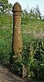 Rusty iron gatepost (4624549915).jpg 1,333 × 2,484; 4 MB
-
 Sheep Hill Lane, Clayton - geograph.org.uk - 1931400.jpg 2,000 × 1,500; 836 KB
-
 Sheep Hill Lane, Old Dolphin - geograph.org.uk - 338898.jpg 640 × 470; 102 KB
-
 Sheep, Tree and Snow, Baldwin Lane, Clayton (3256507724).jpg 2,490 × 1,660; 2.58 MB
-
 Stott Hall Farm (2625048171).jpg 2,378 × 1,657; 2.97 MB
-
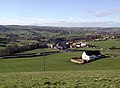
 Up the hill to Clayton Heights (2611349138).jpg 3,056 × 2,292; 5.13 MB


.jpg)


.jpg)


.jpg)


.jpg)


.jpg)
.jpg)
.jpg)