Category:Claxton, County Durham
Jump to navigation
Jump to search
civil parish in Hartlepool, County Durham, England, UK  | |||||
| Upload media | |||||
| Instance of | |||||
|---|---|---|---|---|---|
| Location | Hartlepool, County Durham, North East England, England | ||||
 | |||||
Media in category "Claxton, County Durham"
The following 20 files are in this category, out of 20 total.
-
 Blue House Farm - geograph.org.uk - 279172.jpg 640 × 480; 79 KB
-
 Blue House Farm - geograph.org.uk - 3820676.jpg 640 × 480; 66 KB
-
 Claxton Grange Farm - geograph.org.uk - 279060.jpg 640 × 480; 60 KB
-
 Dalton Back Lane - geograph.org.uk - 1832794.jpg 3,072 × 2,304; 1.45 MB
-
 Dalton Back Lane - geograph.org.uk - 3820675.jpg 640 × 480; 57 KB
-
 Dalton Back Lane - geograph.org.uk - 3820677.jpg 640 × 504; 117 KB
-
 Entering Greatham - geograph.org.uk - 3817911.jpg 640 × 480; 58 KB
-
 Entrance to Blue House Farm - geograph.org.uk - 1834619.jpg 3,088 × 2,056; 4.09 MB
-
 Entrance track to Claxton Grange - geograph.org.uk - 1832783.jpg 3,072 × 2,304; 1.39 MB
-
 Farm Road to West Pastures and Springwell House Farms - geograph.org.uk - 1886266.jpg 2,048 × 1,536; 957 KB
-
 Farmland, Claxton Grange - geograph.org.uk - 3819964.jpg 640 × 480; 66 KB
-
 Macrae Road, Hartlepool - geograph.org.uk - 2098095.jpg 640 × 480; 63 KB
-

-
 Owton Grange Farm, near Hartlepool - geograph.org.uk - 279065.jpg 640 × 480; 65 KB
-
 Public footpath from Dalton Back Lane - geograph.org.uk - 1886293.jpg 2,048 × 1,536; 1.03 MB
-
 Road junction near Claxton Farm - geograph.org.uk - 1832761.jpg 3,072 × 2,304; 1.46 MB
-
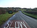
 Stockton Road (A689) - geograph.org.uk - 3819957.jpg 640 × 480; 105 KB
-
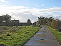
 Track to Claxton Grange - geograph.org.uk - 3819966.jpg 640 × 480; 82 KB
-
 Track to Lower Claxton - geograph.org.uk - 3819958.jpg 640 × 438; 68 KB
-
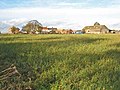
 View across the fields to Claxton Farm - geograph.org.uk - 1832804.jpg 3,072 × 2,304; 1.32 MB


_-_geograph.org.uk_-_3819957.jpg)


