Category:Clawton
Jump to navigation
Jump to search
village in United Kingdom  | |||||
| Upload media | |||||
| Instance of | |||||
|---|---|---|---|---|---|
| Location | Torridge, Devon, South West England, England | ||||
| Population |
| ||||
 | |||||
Subcategories
This category has the following 2 subcategories, out of 2 total.
C
- Clawton War Memorial (2 F)
S
- St Leonard's church, Clawton (10 F)
Media in category "Clawton"
The following 69 files are in this category, out of 69 total.
-
 A388 at Nethercott Cross - geograph.org.uk - 3130244.jpg 640 × 480; 45 KB
-
 A388 south bound, Swingate Cross - geograph.org.uk - 3130239.jpg 640 × 480; 61 KB
-
 Affaland Moor - geograph.org.uk - 682066.jpg 640 × 480; 80 KB
-
 Archies Farm from near Kennicott - geograph.org.uk - 606754.jpg 640 × 379; 45 KB
-
 Below Sellick - geograph.org.uk - 131256.jpg 640 × 433; 119 KB
-
 Below Sellick - geograph.org.uk - 131260.jpg 640 × 434; 82 KB
-
 Claw valley - geograph.org.uk - 5000543.jpg 1,920 × 1,280; 953 KB
-
 Claw valley - geograph.org.uk - 682036.jpg 640 × 480; 60 KB
-
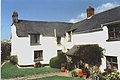
 Clawton Cottages - geograph.org.uk - 599184.jpg 600 × 450; 105 KB
-
 Clawton Village Hall (geograph 3404411).jpg 640 × 480; 73 KB
-
 Corfcott Green - geograph.org.uk - 3404388.jpg 640 × 480; 86 KB
-
 Countryside west of Buckhorn - geograph.org.uk - 4865751.jpg 2,488 × 1,660; 1,010 KB
-
 East Down Farmhouse - geograph.org.uk - 1476898.jpg 590 × 393; 196 KB
-
 Edge of Leworthy Plantation - geograph.org.uk - 697939.jpg 640 × 480; 98 KB
-
 Entrance to Clawton - geograph.org.uk - 3130230.jpg 640 × 449; 64 KB
-
 Farm lane to Higher Horslett - geograph.org.uk - 4865794.jpg 1,920 × 1,280; 794 KB
-
 Farmland at Circuit House - geograph.org.uk - 5001354.jpg 1,920 × 1,202; 829 KB
-
 Farmland near Affaland Cross - geograph.org.uk - 4865762.jpg 1,920 × 1,096; 826 KB
-
 Field at Kennacott Cross - geograph.org.uk - 606770.jpg 640 × 399; 65 KB
-
 Field by Herdicott Cross - geograph.org.uk - 5001237.jpg 1,920 × 1,280; 836 KB
-
 Field near Higher Northbeer - geograph.org.uk - 5000513.jpg 1,920 × 1,280; 769 KB
-
 Field near Parrs Leigh - geograph.org.uk - 4866150.jpg 1,920 × 1,221; 855 KB
-
 Field near Parrs Leigh - geograph.org.uk - 5002911.jpg 2,799 × 1,516; 1.28 MB
-
 Field, Corfcott Green - geograph.org.uk - 5001288.jpg 1,920 × 1,280; 917 KB
-
 Folley - geograph.org.uk - 682124.jpg 640 × 404; 42 KB
-
 Gateway near Leworthy - geograph.org.uk - 5002300.jpg 1,920 × 1,280; 728 KB
-
 Hawkes Place - geograph.org.uk - 5001362.jpg 1,920 × 1,225; 633 KB
-
 Herdicott cross - geograph.org.uk - 3404401.jpg 640 × 480; 53 KB
-
 Higher Sellick Farm near Clawton - geograph.org.uk - 131252.jpg 640 × 423; 89 KB
-
 House on a hill - geograph.org.uk - 599188.jpg 600 × 450; 121 KB
-
 In the Claw valley - geograph.org.uk - 5388661.jpg 3,072 × 2,048; 1.2 MB
-
 Lambs at Horslett - geograph.org.uk - 4873702.jpg 2,072 × 1,118; 522 KB
-
 Lana Lake valley - geograph.org.uk - 606741.jpg 640 × 480; 70 KB
-
 Lane at Horslett - geograph.org.uk - 4873659.jpg 1,920 × 2,880; 1.38 MB
-
 Lane near Layhay - geograph.org.uk - 4865790.jpg 1,611 × 1,068; 364 KB
-
 Lane to Commons Gate - geograph.org.uk - 5258888.jpg 2,048 × 3,072; 1.76 MB
-
 Lane to France - geograph.org.uk - 5002310.jpg 1,920 × 1,280; 718 KB
-
 Lane to Winscott Cross - geograph.org.uk - 5002905.jpg 1,920 × 1,207; 471 KB
-
 Leworthy Farm - geograph.org.uk - 697953.jpg 640 × 480; 111 KB
-
 Looking down the hill to Clawton - geograph.org.uk - 3417088.jpg 750 × 562; 128 KB
-
 Looking into the Deer valley - geograph.org.uk - 599190.jpg 600 × 450; 119 KB
-
 Looking towards the war memorial (geograph 3417077).jpg 789 × 635; 159 KB
-
 Near Leworthy Farm - geograph.org.uk - 4866027.jpg 1,920 × 1,280; 1,005 KB
-
 North Beer Farm - geograph.org.uk - 682201.jpg 640 × 342; 46 KB
-
 PoteArms.png 813 × 936; 132 KB
-
 River Claw below Sellick - geograph.org.uk - 131263.jpg 640 × 424; 102 KB
-
 River Deer at Forda Mill - geograph.org.uk - 682080.jpg 640 × 480; 99 KB
-
 Road from Clawton to Spry's Shop - geograph.org.uk - 5000510.jpg 1,920 × 1,280; 828 KB
-
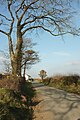
 Road to North Tamerton - geograph.org.uk - 599276.jpg 600 × 450; 111 KB
-
 Sillick Moor - geograph.org.uk - 4866138.jpg 3,072 × 2,048; 1.27 MB
-
 Sillick Moor - geograph.org.uk - 5002889.jpg 3,055 × 1,773; 1.43 MB
-
 Stacey's Christmas Tree Farm - geograph.org.uk - 599183.jpg 600 × 450; 88 KB
-
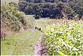
 The Hunt near Higher Horslett - geograph.org.uk - 599200.jpg 600 × 450; 110 KB
-
 Towards Ashwater - geograph.org.uk - 5003121.jpg 3,056 × 1,471; 1.01 MB
-
 Towards Blagdon Wood - geograph.org.uk - 603449.jpg 640 × 427; 274 KB
-
 Towards the Claw valley - geograph.org.uk - 5000599.jpg 1,920 × 1,280; 767 KB
-
 Towards the Claw valley - geograph.org.uk - 5001303.jpg 1,920 × 1,219; 799 KB
-
 Towards the Claw valley - geograph.org.uk - 5001339.jpg 1,920 × 1,253; 789 KB
-
 Towards the Deer valley - geograph.org.uk - 682017.jpg 640 × 480; 65 KB
-
 Track in the Claw valley - geograph.org.uk - 5000520.jpg 3,072 × 2,048; 1.25 MB
-
 Track near North Beer - geograph.org.uk - 4873244.jpg 1,920 × 1,280; 1,009 KB
-
 Track to Blagdon Manor Hotel - geograph.org.uk - 603457.jpg 640 × 427; 266 KB
-
 Trees near Langdon - geograph.org.uk - 682181.jpg 640 × 480; 120 KB
-
 Trig point near Blagdon Lodge Cross - geograph.org.uk - 488395.jpg 640 × 480; 127 KB
-
 View of Higher Broadpark Triangulation Pillar - geograph.org.uk - 4724213.jpg 4,000 × 3,000; 2.99 MB
-
 Wide verge at Herdicott Cross - geograph.org.uk - 5001281.jpg 3,070 × 1,729; 1.18 MB
-
 Windswept oaks - geograph.org.uk - 697955.jpg 640 × 480; 108 KB
-
 Wits End Cottage - geograph.org.uk - 599203.jpg 600 × 450; 108 KB
-
 Wood by the road south of Leworthy Cross - geograph.org.uk - 5002272.jpg 1,920 × 1,280; 972 KB


.jpg)


.jpg)


