Category:Claret (Torà)
Jump to navigation
Jump to search
Català: Claret Poble del municipi de Torà (Solsonès)
| Object location | | View all coordinates using: OpenStreetMap |
|---|
human settlement in Torà, Segarra, Ponent, Spain  | |||||
| Upload media | |||||
| Instance of |
| ||||
|---|---|---|---|---|---|
| Part of | |||||
| Location | Torà, Solsonès, Lleida Province, Catalonia | ||||
| Street address |
| ||||
| Population |
| ||||
| Elevation above sea level |
| ||||
 | |||||
Subcategories
This category has the following 15 subcategories, out of 15 total.
C
- Cabana del Peretó (Claret) (4 F)
- Cal Ferrer de Claret (3 F)
- Cal Ferreric de Claret (1 F)
- Cal Fustegueres de Claret (6 F)
- Cal Miramunt de Claret (6 F)
- Cal Moliner de Claret (4 F)
- Cal Prim (Claret) (3 F)
- Cal Sastre (Torà) (3 F)
- Can Vila (Claret) (5 F)
- Castell de Claret (Torà) (6 F)
E
- Era del Ferrer (2 F)
- Era del Ferreric (3 F)
P
- Paller Torina (6 F)
S
- Santa Maria de Claret (Torà) (14 F)
Media in category "Claret (Torà)"
The following 9 files are in this category, out of 9 total.
-
 CLARET - NUCLI.JPG 2,048 × 1,536; 1.52 MB
-
 CLARET - TORÀ - IB-004.jpg 2,048 × 1,536; 1.38 MB
-
 CLARET - TORÀ - IB-006.jpg 2,048 × 1,536; 1.46 MB
-
 CLARET - TORÀ - IB-P1090818.jpg 2,048 × 1,536; 973 KB
-
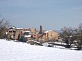 CLARET NEVAT.JPG 2,048 × 1,536; 1.52 MB
-
 Claret-PM 65042.jpg 1,000 × 667; 620 KB
-
 Claret-PM 65043.jpg 1,000 × 667; 785 KB
-
 Claret-PM 65044.jpg 667 × 1,000; 707 KB
-
 Claret-PM 65045.jpg 1,000 × 667; 734 KB


