Category:Clarbeston
Jump to navigation
Jump to search
English: Clarbeston is a village and parish in Pembrokeshire, Wales. It is situated 11 km east of Haverfordwest. The parish, together with Wiston and Walton East, constitutes the community of Wiston.
village in United Kingdom  | |||||
| Upload media | |||||
| Instance of | |||||
|---|---|---|---|---|---|
| Location | Pembrokeshire, Wales | ||||
 | |||||
Subcategories
This category has only the following subcategory.
Media in category "Clarbeston"
The following 17 files are in this category, out of 17 total.
-
 Afon Syfynwy at Stepaside bridge - geograph.org.uk - 691774.jpg 640 × 480; 110 KB
-
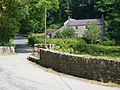
 Cotland Mill - geograph.org.uk - 161774.jpg 640 × 480; 129 KB
-
 Deepford Crossing, Clarbeston - geograph.org.uk - 793673.jpg 640 × 480; 117 KB
-
 Step-aside Bridge - geograph.org.uk - 87797.jpg 640 × 512; 132 KB
-
 Stepaside Bridge - geograph.org.uk - 694331.jpg 640 × 480; 140 KB
-
 The Green, Clarbeston (geograph 6575948).jpg 2,560 × 1,624; 4.15 MB
-
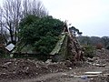 Tumbledown building - geograph.org.uk - 692746.jpg 640 × 480; 105 KB
-
 Typhoo fungus^ - geograph.org.uk - 694339.jpg 640 × 480; 148 KB
-
 Carmel Baptist Chapel - geograph.org.uk - 469407.jpg 640 × 480; 96 KB
-
 Cuckold - geograph.org.uk - 691759.jpg 640 × 480; 120 KB
-
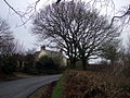
 Forehill Farm - geograph.org.uk - 691779.jpg 640 × 480; 56 KB
-
 Parc y Delin - geograph.org.uk - 473217.jpg 640 × 480; 122 KB
-
 Pont Crwca - geograph.org.uk - 469379.jpg 640 × 480; 139 KB
-
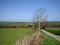
 Riverside pasture - geograph.org.uk - 694661.jpg 640 × 480; 97 KB
-
 Stubbleborough - geograph.org.uk - 161779.jpg 640 × 480; 81 KB
-
 Syfynwy valley near Stepaside Bridge - geograph.org.uk - 694330.jpg 640 × 480; 88 KB
-
 Workman's name - geograph.org.uk - 694335.jpg 640 × 480; 140 KB


.jpg)


