Category:Clady River, County Donegal
Jump to navigation
Jump to search
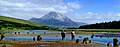
English: The Clady River, County Donegal flows for around 8km through moorlands and drains into Category:Lough Nacung in Gweedore, and then goes on through Bunbeg into the Crolly River estuary.
Media in category "Clady River, County Donegal"
The following 6 files are in this category, out of 6 total.
-
 Clady River - geograph.org.uk - 1030313.jpg 640 × 480; 150 KB
-
 Clady River - geograph.org.uk - 1030314.jpg 640 × 480; 105 KB
-
 Clady River - geograph.org.uk - 892896.jpg 640 × 480; 146 KB
-
 Gweedore - geograph.org.uk - 501791.jpg 640 × 479; 60 KB
-
 Gweefish.jpg 460 × 182; 24 KB
-


_Company%27s_illustrated_guide_to_the_sporting_and_touring_grounds_of_the_north_of_Ireland_(1908)_(14777078901).jpg)