Category:Clabby
Jump to navigation
Jump to search
English: *NI Neighbourhood Information Service
village in United Kingdom  | |||||
| Upload media | |||||
| Instance of | |||||
|---|---|---|---|---|---|
| Location | Northern Ireland | ||||
 | |||||
Media in category "Clabby"
The following 90 files are in this category, out of 90 total.
-
 Aghintain Road, Clabby - geograph.org.uk - 2834998.jpg 640 × 480; 52 KB
-
 Aghintain Road, Ramaley - geograph.org.uk - 4671274.jpg 640 × 480; 155 KB
-
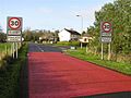 Approaching Clabby.jpg 640 × 479; 65 KB
-
 B107 Clabby Road, Lurganclabby - geograph.org.uk - 4671253.jpg 640 × 480; 138 KB
-
 B107 Road, Clabby - geograph.org.uk - 2835015.jpg 640 × 480; 47 KB
-
 B107, Clabby - geograph.org.uk - 2834991.jpg 640 × 480; 40 KB
-
 Bog at Brockagh - geograph.org.uk - 309346.jpg 640 × 479; 69 KB
-
 Camgart Townland - geograph.org.uk - 2835043.jpg 640 × 480; 95 KB
-
 Church hall, Clabby - geograph.org.uk - 2835013.jpg 640 × 480; 57 KB
-

-
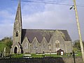
 Clabby Methodist Church - geograph.org.uk - 2835008.jpg 640 × 480; 51 KB
-
 Clabby Methodist Church - geograph.org.uk - 303775.jpg 640 × 479; 55 KB
-
 Clabby Post Office - geograph.org.uk - 303777.jpg 640 × 479; 62 KB
-
 Clabby Road, Lurganclabby - Camgart - geograph.org.uk - 4671270.jpg 640 × 480; 160 KB
-

-
 Clabby, County Tyrone - geograph.org.uk - 2835004.jpg 640 × 480; 51 KB
-
 Fathom Mountain from the M1 - geograph.org.uk - 1753793.jpg 1,024 × 768; 89 KB
-
 Floral display, Clabby (Ramaley) - geograph.org.uk - 4671255.jpg 640 × 480; 175 KB
-
 Frog spawn, Lendrum's Bridge - geograph.org.uk - 1205539.jpg 640 × 479; 88 KB
-
 Glengesh Lower Forest - geograph.org.uk - 309373.jpg 640 × 479; 71 KB
-
 Jimmy Clabby. Boxing LOC 2163449292.jpg 752 × 1,024; 117 KB
-
 Lendrum's Bridge - geograph.org.uk - 1205546.jpg 640 × 479; 60 KB
-
 Lurganclaby Townland - geograph.org.uk - 2834990.jpg 640 × 480; 81 KB
-
 Lurganclaby Townland - geograph.org.uk - 2834993.jpg 640 × 480; 67 KB
-
 Lurganclaby Townland - geograph.org.uk - 2834994.jpg 640 × 480; 49 KB
-
 Main Street, Clabby - geograph.org.uk - 4671259.jpg 640 × 480; 173 KB
-
 Main Street, Clabby - geograph.org.uk - 4671265.jpg 640 × 480; 177 KB
-
 Methodist Church, Ramaley - geograph.org.uk - 4671261.jpg 640 × 480; 170 KB
-
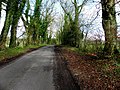
 Minor road, Clabby - geograph.org.uk - 2835010.jpg 640 × 480; 48 KB
-
 Ramaley Townland - geograph.org.uk - 4671272.jpg 640 × 480; 189 KB
-
 Road at Camgart - geograph.org.uk - 2835046.jpg 640 × 480; 101 KB
-
 Road at Clabby - geograph.org.uk - 2835005.jpg 640 × 480; 61 KB
-
 Road at Clabby - geograph.org.uk - 2835012.jpg 640 × 480; 46 KB
-
 Road at Edergole - geograph.org.uk - 309165.jpg 640 × 479; 42 KB
-
 Road sign, Clabby - geograph.org.uk - 2834997.jpg 640 × 480; 46 KB
-
 Ruined building - geograph.org.uk - 436761.jpg 640 × 480; 123 KB
-
-
 Standing Stone at Dooneen - geograph.org.uk - 309443.jpg 640 × 479; 99 KB
-
 Telephone box and floral display, Clabby - geograph.org.uk - 4671263.jpg 640 × 480; 159 KB
-
 Telephone box, Clabby - geograph.org.uk - 2835009.jpg 640 × 480; 58 KB
-
 Tullyweel, Fivemiletown - geograph.org.uk - 309213.jpg 640 × 479; 96 KB
-
 Wind farm near Lendrum's Bridge - geograph.org.uk - 1205529.jpg 640 × 479; 56 KB
-
 Wind farm near Lendrum's Bridge - geograph.org.uk - 1205530.jpg 640 × 479; 50 KB
-
 Brockagh - geograph.org.uk - 309327.jpg 640 × 479; 70 KB
-
 Brockagh - geograph.org.uk - 309336.jpg 640 × 479; 86 KB
-
 Brockagh - geograph.org.uk - 309341.jpg 640 × 479; 63 KB
-
 Brockagh Townland - geograph.org.uk - 309321.jpg 640 × 479; 77 KB
-
 Brockagh Townland - geograph.org.uk - 309329.jpg 640 × 479; 54 KB
-
 Brockagh Townland - geograph.org.uk - 309334.jpg 640 × 286; 39 KB
-
 Christmas garden at Clabby - geograph.org.uk - 303788.jpg 640 × 300; 42 KB
-
 Clabby Forest - geograph.org.uk - 303790.jpg 640 × 478; 62 KB
-
 Clabby Forest - geograph.org.uk - 303795.jpg 640 × 479; 81 KB
-
 Clabby Forest - geograph.org.uk - 309324.jpg 640 × 479; 78 KB
-
 Cloghoge - geograph.org.uk - 309319.jpg 640 × 479; 86 KB
-
 Cloghoge Townland - geograph.org.uk - 309311.jpg 640 × 479; 66 KB
-
 Cloghoge Townland - geograph.org.uk - 309315.jpg 640 × 479; 89 KB
-
 Corcreevy Townland - geograph.org.uk - 309226.jpg 640 × 479; 60 KB
-
 Dooneen Community Education Centre - geograph.org.uk - 309712.jpg 640 × 479; 38 KB
-
 Dooneen Forest Walk - geograph.org.uk - 309389.jpg 640 × 479; 81 KB
-
 Dooneen Townland - geograph.org.uk - 309380.jpg 640 × 479; 61 KB
-
 Edenbane Townland - geograph.org.uk - 309236.jpg 640 × 479; 70 KB
-
 Glengesh Lower Forest - geograph.org.uk - 309344.jpg 640 × 479; 58 KB
-
 Gray Hill - geograph.org.uk - 303763.jpg 640 × 479; 72 KB
-
 Gray Hill - geograph.org.uk - 303764.jpg 640 × 479; 64 KB
-
 Gray Hill - geograph.org.uk - 309255.jpg 640 × 479; 57 KB
-
 Gray Hill Townland - geograph.org.uk - 309260.jpg 640 × 479; 107 KB
-
 Gray Hill Townland - geograph.org.uk - 309262.jpg 640 × 302; 47 KB
-
 Greetings from Clabby - geograph.org.uk - 303781.jpg 640 × 479; 80 KB
-
 House near Clabby Forest - geograph.org.uk - 303761.jpg 640 × 479; 55 KB
-
 Killygordon Townland - geograph.org.uk - 540517.jpg 640 × 479; 78 KB
-
 Killygordon Townland - geograph.org.uk - 540518.jpg 640 × 479; 84 KB
-
 Killygordon Townland - geograph.org.uk - 540521.jpg 640 × 479; 48 KB
-
 Killyliss - geograph.org.uk - 309253.jpg 640 × 479; 62 KB
-
 Killyliss Townland - geograph.org.uk - 309229.jpg 640 × 290; 51 KB
-
 Knocknastracken Townland - geograph.org.uk - 309221.jpg 640 × 479; 62 KB
-
 Largandoy Townland - geograph.org.uk - 309392.jpg 640 × 479; 46 KB
-
 Largandoy Townland - geograph.org.uk - 309395.jpg 640 × 479; 66 KB
-
 Largandoy Townland - geograph.org.uk - 309399.jpg 640 × 293; 32 KB
-
 Letterbailey Townland - geograph.org.uk - 325478.jpg 640 × 479; 65 KB
-
 Ramaley Townland - geograph.org.uk - 303799.jpg 640 × 479; 50 KB
-
 Road at Cloghoge - geograph.org.uk - 309307.jpg 640 × 270; 29 KB
-
 Road at Dooneen - geograph.org.uk - 309377.jpg 479 × 640; 166 KB
-
 Road at Furnish - geograph.org.uk - 309223.jpg 640 × 479; 74 KB
-
 Road at Killyliss - geograph.org.uk - 309231.jpg 640 × 479; 97 KB
-
 Road at Rahoran - geograph.org.uk - 303754.jpg 640 × 479; 53 KB
-
 Tonyglaskan Townland - geograph.org.uk - 309425.jpg 640 × 290; 44 KB
-
 Track to the farm at Killygordon - geograph.org.uk - 436753.jpg 640 × 480; 97 KB
-
 Tullyullagh Townland - geograph.org.uk - 309254.jpg 640 × 479; 75 KB
-
 Tullyweel Townland - geograph.org.uk - 309210.jpg 640 × 479; 60 KB
-
 Tullyweel Townland - geograph.org.uk - 309211.jpg 640 × 283; 31 KB


_-_geograph.org.uk_-_4671255.jpg)


