Category:City maps of Ruhland
Jump to navigation
Jump to search

Media in category "City maps of Ruhland"
The following 11 files are in this category, out of 11 total.
-
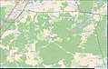 Amt Ruhland Übersicht aus OSM.jpg 1,405 × 889; 317 KB
-
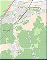
 Geschwister-Scholl-Weg Ruhland, Karte aus OpenStreetMap.jpg 3,899 × 7,218; 333 KB
-
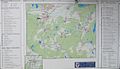 Informationstafel Amt Ruhland vor der Amtsverwaltung.jpg 1,164 × 672; 123 KB
-
 Ruhland Stadtplan - Berliner Str. 19.png 1,481 × 898; 784 KB
-
 Ruhland Stadtplan - Gutshof.png 1,481 × 898; 784 KB
-
 Ruhland Stadtplan - mit OT Arnsdorf 01.jpg 616 × 785; 85 KB
-
 Ruhland Stadtplan - mit OT Arnsdorf 02.jpg 2,421 × 3,479; 906 KB
-
 Ruhland Stadtplan - ohne OT Arnsdorf.jpg 1,215 × 821; 172 KB
-
 Ruhland Stadtplan - OT Arnsdorf.jpg 675 × 640; 61 KB
-
 Ruhland Stadtplan - Zentrum.png 1,481 × 898; 784 KB
-
 Ruhland, Kirchplatz, Gebäudenutzung vor 1900.jpg 761 × 847; 75 KB


