Category:City limit signs in Eure
Jump to navigation
Jump to search
Departments of Metropolitan France: Ain [01] · Aisne [02] · Allier [03] · Alpes-de-Haute-Provence [04] · Hautes-Alpes [05] · Alpes-Maritimes [06] · Ardèche [07] · Ardennes [08] · Ariège [09] · Aube [10] · Aude [11] · Aveyron [12] · Bouches-du-Rhône [13] · Calvados [14] · Cantal [15] · Charente [16] · Charente-Maritime [17] · Cher [18] · Corrèze [19] · Corse-du-Sud [2A]† · Haute-Corse [2B]† · Côte-d’Or [21] · Côtes-d'Armor [22] · Creuse [23] · Dordogne [24] · Doubs [25] · Drôme [26] · Eure [27] · Eure-et-Loir [28] · Finistère [29] · Gard [30] · Haute-Garonne [31] · Gers [32] · Gironde [33] · Hérault [34] · Ille-et-Vilaine [35] · Indre [36] · Indre-et-Loire [37] · Isère [38] · Jura [39] · Landes [40] · Loir-et-Cher [41] · Loire [42] · Haute-Loire [43] · Loire-Atlantique [44] · Loiret [45] · Lot [46] · Lot-et-Garonne [47] · Lozère [48] · Maine-et-Loire [49] · Manche [50] · Marne [51] · Haute-Marne [52] · Mayenne [53] · Meurthe-et-Moselle [54] · Meuse [55] · Morbihan [56] · Moselle [57] · Nièvre [58] · Nord [59] · Oise [60] · Orne [61] · Pas-de-Calais [62] · Puy-de-Dôme [63] · Pyrénées-Atlantiques [64] · Hautes-Pyrénées [65] · Pyrénées-Orientales [66] · Bas-Rhin [67] · Haut-Rhin [68] · departmental district of the Rhône [69] · Haute-Saône [70] · Saône-et-Loire [71] · Sarthe [72] · Savoie [73] · Haute-Savoie [74] · Paris [75] · Seine-Maritime [76] · Seine-et-Marne [77] · Yvelines [78] · Deux-Sèvres [79] · Somme [80] · Tarn [81] · Var [83] · Vaucluse [84] · Vendée [85] · Vienne [86] · Haute-Vienne [87] · Vosges [88] · Yonne [89] · Territoire de Belfort [90] · Essonne [91] · Hauts-de-Seine [92] · Seine-Saint-Denis [93] · Val-de-Marne [94] · Val-d'Oise [95]
Subcategories
This category has the following 2 subcategories, out of 2 total.
Media in category "City limit signs in Eure"
The following 138 files are in this category, out of 138 total.
-
 Aclou (Eure, Fr) city limit sign.JPG 4,320 × 3,240; 5.43 MB
-
 Ailly-FR-27-panneau d'agglomération-01.jpg 3,024 × 4,032; 3.08 MB
-
 Ailly-FR-27-panneau d'agglomération-02.jpg 4,032 × 3,024; 2.4 MB
-
 Ajou (Eure, Fr) city limit sign.JPG 4,320 × 3,240; 4.38 MB
-
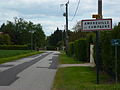 Amfreville-la-Campagne (Eure, Fr) city limit sign.JPG 4,320 × 3,240; 5.47 MB
-
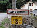 Amécourt Entrée Voisin Vigilants.jpg 2,592 × 1,944; 2.35 MB
-
 Asnières (Eure, Fr) city limit sign.JPG 4,320 × 3,240; 5.74 MB
-
 Authou (Eure, Fr) city limit sign.JPG 4,320 × 3,240; 4.46 MB
-
 Bailleul-la-Vallée (Eure, Fr) city limit sign.JPG 4,320 × 3,240; 4.41 MB
-
 Barc (Eure, Fr) city limit sign.JPG 4,320 × 3,240; 4.52 MB
-
 Barquet (Eure, Fr) city limit sign La Vacherie.JPG 4,320 × 3,240; 4.5 MB
-
 Barquet (Eure, Fr) city limit sign.JPG 4,320 × 3,240; 4.56 MB
-
 Barville (Eure, Fr) city limit sign.JPG 4,320 × 3,240; 5.42 MB
-
 Bazoques (Eure, Fr) city limit sign.JPG 4,320 × 3,240; 5.08 MB
-
 Berthouville (Eure, Fr) city limit sign.JPG 4,320 × 3,240; 4.2 MB
-
 Berthouville city limits.jpg 2,576 × 1,590; 1.75 MB
-
 Berville-la-Campagne (Eure, Fr) city limit sign.JPG 4,320 × 3,240; 4.4 MB
-
 Boisney (Eure, Fr) city limit sign.JPG 4,320 × 3,240; 5.36 MB
-
 Boissy-Lamberville (Eure, Fr) city limit sign.JPG 4,320 × 3,240; 6.09 MB
-
 Bosrobert (Eure, Fr) city limit sign.JPG 4,320 × 3,240; 4.47 MB
-
 Bosrobert (Eure, Fr) St.Taurin city limit sign.JPG 4,320 × 3,240; 5.61 MB
-
 Bournainville-Faverolles (Eure, Fr) city limit sign Bournainville.JPG 4,320 × 3,240; 5.27 MB
-
 Bournainville-Faverolles (Eure, Fr) city limit sign Faverolles-les-Mares.JPG 4,320 × 3,240; 5.34 MB
-
 Bourneville-FR-27-panneau d'agglomération-01.jpg 2,052 × 2,736; 2.07 MB
-
 Brionne (Eure, Fr) city limit sign.JPG 4,320 × 3,240; 4.64 MB
-
 Carsix (Eure, Fr) city limit sign.JPG 4,320 × 3,240; 4.62 MB
-
 Chavigny-Bailleul-FR-27-Ardennes-03.jpg 2,736 × 3,648; 1.43 MB
-
 Chavigny-Bailleul-FR-27-Ardennes-04.jpg 2,736 × 3,648; 1.24 MB
-
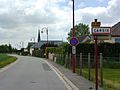
 Combon (Eure, Fr) city limit sign.JPG 4,320 × 3,240; 5.45 MB
-
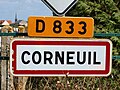
 Corneuil-FR-27-panneau d'agglomération-01.jpg 2,736 × 3,648; 1.23 MB
-
 Corneuil-FR-27-panneau d'agglomération-02.jpg 2,736 × 3,648; 2.81 MB
-
 Corneuil-FR-27-panneau d'agglomération-03.jpg 3,648 × 2,736; 2.75 MB
-
 Courbépine (Eure, Fr) city limit sign Courbépine.JPG 4,320 × 3,240; 4.82 MB
-
 Courbépine (Eure, Fr) city limit sign Le Malharquier.JPG 4,320 × 3,240; 5.62 MB
-
 Courbépine (Eure, Fr) city limit sign Le Val Guérard.JPG 4,320 × 3,240; 4.38 MB
-
 Créton-FR-27-panneau d'agglomération-03.jpg 3,648 × 2,736; 3.05 MB
-
 Damville-FR-27-la ville-01.jpg 2,736 × 3,648; 1.47 MB
-
 Damville-FR-27-la ville-02.jpg 2,736 × 3,648; 1.57 MB
-
 Damville-FR-27-la ville-03.jpg 3,648 × 2,736; 1.75 MB
-
 Damville-FR-27-la ville-04.jpg 3,648 × 2,736; 1.55 MB
-
 Drucourt (Eure, Fr) city limit sign.JPG 4,320 × 3,240; 4.51 MB
-
 Duranville (Eure, Fr) city limit sign.JPG 4,320 × 3,240; 4.54 MB
-
 Entrée de la commune.jpg 3,648 × 2,736; 2.05 MB
-
 Fog at the city limits of Le Bec-Hellouin.jpg 2,048 × 1,347; 1.47 MB
-
 Folleville (Eure, Fr) city limit sign et abri-bus.JPG 4,320 × 3,240; 5.62 MB
-
 Fontaine-l'Abbé (Eure, Fr) city limit sign.JPG 4,320 × 3,240; 5.45 MB
-
 Franqueville (Eure, Fr) city limit sign.JPG 4,320 × 3,240; 4.64 MB
-
 Fresne-Cauverville (Eure, Fr) city limit sign Cauverville.JPG 4,320 × 3,240; 5.75 MB
-
 Fresne-Cauverville (Eure, Fr) city limit sign Fresne.JPG 4,320 × 3,240; 4.6 MB
-
 Giverville (Eure, Fr) city limit sign.JPG 4,320 × 3,240; 5.96 MB
-
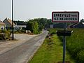
 Graveron-Sémerville (Eure, Fr) city limit sign hameau St-Meslin.JPG 4,320 × 3,240; 4.82 MB
-
 Grosly-sur-Risle (Eure, Fr) city limit sign Conchez.JPG 4,320 × 3,240; 5.59 MB
-
 Grosly-sur-Risle (Eure, Fr) city limit sign Le Nouveau Monde.JPG 4,320 × 3,240; 4.56 MB
-
 Grosly-sur-Risle (Eure, Fr) city limit sign village de l'église.JPG 4,320 × 3,240; 4.47 MB
-
 Hecmanville (Eure, Fr) city limit sign.JPG 4,320 × 3,240; 5.71 MB
-
 Heudreville-en-Lieuvin (Eure, Fr) city limit sign.JPG 4,320 × 3,240; 4.54 MB
-
 Iville (Eure, Fr) city limit sign.JPG 4,320 × 3,240; 5.42 MB
-
 La Cambe (Thibouville, Eure, Fr) city limit sign.JPG 4,320 × 3,240; 4.61 MB
-
 La Ferrière-sur-Risle (Eure, Fr) city limit sign.JPG 4,320 × 3,240; 4.69 MB
-
 La Haye-du-Theil (Eure, Fr) city limit sign.JPG 4,320 × 3,240; 5.39 MB
-
 La Houssaye (Eure, Fr) city limit sign.JPG 4,320 × 3,240; 4.57 MB
-
 La Madeleine-de-Nonancourt-FR-27-panneau d'agglomération-01.jpg 2,736 × 3,648; 3.24 MB
-
 La Madeleine-de-Nonancourt-FR-27-panneau d'agglomération-02.jpg 3,648 × 2,736; 2.5 MB
-
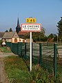 Le Chesne-FR-27-panneau d'agglomération-01.jpg 2,736 × 3,648; 2.98 MB
-
 Le Chesne-FR-27-panneau d'agglomération-02.jpg 2,736 × 3,648; 2.83 MB
-
 Le Chesne-FR-27-panneau d'agglomération-03.jpg 3,648 × 2,736; 2.95 MB
-
 Le Favril (Eure, Fr) city limit sign.JPG 4,320 × 3,240; 5.59 MB
-
 Le Gros-Theil (Eure, Fr) city limit sign.JPG 4,320 × 3,240; 5.88 MB
-
 Le Malassis-FR-27-panneau d'agglomération-01.jpg 3,024 × 4,032; 2.93 MB
-
 Le Malassis-FR-27-panneau d'agglomération-02.jpg 4,032 × 3,024; 2.46 MB
-
 Le Mesnil-Pipart (Eure, Fr) city limit sign.JPG 4,320 × 3,240; 5.45 MB
-
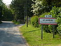
 Le Neubourg (Eure, Fr) city limit sign.JPG 4,320 × 3,240; 5.44 MB
-
 Le plessis hebert.jpg 2,560 × 1,920; 1.49 MB
-
 Le Plessis-Sainte-Opportune (Eure, Fr) city limit sign Le Plessis.JPG 4,320 × 3,240; 5.12 MB
-
 Le Plessis-Sainte-Opportune (Eure, Fr) city limit sign Sainte-Opportune-la-Campagne.JPG 4,320 × 3,240; 4.6 MB
-
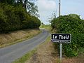
 Le Theil-Nolent (Eure, Fr) city limit sign.JPG 4,320 × 3,240; 5.91 MB
-
 Le Tilleul-Lambert (Eure, Fr) city limit sign.JPG 4,320 × 3,240; 4.24 MB
-
 Le Tilleul-Othon (Eure, Fr) city limit sign.JPG 4,320 × 3,240; 4.43 MB
-
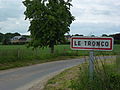 Le Troncq (Eure, Fr) city limit sign.JPG 4,320 × 3,240; 5.28 MB
-
 Lieurey (Eure, Fr) city limit sign.JPG 4,320 × 3,240; 4.29 MB
-
 Malleville-sur-le-Bec (Eure, Fr) city limit sign.JPG 4,320 × 3,240; 5.45 MB
-
 Malouy (Eure, Fr) city limit sign.JPG 4,320 × 3,240; 4.53 MB
-
 MANDEVILLE Entree village.jpg 3,648 × 2,736; 4.26 MB
-
 Menneval (Eure, Fr) city limit sign.jpg 4,320 × 3,240; 5.47 MB
-
 Moisville-FR-27-panneau d'agglomération-01.jpg 2,736 × 3,648; 2.92 MB
-
 Moisville-FR-27-panneau d'agglomération-02.jpg 3,648 × 2,736; 2.04 MB
-
 Morainville-Jouveaux (Eure, Fr) city limit sign, Jouveaux.JPG 4,320 × 3,240; 5.57 MB
-
 Morainville-Jouveaux (Eure, Fr) city limit sign, Morainville.JPG 4,320 × 3,240; 5.87 MB
-
 Morsan (Eure, Fr) city limit sign.JPG 4,320 × 3,240; 5.47 MB
-
 Nassandres (Eure, Fr) city limit sign.JPG 4,320 × 3,240; 4.76 MB
-
 Neuville-sur-Authou (Eure, Fr) city limit sign.JPG 4,320 × 3,240; 4.15 MB
-
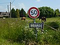 Noards (Eure, Fr) city limit sign and horses.JPG 4,320 × 3,240; 5.37 MB
-
 Panneau entrée Faverolles-la-Campagne 2023.jpg 1,559 × 1,169; 552 KB
-
 Perriers-la-Campagne (Eure, Fr) city limit sign.JPG 4,320 × 3,240; 4.17 MB
-
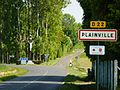 Plainville (Eure, Fr) city limit sign.JPG 4,320 × 3,240; 4.55 MB
-
 Plasnes (Eure, Fr) city limit sign.JPG 4,320 × 3,240; 5.2 MB
-
 PN Amécourt.jpg 2,592 × 1,944; 2.41 MB
-
 Romilly-La Puthenaye (Eure, Fr) city limit sign.JPG 4,320 × 3,240; 4.49 MB
-
 Romilly-la-Puthenaye (Eure, Fr) city limit sign La Puthenaye.JPG 4,320 × 3,240; 4.59 MB
-
 Romilly-la-Puthenaye (Eure, Fr) city limit sign Le Noé de Bougy.JPG 4,320 × 3,240; 4.72 MB
-
 Rouge-Perriers (Eure, Fr) city lim it sign.JPG 4,320 × 3,240; 5.15 MB
-
 Saint-Aubin-de-Scellon (Eure, Fr) city limit sign.JPG 4,320 × 3,240; 5.73 MB
-
 Saint-Georges-du-Mesnil (Eure, Fr) city limit sign.JPG 4,320 × 3,240; 5.5 MB
-
 Saint-Georges-du-Vièvre (Eure, Fr) city limit sign.JPG 4,320 × 3,240; 5.9 MB
-
 Saint-Jean-de-la-Léqueraye (Eure, Fr) city limit sign.JPG 4,320 × 3,240; 4.3 MB
-
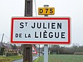
 Saint-Julien-de-la-Liègue-FR-27-panneau d'agglomération-01.jpg 3,024 × 4,032; 2.78 MB
-
 Saint-Julien-de-la-Liègue-FR-27-panneau d'agglomération-02.jpg 4,032 × 3,024; 3.06 MB
-
 Saint-Julien-de-la-Liègue-FR-27-panneau d'agglomération-03.jpg 3,024 × 4,032; 2.78 MB
-
 Saint-Julien-de-la-Liègue-FR-27-panneau d'agglomération-04.jpg 4,032 × 3,024; 2.67 MB
-
 Saint-Julien-de-la-Liègue-FR-27-panneau d'agglomération-05.jpg 3,024 × 4,032; 2.88 MB
-
 Saint-Julien-de-la-Liègue-FR-27-panneau d'agglomération-06.jpg 4,032 × 3,024; 2.81 MB
-
 Saint-Léger-de-Rôtes (Eure, Fr) city limit sign.JPG 4,320 × 3,240; 5.95 MB
-
 Saint-Martin-du-Tilleul (Eure) city limit sign.JPG 4,320 × 3,240; 4.69 MB
-
 Saint-Meslin-du-Bosc (Eure, Fr) city limit sign.JPG 4,320 × 3,240; 5.51 MB
-
 Saint-Nicolas-du-Bosc (Eure, Fr) city limit sign.JPG 4,320 × 3,240; 5.72 MB
-
 Saint-Pierre-de-Salerne (Eure, Fr) city limit sign et église Saint-Pierre.JPG 3,240 × 4,320; 4.24 MB
-
 Saint-Victor-d'Épine (Eure, Fr) city limit sign.JPG 4,320 × 3,240; 5.91 MB
-
 Saint-Vincent-du-Boulay (Eure, Fr) city limit sign.JPG 4,320 × 3,240; 4.41 MB
-
 Saint-Éloi-de-Fourques (Eure, Fr) city limit sign Le Bosc Yves.JPG 4,320 × 3,240; 5.6 MB
-
 Saint-Éloi-de-Fourques (Eure, Fr) city limit sign Le Mouchel.JPG 4,320 × 3,240; 5.96 MB
-
 Sainte-Opportune-du-Bosc (Eure, Fr) city limit sign.JPG 4,320 × 3,240; 5.37 MB
-
 Sébécourt (Eure, Fr) city limit sign.JPG 4,320 × 3,240; 4.45 MB
-
 Theil-Nolent panneau.jpg 1,233 × 1,500; 1.32 MB
-
 Thiberville (Eure, Fr) city limit sign.JPG 4,320 × 3,240; 4.64 MB
-
 Tilleul-Dame-Agnès (Eure, Fr) city limit sign.JPG 4,320 × 3,240; 4.59 MB
-
 Tourville-la-Campagne (Eure, Fr) city limit sign.JPG 4,320 × 3,240; 5.9 MB
-
 Trouville-la-Haule-FR-27-panneau d'agglomération-01.jpg 2,736 × 3,648; 2 MB
-
 Valailles (Eure, Fr) city limit sign and landscape.JPG 4,320 × 3,240; 4.48 MB
-
 Valailles (Eure, Fr) city limit sign Le Theil.JPG 4,320 × 3,240; 4.27 MB
-
 Valailles (Eure, Fr) city limit sign Montaigu.JPG 4,320 × 3,240; 4.58 MB
-
 VEZILLON 2017 1171 04.jpg 1,142 × 857; 322 KB
-
 Villez-sur-le-Neubourg (Eure, Fr) city limit sign Le Hameau.JPG 4,320 × 3,240; 5.34 MB
-
 Villez-sur-le-Neubourg (Eure, Fr) city limit sign.JPG 4,320 × 3,240; 5.33 MB
-
 Écardenville-la-Campagne (Eure, Fr) city limit sign.JPG 4,320 × 3,240; 5.9 MB
-
 Émanville (Eure, fr) city limit sign.JPG 4,320 × 3,240; 5.53 MB
-
 Épreville-en-Lieuvin (Eure, Fr) city limit sign.JPG 4,320 × 3,240; 4.25 MB
-
 Épreville-près-le-Neubourg (Eure, Fr) city limit sign.JPG 4,320 × 3,240; 4.54 MB
-
 Épégard (Eure, Fr) city limit sign.JPG 4,320 × 3,240; 5.4 MB
_city_limit_sign.JPG)


_city_limit_sign.JPG)
_city_limit_sign.JPG)

_city_limit_sign.JPG)
_city_limit_sign.JPG)
_city_limit_sign.JPG)
_city_limit_sign.JPG)
_city_limit_sign_La_Vacherie.JPG)
_city_limit_sign.JPG)
_city_limit_sign.JPG)
_city_limit_sign.JPG)
_city_limit_sign.JPG)

_city_limit_sign.JPG)
_city_limit_sign.JPG)
_city_limit_sign.JPG)
_city_limit_sign.JPG)
_St.Taurin_city_limit_sign.JPG)
_city_limit_sign_Bournainville.JPG)
_city_limit_sign_Faverolles-les-Mares.JPG)

_city_limit_sign.JPG)
_city_limit_sign.JPG)


_city_limit_sign.JPG)


_city_limit_sign_Courb%C3%A9pine.JPG)
_city_limit_sign_Le_Malharquier.JPG)
_city_limit_sign_Le_Val_Gu%C3%A9rard.JPG)


_city_limit_sign.JPG)
_city_limit_sign.JPG)


_city_limit_sign_et_abri-bus.JPG)
_city_limit_sign.JPG)
_city_limit_sign.JPG)
_city_limit_sign_Cauverville.JPG)
_city_limit_sign_Fresne.JPG)
_city_limit_sign.JPG)
_city_limit_sign_hameau_St-Meslin.JPG)
_city_limit_sign_Conchez.JPG)
_city_limit_sign_Le_Nouveau_Monde.JPG)
_city_limit_sign_village_de_l%27%C3%A9glise.JPG)
_city_limit_sign.JPG)
_city_limit_sign.JPG)
_city_limit_sign.JPG)
_city_limit_sign.JPG)
_city_limit_sign.JPG)
_city_limit_sign.JPG)
_city_limit_sign.JPG)


_city_limit_sign.JPG)
_city_limit_sign.JPG)


_city_limit_sign.JPG)
_city_limit_sign.JPG)

_city_limit_sign_Le_Plessis.JPG)
_city_limit_sign_Sainte-Opportune-la-Campagne.JPG)
_city_limit_sign.JPG)
_city_limit_sign.JPG)
_city_limit_sign.JPG)
_city_limit_sign.JPG)
_city_limit_sign.JPG)
_city_limit_sign.JPG)
_city_limit_sign.JPG)

_city_limit_sign.jpg)


_city_limit_sign,_Jouveaux.JPG)
_city_limit_sign,_Morainville.JPG)
_city_limit_sign.JPG)
_city_limit_sign.JPG)
_city_limit_sign.JPG)
_city_limit_sign_and_horses.JPG)

_city_limit_sign.JPG)
_city_limit_sign.JPG)
_city_limit_sign.JPG)

_city_limit_sign.JPG)
_city_limit_sign_La_Puthenaye.JPG)
_city_limit_sign_Le_No%C3%A9_de_Bougy.JPG)
_city_lim_it_sign.JPG)
_city_limit_sign.JPG)
_city_limit_sign.JPG)
_city_limit_sign.JPG)
_city_limit_sign.JPG)


_city_limit_sign.JPG)
_city_limit_sign.JPG)
_city_limit_sign.JPG)
_city_limit_sign.JPG)
_city_limit_sign_et_%C3%A9glise_Saint-Pierre.JPG)
_city_limit_sign.JPG)
_city_limit_sign.JPG)
_city_limit_sign_Le_Bosc_Yves.JPG)
_city_limit_sign_Le_Mouchel.JPG)
_city_limit_sign.JPG)
_city_limit_sign.JPG)

_city_limit_sign.JPG)
_city_limit_sign.JPG)
_city_limit_sign.JPG)

_city_limit_sign_and_landscape.JPG)
_city_limit_sign_Le_Theil.JPG)
_city_limit_sign_Montaigu.JPG)

_city_limit_sign_Le_Hameau.JPG)
_city_limit_sign.JPG)
_city_limit_sign.JPG)
_city_limit_sign.JPG)
_city_limit_sign.JPG)
_city_limit_sign.JPG)
_city_limit_sign.JPG)