Category:Cité Rougemont (Paris)
Jump to navigation
Jump to search
| Object location | | View all coordinates using: OpenStreetMap |
|---|
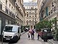
thoroughfare in Paris, France  _-_2021-06-28_-_1.jpg) | |||||
| Upload media | |||||
| Instance of | |||||
|---|---|---|---|---|---|
| Part of | |||||
| Named after | |||||
| Location | |||||
| Width |
| ||||
| Length |
| ||||
 | |||||
Media in category "Cité Rougemont (Paris)"
The following 5 files are in this category, out of 5 total.
-
 Cité Rougemont - Paris IX (FR75) - 2021-06-28 - 1.jpg 4,032 × 3,024; 4.41 MB
-
 Cité Rougemont - Paris IX (FR75) - 2021-06-28 - 2.jpg 4,032 × 3,024; 4.27 MB
-
 Cité Rougemont, Paris 2015-02-27.jpg 2,448 × 3,264; 2.47 MB
-
 Plaque Cité Rougemont - Paris IX (FR75) - 2021-06-28 - 1.jpg 2,234 × 2,727; 1.32 MB
-
 Plaque Cité Rougemont - Paris IX (FR75) - 2021-06-28 - 2.jpg 4,032 × 3,024; 4.14 MB
_-_2021-06-28_-_1.jpg)
_-_2021-06-28_-_2.jpg)
_-_2021-06-28_-_2.jpg)