Category:Cihelenské rybníky
Jump to navigation
Jump to search
| Object location | | View all coordinates using: OpenStreetMap |
|---|
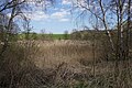
protected area in Czech Republic  Rybník Souška, součást PP Cihelenské rybníky | |||||
| Upload media | |||||
| Instance of | |||||
|---|---|---|---|---|---|
| Location | Horní Libchava, Česká Lípa District, Liberec Region, Czechia | ||||
| Maintained by | |||||
| Founded by | |||||
| IUCN protected areas category | |||||
| Inception |
| ||||
| Area |
| ||||
| Partially coincident with | |||||
 | |||||
Media in category "Cihelenské rybníky"
The following 34 files are in this category, out of 34 total.
-
 Cihelenské rybníky 1.JPG 2,592 × 1,944; 2.32 MB
-
 Cihelenské rybníky 2.JPG 2,592 × 1,944; 2.3 MB
-
 Cihelenské rybníky 3.JPG 2,592 × 1,944; 2.24 MB
-
 Cihelenské rybníky 4.JPG 2,592 × 1,944; 2.28 MB
-
 PP Cihelenské rybníky (duben 2020) (1).jpg 4,240 × 2,832; 6 MB
-
 PP Cihelenské rybníky (duben 2020) (10).jpg 4,240 × 2,832; 6.63 MB
-
 PP Cihelenské rybníky (duben 2020) (11).jpg 4,240 × 2,832; 6.53 MB
-
 PP Cihelenské rybníky (duben 2020) (12).jpg 4,240 × 2,832; 6 MB
-
 PP Cihelenské rybníky (duben 2020) (13).jpg 4,240 × 2,832; 6.31 MB
-
 PP Cihelenské rybníky (duben 2020) (14).jpg 4,240 × 2,832; 5.41 MB
-
 PP Cihelenské rybníky (duben 2020) (15).jpg 4,240 × 2,832; 6 MB
-
 PP Cihelenské rybníky (duben 2020) (16).jpg 4,240 × 2,832; 6.59 MB
-
 PP Cihelenské rybníky (duben 2020) (17).jpg 4,240 × 2,832; 6.25 MB
-
 PP Cihelenské rybníky (duben 2020) (18).jpg 4,240 × 2,832; 4.44 MB
-
 PP Cihelenské rybníky (duben 2020) (19).jpg 4,240 × 2,832; 5.97 MB
-
 PP Cihelenské rybníky (duben 2020) (2).jpg 4,240 × 2,832; 5.97 MB
-
 PP Cihelenské rybníky (duben 2020) (20).jpg 4,240 × 2,832; 6.25 MB
-
 PP Cihelenské rybníky (duben 2020) (21).jpg 4,240 × 2,832; 6.34 MB
-
 PP Cihelenské rybníky (duben 2020) (22).jpg 4,240 × 2,832; 6.13 MB
-
 PP Cihelenské rybníky (duben 2020) (23).jpg 4,240 × 2,832; 6.19 MB
-
 PP Cihelenské rybníky (duben 2020) (24).jpg 4,240 × 2,832; 6.75 MB
-
 PP Cihelenské rybníky (duben 2020) (25).jpg 4,240 × 2,832; 6.41 MB
-
 PP Cihelenské rybníky (duben 2020) (26).jpg 4,240 × 2,832; 6.22 MB
-
 PP Cihelenské rybníky (duben 2020) (27).jpg 4,240 × 2,832; 5.81 MB
-
 PP Cihelenské rybníky (duben 2020) (28).jpg 4,240 × 2,832; 6.19 MB
-
 PP Cihelenské rybníky (duben 2020) (29).jpg 4,240 × 2,832; 6.78 MB
-
 PP Cihelenské rybníky (duben 2020) (3).jpg 4,240 × 2,832; 5.94 MB
-
 PP Cihelenské rybníky (duben 2020) (30).jpg 4,240 × 2,832; 6.16 MB
-
 PP Cihelenské rybníky (duben 2020) (4).jpg 4,240 × 2,832; 6.88 MB
-
 PP Cihelenské rybníky (duben 2020) (5).jpg 4,240 × 2,832; 6.41 MB
-
 PP Cihelenské rybníky (duben 2020) (6).jpg 4,240 × 2,832; 6.13 MB
-
 PP Cihelenské rybníky (duben 2020) (7).jpg 4,240 × 2,832; 6.16 MB
-
 PP Cihelenské rybníky (duben 2020) (8).jpg 4,240 × 2,832; 6.16 MB
-
 PP Cihelenské rybníky (duben 2020) (9).jpg 4,240 × 2,832; 4.81 MB


_(1).jpg)
_(10).jpg)
_(11).jpg)
_(12).jpg)
_(13).jpg)
_(14).jpg)
_(15).jpg)
_(16).jpg)
_(17).jpg)
_(18).jpg)
_(19).jpg)
_(2).jpg)
_(20).jpg)
_(21).jpg)
_(22).jpg)
_(23).jpg)
_(24).jpg)
_(25).jpg)
_(26).jpg)
_(27).jpg)
_(28).jpg)
_(29).jpg)
_(3).jpg)
_(30).jpg)
_(4).jpg)
_(5).jpg)
_(6).jpg)
_(7).jpg)
_(8).jpg)
_(9).jpg)