Category:Churston Ferrers
Jump to navigation
Jump to search
area and former civil parish in Devon, England  | |||||
| Upload media | |||||
| Instance of | |||||
|---|---|---|---|---|---|
| Location | Torbay, Devon, South West England, England | ||||
 | |||||
Subcategories
This category has the following 13 subcategories, out of 13 total.
B
C
- Churston Court Inn (2 F)
- Churston Cove (12 F)
- Churston Golf Course (8 F)
- Churston Library (2 F)
E
G
- Greenway Tunnel (7 F)
L
M
N
- Nature of Churston Ferrers (1 F)
Media in category "Churston Ferrers"
The following 200 files are in this category, out of 246 total.
(previous page) (next page)-
 5542 Arrives at Churston - geograph.org.uk - 5034901.jpg 640 × 411; 92 KB
-

-
 A postbox in isolation, with its own steps - geograph.org.uk - 1828488.jpg 2,386 × 3,204; 3.15 MB
-
 A3022 Dartmouth Road - geograph.org.uk - 4589196.jpg 800 × 532; 119 KB
-

-
 Approaching Kennels Road - geograph.org.uk - 3106297.jpg 640 × 430; 50 KB
-
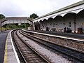
 At Churston Station - geograph.org.uk - 5105335.jpg 4,000 × 3,000; 2.68 MB
-
 Beach huts at the north end of Broadsands beach - geograph.org.uk - 2062454.jpg 1,600 × 1,200; 481 KB
-
 Beach huts, Broadsands - geograph.org.uk - 2061469.jpg 1,024 × 791; 365 KB
-
 Beach huts, Broadsands beach - geograph.org.uk - 1924463.jpg 1,600 × 1,323; 457 KB
-
 Beach huts, Broadsands beach - geograph.org.uk - 1924497.jpg 414 × 640; 96 KB
-
 Beach huts, Broadsands beach - geograph.org.uk - 1924554.jpg 452 × 640; 57 KB
-
 Beach huts, Broadsands beach - geograph.org.uk - 1924593.jpg 1,600 × 1,192; 328 KB
-
 Beach huts, Broadsands beach - geograph.org.uk - 1924746.jpg 1,600 × 1,212; 330 KB
-
 Beach huts, Broadsands beach - geograph.org.uk - 1924767.jpg 1,600 × 868; 250 KB
-
 Beach huts, Broadsands beach - geograph.org.uk - 2061459.jpg 1,024 × 768; 254 KB
-
 Beach huts, Broadsands beach - geograph.org.uk - 2065252.jpg 1,600 × 1,200; 414 KB
-
 Beach huts, Broadsands beach - geograph.org.uk - 2065273.jpg 1,600 × 1,200; 592 KB
-
 Beach steps, Broadsands beach - geograph.org.uk - 1924619.jpg 640 × 480; 79 KB
-

-
 Bench, Broadsands Beach - geograph.org.uk - 1908813.jpg 1,444 × 1,600; 552 KB
-
 Bench, Broadsands beach - geograph.org.uk - 1924681.jpg 1,600 × 1,143; 463 KB
-
 Blown bridge on dismantled railway, Churston Ferrers - geograph.org.uk - 5393600.jpg 2,048 × 1,536; 2.34 MB
-
 Bridge on Dartmouth Road over Steam Railway Line - geograph.org.uk - 2827704.jpg 2,564 × 3,437; 3.85 MB
-

-
 Brixham , Texaco Petrol Station - geograph.org.uk - 1928511.jpg 3,264 × 2,448; 2.32 MB
-
 Brixham Park ^ Ride Exit - geograph.org.uk - 3623957.jpg 640 × 481; 59 KB
-
 Broad Sands - geograph.org.uk - 2150907.jpg 640 × 480; 65 KB
-
 Broad Sands from the railway viaduct - geograph.org.uk - 3865504.jpg 4,000 × 3,000; 1.69 MB
-
 Broad Sands, Torbay - geograph.org.uk - 3536241.jpg 1,024 × 768; 194 KB
-
 Broadsands (15) - geograph.org.uk - 6181581.jpg 4,320 × 3,240; 3.08 MB
-
 Broadsands (16) - geograph.org.uk - 6181583.jpg 4,320 × 3,240; 3.18 MB
-
 Broadsands - geograph.org.uk - 1935369.jpg 640 × 480; 57 KB
-
 Broadsands and beyond - geograph.org.uk - 2062445.jpg 1,600 × 1,186; 493 KB
-
 Broadsands Bay - geograph.org.uk - 1879820.jpg 1,024 × 768; 165 KB
-
 Broadsands Beach - geograph.org.uk - 2061449.jpg 1,024 × 759; 144 KB
-
 Broadsands Beach - geograph.org.uk - 2062521.jpg 1,600 × 1,200; 756 KB
-
 Broadsands Beach - geograph.org.uk - 2083930.jpg 1,600 × 1,059; 368 KB
-
 Broadsands beach and beach huts, Churston - geograph.org.uk - 2061888.jpg 1,600 × 1,200; 419 KB
-
 Broadsands Beach and beyond, Churston - geograph.org.uk - 2061876.jpg 1,600 × 1,200; 408 KB
-
 Broadsands Court - geograph.org.uk - 3936859.jpg 4,714 × 2,933; 3.7 MB
-
 Broadsands on Boxing Day - geograph.org.uk - 2212789.jpg 640 × 377; 38 KB
-
 Broadsands promontory - geograph.org.uk - 2062541.jpg 1,600 × 1,200; 519 KB
-
 Broadsands Road, Broadsands, Devon - geograph.org.uk - 2632023.jpg 640 × 480; 53 KB
-
 Broadsands Viaduct View - geograph.org.uk - 5034914.jpg 640 × 450; 73 KB
-
 Broadsands, Torbay - geograph.org.uk - 2128241.jpg 800 × 600; 324 KB
-
 Brunel's Viaduct near Broadsands Beach - geograph.org.uk - 2890471.jpg 1,600 × 1,200; 429 KB
-
 Buoys on Broadsands beach - geograph.org.uk - 2065242.jpg 1,176 × 1,600; 515 KB
-

-
 Buses at Churston Station - geograph.org.uk - 5105443.jpg 3,609 × 2,693; 1.75 MB
-
 Cattle at Churston - geograph.org.uk - 991044.jpg 640 × 480; 91 KB
-
 Cayman Golf - geograph.org.uk - 3145179.jpg 4,000 × 3,000; 1.81 MB
-
 Churchston Station - geograph.org.uk - 2150894.jpg 640 × 480; 88 KB
-
 Churchston Station - geograph.org.uk - 3946561.jpg 1,024 × 681; 143 KB
-
 Churchyard, Churston - geograph.org.uk - 991101.jpg 640 × 489; 136 KB
-
 Churston , Brixham Road - geograph.org.uk - 1928670.jpg 2,048 × 1,536; 440 KB
-
 Churston , Churston Farm Shop - geograph.org.uk - 2296915.jpg 3,264 × 2,448; 3.2 MB
-
 Churston , Churston Farm Shop - geograph.org.uk - 2296920.jpg 3,264 × 2,448; 2.61 MB
-
 Churston , Dartmouth Road ^ Bus Stop - geograph.org.uk - 1928656.jpg 2,048 × 1,536; 588 KB
-
 Churston , Grassy Field - geograph.org.uk - 1928579.jpg 2,048 × 1,536; 461 KB
-
 Churston , Greenway Road - geograph.org.uk - 1928555.jpg 3,264 × 2,448; 2.88 MB
-
 Churston , The Weary Ploughman - geograph.org.uk - 1928546.jpg 3,264 × 2,448; 2.96 MB
-
 Churston , War Memorial - geograph.org.uk - 1928611.jpg 2,048 × 1,536; 526 KB
-
 Churston - Bridge Road - geograph.org.uk - 2632016.jpg 640 × 480; 73 KB
-
 Churston - Stagecoach 15310 (YN67YJT).JPG 1,366 × 910; 512 KB
-
 Churston - Stagecoach 15802 (WA61KZN).JPG 1,366 × 910; 434 KB
-
 Churston Common - geograph.org.uk - 371029.jpg 640 × 464; 94 KB
-
 Churston Ferrers Crossroads - geograph.org.uk - 79762.jpg 640 × 425; 152 KB
-
 Churston Ferrers, private lane - geograph.org.uk - 1574980.jpg 480 × 640; 123 KB
-
 Churston Ferrers, private lane - geograph.org.uk - 1575005.jpg 640 × 480; 134 KB
-
 Churston Golf Club, Clubhouse - geograph.org.uk - 3111998.jpg 640 × 480; 70 KB
-
 Churston Grammar School (geograph 3644870).jpg 640 × 480; 48 KB
-
 Churston Library - Stagecoach 15326 (YN67YKK).JPG 1,366 × 1,024; 525 KB
-
 Churston Point - geograph.org.uk - 918052.jpg 640 × 480; 110 KB
-
 Churston railway station - geograph.org.uk - 5536198.jpg 640 × 480; 103 KB
-

-
 Churston railway station, Devon - geograph.org.uk - 3534819.jpg 1,024 × 768; 193 KB
-
 Churston Road, Churston Ferrers - geograph.org.uk - 79765.jpg 640 × 425; 130 KB
-
 Churston Station - geograph.org.uk - 2443836.jpg 2,585 × 2,697; 2.47 MB
-
 Churston Station - geograph.org.uk - 2624626.jpg 640 × 480; 95 KB
-
 Churston Station - geograph.org.uk - 3555764.jpg 640 × 462; 76 KB
-
 Churston Station - geograph.org.uk - 5544055.jpg 1,024 × 768; 469 KB
-
 Churston Station - geograph.org.uk - 5748935.jpg 640 × 426; 66 KB
-
 Churston Station Footbridge - geograph.org.uk - 3261621.jpg 800 × 600; 133 KB
-
 Churston Station Platform - geograph.org.uk - 2443842.jpg 4,000 × 3,000; 3.85 MB
-
 Churston Station View - geograph.org.uk - 3261599.jpg 800 × 600; 138 KB
-

-
 Churston Viaduct - geograph.org.uk - 3936861.jpg 4,912 × 3,127; 4.09 MB
-
 Churston, A379-A3022 Junction - geograph.org.uk - 3111996.jpg 640 × 480; 86 KB
-
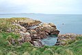
 Cliffs near Elberry Cove - geograph.org.uk - 1084764.jpg 640 × 429; 71 KB
-

-

-
 Club House, Churston Golf Club - geograph.org.uk - 3104146.jpg 640 × 430; 75 KB
-
 Cove east of Elberry - geograph.org.uk - 1437787.jpg 640 × 480; 381 KB
-
 Crop by Bridge Road - geograph.org.uk - 5244568.jpg 3,072 × 2,048; 1.5 MB
-
 Daffodils point to Elberry Cove, Torbay - geograph.org.uk - 714024.jpg 640 × 480; 116 KB
-
 Dartmouth Road, Churston Common - geograph.org.uk - 2827684.jpg 640 × 480; 73 KB
-
 Dartmouth Road, Paignton - geograph.org.uk - 2475115.jpg 1,024 × 768; 203 KB
-
 Dartmouth Steam Railway train approaching Churston, 1984 - geograph.org.uk - 4556305.jpg 2,369 × 1,473; 3.54 MB
-

-

-

-
 Early morning beach cleaning, Broadsands beach - geograph.org.uk - 1908844.jpg 1,600 × 1,200; 430 KB
-
 Elberry Cove - geograph.org.uk - 2128202.jpg 800 × 600; 266 KB
-
 Elberry Farm near Broadsands - geograph.org.uk - 2062525.jpg 1,600 × 1,200; 787 KB
-
 Elbury cove in winter - geograph.org.uk - 108957.jpg 640 × 480; 157 KB
-
 Enclosure near Broadsands neolithic chamber tomb - geograph.org.uk - 2062293.jpg 1,600 × 1,241; 885 KB
-
 Enclosure near Broadsands neolithic chamber tomb - geograph.org.uk - 2062307.jpg 1,600 × 1,200; 961 KB
-
 Enclosure near Broadsands neolithic chamber tomb - geograph.org.uk - 2062316.jpg 1,600 × 1,200; 712 KB
-
 Field in the misty morning sun, Kennels Road - geograph.org.uk - 3701143.jpg 3,648 × 2,736; 4.46 MB
-
 Field near Churston - geograph.org.uk - 991040.jpg 640 × 480; 112 KB
-
 Fields near Windy Corner one planted for car boot sales - geograph.org.uk - 5147256.jpg 4,608 × 3,456; 5.39 MB
-
 Fishcombe Point - geograph.org.uk - 1084735.jpg 640 × 429; 79 KB
-
 Fishcombe Point - geograph.org.uk - 1098293.jpg 640 × 429; 37 KB
-
 Fishcombe Point and sailing boat - geograph.org.uk - 990681.jpg 480 × 640; 106 KB
-
 Fishcombe Point with boats - geograph.org.uk - 990698.jpg 506 × 640; 94 KB
-
 Fishing at Churston Point - geograph.org.uk - 918065.jpg 640 × 421; 101 KB
-
 Footpath to Broadsands - geograph.org.uk - 2316042.jpg 1,600 × 1,200; 591 KB
-

-
 Frosty coastline - Elberry Cove - geograph.org.uk - 675632.jpg 640 × 480; 62 KB
-

-
 Fuchsia, Churston - geograph.org.uk - 991109.jpg 640 × 480; 108 KB
-
 Galmpton - Bascombe Road - geograph.org.uk - 2632018.jpg 640 × 480; 60 KB
-
 Galmpton A3022 Junction With A379 - geograph.org.uk - 2630292.jpg 640 × 480; 64 KB
-
 Galmpton Warborough Common - geograph.org.uk - 5331958.jpg 1,600 × 1,200; 720 KB
-
 Galmpton Warborough Common - geograph.org.uk - 5748945.jpg 640 × 426; 53 KB
-
 Galmpton Warborough Common - geograph.org.uk - 5749000.jpg 640 × 426; 49 KB
-
 Galmpton Warborough Common and windmill - geograph.org.uk - 5023856.jpg 640 × 478; 191 KB
-
 Galmpton Warborough in fog - geograph.org.uk - 5734579.jpg 3,421 × 1,930; 434 KB
-
 Galmpton Windmill - geograph.org.uk - 5748950.jpg 640 × 426; 36 KB
-
 Galmpton Windmill - geograph.org.uk - 5748969.jpg 640 × 426; 37 KB
-
 Galmpton Windy Corner - geograph.org.uk - 2630294.jpg 640 × 480; 49 KB
-
 Green Lane, Churston - geograph.org.uk - 991196.jpg 640 × 480; 128 KB
-
 Greenway Rd - geograph.org.uk - 5748939.jpg 640 × 425; 61 KB
-
 GWR 2-6-2T 4555 at Churston - geograph.org.uk - 3644068.jpg 640 × 480; 59 KB
-
 Hedge and field - geograph.org.uk - 5748900.jpg 640 × 426; 48 KB
-
 Hook Hills viaduct - geograph.org.uk - 3018382.jpg 640 × 436; 89 KB
-
 Hookhills Viaduct - geograph.org.uk - 3364786.jpg 1,024 × 687; 793 KB
-
 Houses below Bascombe Road - geograph.org.uk - 3012615.jpg 800 × 600; 265 KB
-
 Houses in Broadsands from the Railway - geograph.org.uk - 5133230.jpg 1,600 × 1,246; 521 KB
-
 Houses, Dartmouth Rd - geograph.org.uk - 5749022.jpg 640 × 426; 52 KB
-
 Keep off, Churston - geograph.org.uk - 5296533.jpg 3,072 × 2,048; 1.33 MB
-
 Kennels Rd - geograph.org.uk - 5748914.jpg 640 × 426; 61 KB
-
 Lady's smock, Cuckoo flower, Cardamine pratensis - geograph.org.uk - 1828444.jpg 1,600 × 1,053; 547 KB
-
 Lady's smock, Cuckoo flower, Cardamine pratensis - geograph.org.uk - 1828456.jpg 3,264 × 2,448; 3.6 MB
-
 Lady's smock, Cuckoo flower, Cardamine pratensis - geograph.org.uk - 1828467.jpg 3,264 × 2,448; 2.97 MB
-
 Landscaped area Dartmouth Road, Churston - geograph.org.uk - 2827766.jpg 3,562 × 2,663; 4.73 MB
-
 Landscaped area Dartmouth Road, Churston - geograph.org.uk - 2827772.jpg 3,648 × 2,736; 5.24 MB
-

-
 Langdon Lane - geograph.org.uk - 5749004.jpg 640 × 426; 67 KB
-
 Langdon Lane, Galmpton - geograph.org.uk - 2854937.jpg 3,543 × 2,414; 3.44 MB
-
 Large field - geograph.org.uk - 5748908.jpg 640 × 426; 47 KB
-
 Leaves on a fence - geograph.org.uk - 990469.jpg 640 × 480; 100 KB
-
 Lime kiln in the Grove - geograph.org.uk - 108954.jpg 640 × 512; 135 KB
-
 Looking back towards Elberry Cove - geograph.org.uk - 2128220.jpg 800 × 600; 292 KB
-
 Lydham Manor at Churston - geograph.org.uk - 5034892.jpg 640 × 385; 69 KB
-

-
 Muddy Path down to Elberry Cove - geograph.org.uk - 364654.jpg 480 × 640; 138 KB
-
 Neolithic Chamber Tomb at Broadsands - geograph.org.uk - 2062384.jpg 3,648 × 2,736; 5.23 MB
-
 New cycle track, near Brixham - geograph.org.uk - 1283534.jpg 640 × 480; 127 KB
-
 No dogs on the beach, Broadsands - geograph.org.uk - 1924638.jpg 640 × 451; 90 KB
-
 Old Man's Beard, Fishcombe Point - geograph.org.uk - 990631.jpg 640 × 480; 73 KB
-
 Old windmill tower, Churston Common - geograph.org.uk - 1950475.jpg 1,600 × 1,185; 304 KB
-
 One of the Churston Quarries - geograph.org.uk - 1099623.jpg 640 × 480; 125 KB
-
 Orange Way in Devon and Torbay (12) - geograph.org.uk - 2667042.jpg 1,024 × 768; 191 KB
-
 Orange Way in Devon and Torbay (13) - geograph.org.uk - 2667047.jpg 1,024 × 768; 216 KB
-
 Paignton , Dartmouth Road ^ Paignton Sign - geograph.org.uk - 1928675.jpg 2,048 × 1,536; 518 KB
-

-
 Paignton Town Sign on A379 - geograph.org.uk - 4168758.jpg 640 × 480; 70 KB
-
 Park and Ride site for Brixham - geograph.org.uk - 3012620.jpg 800 × 600; 298 KB
-
 Path through Marridge Wood - geograph.org.uk - 990491.jpg 640 × 480; 144 KB
-
 Pedalo Parking Notice Broadsands - OTT - geograph.org.uk - 2065124.jpg 3,455 × 2,523; 3.35 MB
-
 Platform 2 at Churston Railway Station - geograph.org.uk - 5858617.jpg 800 × 600; 694 KB
-
 Platform 2 at Churston Station - geograph.org.uk - 5134784.jpg 3,993 × 2,775; 2.02 MB
-

-
 Price list, Turnpike Toll Cottage - geograph.org.uk - 3104144.jpg 640 × 430; 48 KB
-
 Primroses in Marridge Wood.jpg 5,152 × 3,864; 5.5 MB
-
 Public golf course, Broadsands - geograph.org.uk - 2062515.jpg 1,600 × 1,200; 627 KB
-
-

-
 Railway Line , near Golf Course, Churston - geograph.org.uk - 369919.jpg 640 × 480; 114 KB
-

-

-
 Railway viaduct at Broadsands - geograph.org.uk - 3013613.jpg 600 × 800; 342 KB
-
 Railway viaduct at Broadsands - geograph.org.uk - 4882696.jpg 640 × 427; 100 KB
-

-

-

-

-
 Residents Against the Golf Club Sell-Off, Churston - geograph.org.uk - 2049916.jpg 3,271 × 2,400; 3.04 MB
-
 Ripening sloes on the Blackthorn, near Broadsands - geograph.org.uk - 2062390.jpg 1,600 × 1,200; 899 KB
-
 Road to Brixham by Churston Common - geograph.org.uk - 2791480.jpg 3,648 × 2,736; 5.08 MB
-

-
 Rocks near Churston Point - geograph.org.uk - 918071.jpg 480 × 640; 110 KB
-
 Rocky coastline - geograph.org.uk - 1084782.jpg 640 × 429; 67 KB
-

-

-
 Scrubby copse on Galmpton Warborough Common - geograph.org.uk - 5331982.jpg 1,600 × 1,200; 822 KB
-
 Shops and outdoor seating - geograph.org.uk - 6385726.jpg 768 × 1,024; 230 KB
-
 Shops by the Dartmouth Road - geograph.org.uk - 3936886.jpg 4,729 × 2,955; 4.28 MB


_-_geograph.org.uk_-_6181581.jpg)
_-_geograph.org.uk_-_6181583.jpg)


.JPG)
.JPG)


.jpg)
.JPG)


_-_geograph.org.uk_-_2667042.jpg)
_-_geograph.org.uk_-_2667047.jpg)


