Category:Churchyard of St Mary's, Walton
Jump to navigation
Jump to search
| Object location | | View all coordinates using: OpenStreetMap |
|---|
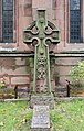
The main churchyard of St Mary's is circular, surrounding the church itself, and also has separate sections to the south.
Subcategories
This category has the following 3 subcategories, out of 3 total.
Media in category "Churchyard of St Mary's, Walton"
The following 8 files are in this category, out of 8 total.
-
 Celtic cross, St Mary's, Walton.jpg 3,258 × 5,115; 14.23 MB
-
 Churchyard of St Mary's, Walton 1.jpg 4,827 × 3,323; 17.42 MB
-
 Churchyard of St Mary's, Walton 2.jpg 5,120 × 3,413; 20.63 MB
-
 Churchyard of St Mary's, Walton 3.jpg 5,040 × 3,330; 15.71 MB
-
 Churchyard of St Mary's, Walton 4.jpg 5,046 × 3,360; 16.66 MB
-
 Churchyard of St Mary's, Walton 5.jpg 4,890 × 3,327; 14.62 MB
-
 Churchyard of St Mary's, Walton 6.jpg 5,259 × 3,417; 22.23 MB
-
 Stone base, St Mary's Walton.jpg 5,053 × 3,368; 14.69 MB


