Category:Churchyard of St John the Evangelist, Knotty Ash
Jump to navigation
Jump to search
| Object location | | View all coordinates using: OpenStreetMap |
|---|
Subcategories
This category has only the following subcategory.
Media in category "Churchyard of St John the Evangelist, Knotty Ash"
The following 3 files are in this category, out of 3 total.
-
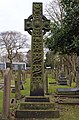 Bencke monument, St John the Evangelist, Knotty Ash.jpg 3,237 × 4,902; 10.71 MB
-
 Churchyard of St John the Evangelist, Knotty Ash 1.jpg 5,184 × 3,456; 10.37 MB
-
 Churchyard of St John the Evangelist, Knotty Ash 2.jpg 5,184 × 3,456; 11.8 MB


