Category:Churchdown
Jump to navigation
Jump to search
village in Gloucestershire, England, United Kingdom  | |||||
| Upload media | |||||
| Instance of | |||||
|---|---|---|---|---|---|
| Location | Tewkesbury, Gloucestershire, South West England, England | ||||
| Population |
| ||||
| Said to be the same as | Churchdown (Wikimedia duplicated page, civil parish) | ||||
 | |||||
English: Churchdown is a village in Gloucestershire, England, situated between Gloucester and Cheltenham.
Subcategories
This category has the following 4 subcategories, out of 4 total.
C
- Churchdown railway station (5 F)
- Churchdown War Memorial (1 F)
S
Media in category "Churchdown"
The following 200 files are in this category, out of 238 total.
(previous page) (next page)-
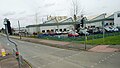
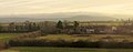
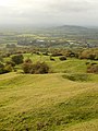
 A view over Churchdown - geograph.org.uk - 1300516.jpg 640 × 480; 211 KB
-
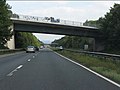
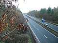
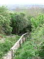
 A40 - footbridge at Churchdown - geograph.org.uk - 2087796.jpg 640 × 480; 60 KB
-
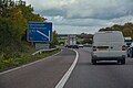
 A40 - half-mile to the M5 junction - geograph.org.uk - 2087811.jpg 640 × 480; 52 KB
-
-

-
 A40 - straight ahead for Cheltenham - geograph.org.uk - 2087789.jpg 640 × 480; 49 KB
-
 A40 Gloucester bypass, M5 two miles. - geograph.org.uk - 6246864.jpg 640 × 480; 45 KB
-
 A40 Golden Valley road - geograph.org.uk - 2234163.jpg 800 × 600; 420 KB
-
 A40 leaving Churchdown - geograph.org.uk - 2087804.jpg 640 × 480; 53 KB
-
 A40 near to Gloucestershire Airport - geograph.org.uk - 6287873.jpg 800 × 600; 607 KB
-
 A40 westbound at Churchdown - geograph.org.uk - 3046810.jpg 640 × 480; 60 KB
-
 Amongst the reservoirs, Churchdown Hill - geograph.org.uk - 2541289.jpg 640 × 480; 129 KB
-
 An entrance to Gloucestershire Airport, Staverton - geograph.org.uk - 5908926.jpg 1,474 × 1,414; 429 KB
-
 Aviator pub, Bamfurlong Lane, Staverton - geograph.org.uk - 5908847.jpg 1,024 × 686; 161 KB
-
 Avro Vulcan - geograph.org.uk - 6322081.jpg 1,024 × 768; 214 KB
-
 Badgeworth , M5 Motorway - geograph.org.uk - 6283959.jpg 6,000 × 4,000; 4.97 MB
-
 Badgeworth , M5 Motorway - geograph.org.uk - 6283962.jpg 6,000 × 4,000; 4.97 MB
-

-
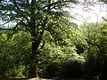
 Bluebells on Churchdown Hill.JPG 2,048 × 1,536; 1.54 MB
-
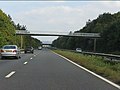
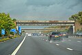
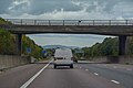
 Bridge over the A40 at Churchdown - geograph.org.uk - 6287874.jpg 800 × 600; 531 KB
-
 Brockworth Road - geograph.org.uk - 3831343.jpg 800 × 451; 195 KB
-
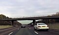
 Brockworth Road bridge over M5 - geograph.org.uk - 3187088.jpg 1,024 × 768; 445 KB
-
 Brockworth Road bridge over M5 - geograph.org.uk - 4740596.jpg 640 × 385; 99 KB
-
 Brookfield Lane - geograph.org.uk - 2636412.jpg 800 × 600; 399 KB
-
 Built over triangulation pillar - geograph.org.uk - 2541299.jpg 640 × 480; 106 KB
-
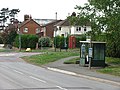 Bus stop - geograph.org.uk - 2542307.jpg 640 × 480; 114 KB
-

-
 Chapel Hay Lane - geograph.org.uk - 2770081.jpg 1,024 × 768; 403 KB
-
 Cheltenham Road East, Churchdown - geograph.org.uk - 2285206.jpg 1,024 × 680; 168 KB
-
 Cheltenham Road, Innsworth - geograph.org.uk - 2119992.jpg 640 × 480; 189 KB
-
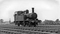
 Cheltenham Two light engines coupled heading towards geograph-2795652-by-Ben-Brooksbank.jpg 2,394 × 1,347; 2.15 MB
-
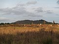
 Chosen Hill - geograph.org.uk - 1222644.jpg 640 × 480; 96 KB
-
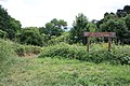 Chosen Hill Nature Reserve - geograph.org.uk - 1946539.jpg 1,024 × 683; 628 KB
-
 Chosen Hill Rugby Club, Churchdown - geograph.org.uk - 1610234.jpg 640 × 426; 60 KB
-
 Chosen Hill School, Churchdown - geograph.org.uk - 1610235.jpg 640 × 426; 50 KB
-
 Church time - geograph.org.uk - 3937965.jpg 1,704 × 2,304; 1.96 MB
-
 Churchdown , M5 Motorway - geograph.org.uk - 6283952.jpg 6,000 × 4,000; 4.38 MB
-
 Churchdown , M5 Motorway - geograph.org.uk - 6283956.jpg 6,000 × 4,000; 4.89 MB
-
 Churchdown , M5 Motorway - geograph.org.uk - 6283957.jpg 6,000 × 4,000; 5.14 MB
-
 Churchdown - geograph.org.uk - 6443574.jpg 1,200 × 809; 1.45 MB
-
 Churchdown 3 railway geograph-2180956.jpg 1,024 × 627; 314 KB
-
 Churchdown Day Nursery - geograph.org.uk - 5049039.jpg 3,264 × 2,448; 2.43 MB
-
 Churchdown express geograph-2561763-by-Ben-Brooksbank.jpg 2,394 × 1,381; 686 KB
-
 Churchdown Gas Laying Gang, 1914.tif 1,864 × 1,220; 6.51 MB
-

-
 Churchdown Hill (Chosen Hill) (Tinker's Hill) - geograph.org.uk - 3289071.jpg 1,280 × 960; 1.08 MB
-
 Churchdown Hill - geograph.org.uk - 1608883.jpg 640 × 426; 73 KB
-
 Churchdown Hill - panoramio.jpg 4,608 × 3,456; 3.44 MB
-
 Churchdown Hill Burial Ground - geograph.org.uk - 1946238.jpg 1,024 × 683; 596 KB
-
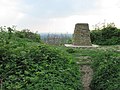
 Churchdown Hill Trig Point (155m) - geograph.org.uk - 1946325.jpg 1,024 × 683; 510 KB
-
 Churchdown Library, Parton Road - geograph.org.uk - 1409669.jpg 640 × 480; 123 KB
-
 Churchdown Library.jpg 4,080 × 3,072; 4.56 MB
-
 Churchdown light engine geograph-2960900-by-Ben-Brooksbank.jpg 2,395 × 1,378; 1.13 MB
-
 Churchdown local train geograph-2935671-by-Ben-Brooksbank.jpg 2,395 × 1,447; 1.29 MB
-
 Churchdown Methodist church and hall - geograph.org.uk - 2770090.jpg 1,024 × 768; 431 KB
-
 Churchdown Park - geograph.org.uk - 5275.jpg 640 × 480; 53 KB
-
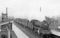
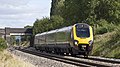
 Churchdown station geograph-2474736-by-Ben-Brooksbank.jpg 2,276 × 1,448; 800 KB
-
 Churchdown stopping train east of geograph-2955073-by-Ben-Brooksbank.jpg 2,361 × 1,376; 1.08 MB
-
 Churchdown Telephone Exchange - geograph.org.uk - 6158683.jpg 2,592 × 1,944; 1.37 MB
-
 Churchdown with Fishguard Harbour express geograph-2910857-by-Ben-Brooksbank.jpg 2,391 × 1,362; 1.03 MB
-

-
 Churchdown, Down relief express to Paignton, 1957 - geograph.org.uk - 4247647.jpg 2,241 × 1,424; 1.55 MB
-
 Churchdown, Gloucestershire geograph-2718339-by-Ben-Brooksbank.jpg 2,231 × 1,425; 588 KB
-
 Churchyard and church, Chosen Hill - geograph.org.uk - 1222244.jpg 640 × 480; 85 KB
-
 Communication mast, Churchdown Hill - geograph.org.uk - 1946342.jpg 683 × 1,024; 325 KB
-
 Concrete suburban road - geograph.org.uk - 2119990.jpg 640 × 480; 210 KB
-
 Cordyline australis, Torbay Palm - geograph.org.uk - 1201426.jpg 480 × 640; 241 KB
-

-
 Covered reservoir, Churchdown Hill - geograph.org.uk - 1946358.jpg 2,048 × 1,359; 1.11 MB
-
 Covered reservoir, Churchdown Hill - geograph.org.uk - 2541284.jpg 640 × 480; 85 KB
-
 Dairy herd grazing near Churchdown - geograph.org.uk - 882223.jpg 640 × 480; 114 KB
-
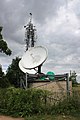
 Dishes and masts, Churchdown Hill - geograph.org.uk - 2541293.jpg 640 × 480; 136 KB
-
 Diverted Gloucestershire Way - geograph.org.uk - 2776441.jpg 1,024 × 680; 301 KB
-
 Dolphin Close, Innsworth - geograph.org.uk - 2120004.jpg 640 × 480; 234 KB
-
 Down Hatherley Lane - geograph.org.uk - 4892967.jpg 800 × 451; 69 KB
-

-

-
 Entrance to Hurran's, Churchdown - geograph.org.uk - 1201419.jpg 640 × 480; 226 KB
-
 Entrance to Pressmead Farm - geograph.org.uk - 3831337.jpg 800 × 451; 190 KB
-
 Falk Oberdorf Churchdown Waldlandschaft.JPG 640 × 480; 366 KB
-
 Falk Oberdorf Churchdown Whitehouse Farm 1.JPG 2,816 × 2,112; 3.51 MB
-
 Falk Oberdorf Churchdown Wiese.JPG 2,816 × 2,112; 2.82 MB
-
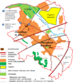
 Falk Oberdorf Churchdown.png 575 × 648; 70 KB
-
 Falk Oberdorf Churchdown2.png 575 × 658; 116 KB
-
 Farmland at The Follies - geograph.org.uk - 4697630.jpg 1,260 × 650; 150 KB
-
 Farmland near Churchdown - geograph.org.uk - 4386364.jpg 640 × 411; 52 KB
-
 Fields to west of Tinker's Hill - geograph.org.uk - 4997724.jpg 800 × 403; 40 KB
-
 Fly2help, Gloucestershire Airport, Staverton - geograph.org.uk - 5908946.jpg 1,024 × 735; 157 KB
-
 Footbridge over M5 - geograph.org.uk - 4740590.jpg 640 × 423; 100 KB
-

-
 Footpath from Hucclecote Lane - geograph.org.uk - 3781680.jpg 800 × 456; 162 KB
-
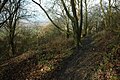 Footpath on Churchdown Hill - geograph.org.uk - 1609136.jpg 640 × 426; 123 KB
-
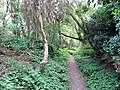
 Footpath to Churchdown Hill - geograph.org.uk - 1300942.jpg 640 × 480; 269 KB
-
 Footpath to Pirton Lane - geograph.org.uk - 2263086.jpg 800 × 600; 205 KB
-

-
-

-
 Gate on the Gloucestershire Way - geograph.org.uk - 2160410.jpg 800 × 600; 418 KB
-
 Glevum Way, near Churchdown - geograph.org.uk - 1069961.jpg 640 × 480; 179 KB
-
 Gloster Meteor - geograph.org.uk - 6322071.jpg 1,024 × 768; 232 KB
-
 Gloster Meteor - geograph.org.uk - 6322074.jpg 1,024 × 768; 239 KB
-
 Gloucestershire Airport - geograph.org.uk - 5598360.jpg 1,600 × 1,200; 217 KB
-
 Gloucestershire Airport car park, Staverton - geograph.org.uk - 5908796.jpg 3,309 × 2,404; 1.09 MB
-
 Gloucestershire Airport runway - geograph.org.uk - 2263091.jpg 1,024 × 768; 594 KB
-

-
 Gloucestershire Way and Norman's Brook - geograph.org.uk - 2776445.jpg 1,024 × 680; 239 KB
-
 Gloucestershire Wildlife Trust Nature Reserve, Churchdown Hill, Gloucestershire.JPG 2,560 × 1,440; 1.75 MB
-
 Golden Valley bypass - geograph.org.uk - 2285177.jpg 680 × 1,024; 174 KB
-
 Grazing, Churchdown - geograph.org.uk - 4382371.jpg 640 × 410; 46 KB
-
 Hare and Hounds pub sign, Churchdown - geograph.org.uk - 1409701.jpg 412 × 640; 100 KB
-

-
 Hare ^ Hounds Churchdown - geograph.org.uk - 4854327.jpg 1,200 × 802; 1.02 MB
-
 Heading down to Churchdown - geograph.org.uk - 1946554.jpg 1,024 × 683; 554 KB
-
 Hilltop position of St Bartholomew's Church - geograph.org.uk - 1946566.jpg 1,024 × 683; 513 KB
-
 Home Farm - geograph.org.uk - 1222745.jpg 640 × 480; 78 KB
-
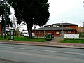 Horizons Youth and Community Centre - geograph.org.uk - 1201423.jpg 640 × 480; 211 KB
-
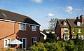
 Houses at Churchdown - geograph.org.uk - 3289936.jpg 640 × 253; 24 KB
-
 Houses on Cheltenham Road East - geograph.org.uk - 4013115.jpg 1,600 × 970; 495 KB
-
 Houses on Pirton Lane, Churchdown - geograph.org.uk - 4013118.jpg 1,332 × 987; 390 KB
-
 Hurrans for not much longer - geograph.org.uk - 1201418.jpg 640 × 480; 228 KB
-
 Innsworth - Cheltenham Road - geograph.org.uk - 2151583.jpg 1,600 × 1,081; 497 KB
-
 Jet Age Museum - geograph.org.uk - 6321484.jpg 1,024 × 768; 157 KB
-
 Junction with Innsworth Lane - geograph.org.uk - 4892782.jpg 800 × 541; 78 KB
-

-
 Landing lights at Gloucestershire Airport - geograph.org.uk - 4013109.jpg 1,600 × 818; 352 KB
-

-
 Little bits of Norman stone - geograph.org.uk - 3937962.jpg 2,304 × 1,704; 1.77 MB
-
 Lower slopes of Churchdown Hill-Chosen Hill - geograph.org.uk - 1946618.jpg 4,272 × 2,848; 3.98 MB
-
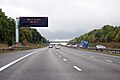
 M5 at junction 11a - geograph.org.uk - 3690183.jpg 4,098 × 2,411; 1.83 MB
-
 M5 at marker 85.2 - geograph.org.uk - 4686488.jpg 2,054 × 1,287; 1.24 MB
-
 M5 from railway line - geograph.org.uk - 4997710.jpg 800 × 545; 74 KB
-
 M5 Motorway - Brockworth Road bridge - geograph.org.uk - 2046335.jpg 640 × 480; 53 KB
-
 M5 Motorway - geograph.org.uk - 5307.jpg 480 × 640; 46 KB
-
-
 M5 near White House Farm - geograph.org.uk - 4740602.jpg 640 × 408; 100 KB
-
 M5 northbound after the footbridge - geograph.org.uk - 2046328.jpg 640 × 480; 47 KB
-
 M5 northbound towards junction 11 - geograph.org.uk - 4325580.jpg 1,600 × 1,200; 1.05 MB
-
 M5 sign and footbridge - geograph.org.uk - 4686494.jpg 2,185 × 1,436; 1.37 MB
-
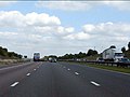
 M5 Southbound - geograph.org.uk - 3407599.jpg 640 × 480; 357 KB
-
 M5 southbound - geograph.org.uk - 3536935.jpg 640 × 418; 30 KB
-
 M5 southbound near Badgeworth - geograph.org.uk - 4686154.jpg 2,178 × 1,444; 1.62 MB
-
 Mary Rose Avenue, Innsworth - geograph.org.uk - 2120001.jpg 640 × 428; 202 KB
-
 Messier-Dowty - geograph.org.uk - 1088386.jpg 640 × 480; 60 KB
-
 Messier-Dowty, Staverton - geograph.org.uk - 2776160.jpg 1,024 × 680; 106 KB
-
 Mitsubushi Motors, Staverton - geograph.org.uk - 2776941.jpg 1,024 × 680; 143 KB
-
 Muddy path, Churchdown Hill - geograph.org.uk - 2541330.jpg 640 × 480; 160 KB
-
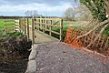 New footbridge over Norman's Brook - geograph.org.uk - 2776170.jpg 1,024 × 680; 290 KB
-
 Norman's Brook - geograph.org.uk - 2776448.jpg 1,024 × 680; 235 KB
-
-
 Ostrich Farm - geograph.org.uk - 133956.jpg 640 × 479; 95 KB
-
 Pasture by the M5 - geograph.org.uk - 3831266.jpg 800 × 451; 174 KB
-
 Path, Chosen Hill Nature Reserve - geograph.org.uk - 2541267.jpg 640 × 480; 135 KB
-
 Path, Churchdown Hill - geograph.org.uk - 2541288.jpg 640 × 480; 184 KB
-
 Payne's Pitch, Churchdown - geograph.org.uk - 2770094.jpg 1,024 × 768; 414 KB
-
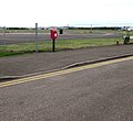
 Pillar box in Churchdown - geograph.org.uk - 1610532.jpg 426 × 640; 94 KB
-
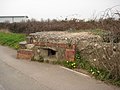 Pillbox overlooking Staverton Airport - geograph.org.uk - 2329608.jpg 1,024 × 768; 220 KB
-
 Pirton Lane, Churchdown - geograph.org.uk - 2285183.jpg 1,024 × 680; 200 KB
-
 Ploughed field by Buttermilk Lane - geograph.org.uk - 2636411.jpg 800 × 600; 370 KB
-
-

-
 Railway near Churchdown - geograph.org.uk - 3687238.jpg 1,600 × 900; 420 KB
-

-
 Reservoir on Churchdown Hill - geograph.org.uk - 1608875.jpg 640 × 426; 62 KB
-
 RGV Aviation, Gloucestershire Airport, Staverton - geograph.org.uk - 5908785.jpg 1,024 × 960; 167 KB
-
 Ripples, Churchdown - geograph.org.uk - 1610537.jpg 640 × 426; 79 KB
-
 Runway at Gloucestershire Airport - geograph.org.uk - 4013086.jpg 1,600 × 925; 343 KB
-
 Safran building - geograph.org.uk - 4892970.jpg 800 × 600; 106 KB
-
 Safran building at Gloucestershire Airport - geograph.org.uk - 4013107.jpg 1,600 × 844; 513 KB
-
-
 Single track roads descending Churchdown Hill - geograph.org.uk - 1946547.jpg 683 × 1,024; 599 KB
-
 Site of old golf course, Churchdown Hill.JPG 2,560 × 1,440; 1.76 MB
-
 SO8719 , Woodland, Churchdown Hill - geograph.org.uk - 2542294.jpg 640 × 480; 175 KB
-
 Southbound M5 approaching Junction 11A - geograph.org.uk - 3407610.jpg 640 × 427; 351 KB
-
 Southbound M5 at Junction 11A - geograph.org.uk - 3407615.jpg 640 × 480; 396 KB
-
 Southbound M5 near Churchdown - geograph.org.uk - 3407605.jpg 640 × 480; 345 KB
-
 St Bartholomew's Church - geograph.org.uk - 6443578.jpg 1,200 × 802; 1.48 MB
-
 St John the Evangelist church, Churchdown - geograph.org.uk - 2285166.jpg 1,024 × 680; 208 KB
-
 St. John's Ambulance building - geograph.org.uk - 2636405.jpg 800 × 450; 303 KB
-
 St. Vincent Way, Innsworth - geograph.org.uk - 2120005.jpg 640 × 480; 222 KB
-
 STAGECOACH WEST - Flickr - secret coach park (23).jpg 2,619 × 1,746; 1.78 MB
-

-
 Staverton Airport Runway - geograph.org.uk - 4296598.jpg 1,600 × 1,195; 281 KB
-
 Staverton Airshow - geograph.org.uk - 2151572.jpg 1,818 × 1,228; 606 KB
-
 Staverton Airshow - geograph.org.uk - 2151579.jpg 1,818 × 1,228; 506 KB
-
 Steps on Churchdown Hill - geograph.org.uk - 2541325.jpg 480 × 640; 139 KB
-
 Tewkesbury , The M5 Motorway Northbound - geograph.org.uk - 2794478.jpg 4,288 × 2,848; 4.53 MB
-
 Tewkesbury , The M5 Motorway Southbound - geograph.org.uk - 2795419.jpg 4,288 × 2,848; 4.8 MB
-
 Tewkesbury Borough , M5 Motorway - geograph.org.uk - 5951394.jpg 6,000 × 4,000; 7.14 MB
-
 Tewkesbury Borough , M5 Motorway - geograph.org.uk - 5951396.jpg 6,000 × 4,000; 6.91 MB
-
 Tewkesbury Borough , M5 Motorway - geograph.org.uk - 5951397.jpg 6,000 × 4,000; 5.98 MB
-
 Tewkesbury Borough , M5 Motorway - geograph.org.uk - 5951399.jpg 6,000 × 4,000; 6.39 MB
-
 Tewkesbury District , The M5 Motorway - geograph.org.uk - 3724126.jpg 4,286 × 2,846; 5.61 MB
-
 Tewkesbury District , The M5 Motorway - geograph.org.uk - 4930140.jpg 6,000 × 4,000; 6.32 MB
-
 The B4063 at Staverton - geograph.org.uk - 2776452.jpg 1,024 × 680; 146 KB
-
 The Bat and Ball, Churchdown - geograph.org.uk - 1610528.jpg 640 × 426; 63 KB
-
 The Glevum Way, near Churchdown - geograph.org.uk - 1069905.jpg 640 × 480; 173 KB
-
 The Golden Valley at Churchdown - geograph.org.uk - 2285191.jpg 680 × 1,024; 150 KB
-
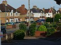
 The Green, Churchdown - geograph.org.uk - 1946638.jpg 800 × 533; 407 KB
-
 The Hatherley Brook - geograph.org.uk - 2160420.jpg 800 × 600; 377 KB
-
 The Old Elm Inn - geograph.org.uk - 5743460.jpg 640 × 433; 61 KB


_(Tinker%27s_Hill)_-_geograph.org.uk_-_3289071.jpg)


_-_geograph.org.uk_-_1946325.jpg)


.jpg)


