Category:Church spires in Worcestershire
Jump to navigation
Jump to search
Ceremonial counties of England: Bedfordshire · Berkshire · Buckinghamshire · Cambridgeshire · Cheshire · Cornwall · Cumbria · Derbyshire · Devon · Dorset · Durham · East Riding of Yorkshire · East Sussex · Essex · Gloucestershire · Greater London · Greater Manchester · Hampshire · Herefordshire · Hertfordshire · Isle of Wight · Kent · Lancashire · Leicestershire · Lincolnshire · Merseyside · Norfolk · North Yorkshire · Northamptonshire · Northumberland · Nottinghamshire · Oxfordshire · Rutland · Shropshire · Somerset · South Yorkshire · Staffordshire · Suffolk · Surrey · Tyne and Wear · Warwickshire · West Midlands · West Sussex · West Yorkshire · Wiltshire · Worcestershire
City-counties: Bristol ·
Former historic counties:
Other former counties:
City-counties: Bristol ·
Former historic counties:
Other former counties:
Subcategories
This category has only the following subcategory.
W
- Glover's Needle, Worcester (122 F)
Media in category "Church spires in Worcestershire"
The following 200 files are in this category, out of 219 total.
(previous page) (next page)-
 Abberley St Mary's Church DSC00298.JPG 1,704 × 2,272; 374 KB
-
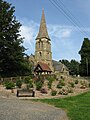
 Abberley, St Mary's & Village Green.jpg 2,640 × 2,036; 1.27 MB
-
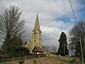
 Abberley, Worcs, St Mary's Church.jpg 399 × 610; 116 KB
-
 Alfrick Church - geograph.org.uk - 591128.jpg 640 × 426; 105 KB
-
 St Mary's Church, Alfrick - sundial - geograph.org.uk - 362531.jpg 640 × 480; 83 KB
-
 The spire of Alfrick church - geograph.org.uk - 591129.jpg 426 × 640; 101 KB
-
 Alfrick Church - geograph.org.uk - 55819.jpg 640 × 479; 117 KB
-
 All Saints Church, Evesham (5139) (cropped).jpg 3,082 × 2,328; 3.24 MB
-
 All Saints Church, Evesham (5139).jpg 4,288 × 2,848; 5.5 MB
-
 Belbroughton Holy Trinity fr S GeUK 1726792.jpg 2,304 × 3,072; 885 KB
-
 Holy Trinity Church Belbroughton, Worcs - geograph.org.uk - 1726792.jpg 2,304 × 3,072; 2.94 MB
-
 Stone Cross, Belbroughton church - geograph.org.uk - 389459.jpg 426 × 640; 113 KB
-
 Woodgate Boer War Memorial, Belbroughton - geograph.org.uk - 1726799.jpg 2,304 × 3,072; 2.56 MB
-
 BesfordChurch(PhilipHalling)Aug2005.jpg 640 × 426; 164 KB
-
-
 Bredon church - geograph.org.uk - 318605.jpg 640 × 426; 97 KB
-
 Bredon church - geograph.org.uk - 318613.jpg 426 × 640; 117 KB
-
 Bredon churchyard - geograph.org.uk - 467448.jpg 640 × 480; 126 KB
-
 St Mary Magdalene church, Broadwas - geograph.org.uk - 969295.jpg 640 × 480; 106 KB
-
 Broadwas Church - geograph.org.uk - 55378.jpg 640 × 479; 124 KB
-
 Broughton Hacket Church - geograph.org.uk - 1292145.jpg 640 × 480; 76 KB
-
 Broughton Hackett - St Leonard's Church - geograph.org.uk - 1767904.jpg 640 × 480; 216 KB
-
-
 Bushley Church - geograph.org.uk - 4772.jpg 640 × 479; 67 KB
-
 Bushley Church - geograph.org.uk - 715788.jpg 640 × 426; 70 KB
-
 Bushley Church - geograph.org.uk - 715790.jpg 426 × 640; 62 KB
-
 Castlemorton Church - geograph.org.uk - 1731662.jpg 426 × 640; 108 KB
-
 Castlemorton Church - geograph.org.uk - 1731670.jpg 426 × 640; 87 KB
-
 Castlemorton Church - geograph.org.uk - 720496.jpg 426 × 640; 62 KB
-
 Castlemorton church - geograph.org.uk - 823080.jpg 480 × 640; 55 KB
-
 Castlemorton church and village.jpg 640 × 427; 253 KB
-
 Chaddesley Corbett 02.jpg 3,264 × 2,448; 2.53 MB
-
 Chaddesley Corbett church - geograph.org.uk - 387504.jpg 426 × 640; 101 KB
-
 Chaddesley Corbett church - geograph.org.uk - 387506.jpg 640 × 426; 113 KB
-

-

-
 Chaddesley Corbett St Cassian.JPG 3,000 × 4,000; 2.37 MB
-
 Childswickham - geograph.org.uk - 128160.jpg 480 × 640; 122 KB
-
 Childswickham Church - geograph.org.uk - 1201581.jpg 426 × 640; 55 KB
-
 Childswickham Church - geograph.org.uk - 1726006.jpg 426 × 640; 58 KB
-
 Childswickham Church - geograph.org.uk - 1726009.jpg 426 × 640; 46 KB
-
 Childswickham Church - geograph.org.uk - 52540.jpg 480 × 640; 53 KB
-

-
 Church Lane sign, Eldersfield - geograph.org.uk - 717382.jpg 480 × 640; 213 KB
-
 Church of All Saints.jpg 4,000 × 2,672; 5.67 MB
-
 Church of St John the Baptist in Bromsgrove.jpg 4,288 × 3,216; 3.12 MB
-
 Church of St Lawrence, Evesham - geograph.org.uk - 1113001.jpg 426 × 640; 36 KB
-

-

-
 Church of St Stephen, Redditch - geograph.org.uk - 7218.jpg 517 × 640; 141 KB
-
 Church of St Stephen, Redditch - geograph.org.uk - 7219.jpg 640 × 480; 79 KB
-
-
-
-
-
 Clifton on Teme Church - geograph.org.uk - 457966.jpg 640 × 480; 136 KB
-
 Clifton on Teme parish church - geograph.org.uk - 959693.jpg 640 × 480; 84 KB
-
 Clifton-upon-Teme church - geograph.org.uk - 277689.jpg 640 × 480; 97 KB
-
 Doverdale church - geograph.org.uk - 134212.jpg 640 × 426; 123 KB
-
 Drake's Broughton Church - geograph.org.uk - 79969.jpg 640 × 479; 103 KB
-
 Drakes Broughton Church - geograph.org.uk - 926442.jpg 480 × 640; 74 KB
-
 The spire of Eldersfield Church - geograph.org.uk - 545274.jpg 426 × 640; 112 KB
-
 Eldersfield Church - geograph.org.uk - 3614.jpg 451 × 640; 48 KB
-
 Eldersfield Church - geograph.org.uk - 545251.jpg 426 × 640; 91 KB
-
 Eldersfield church 1.jpg 2,448 × 3,264; 2.36 MB
-
 Eldersfield church 2.jpg 3,264 × 2,448; 2.82 MB
-
 St Michael's Church, Elmley Lovett - geograph.org.uk - 136462.jpg 640 × 426; 89 KB
-
 St.Lawrence's church - geograph.org.uk - 1405777.jpg 640 × 426; 56 KB
-
 Former Mary Magdalene church, Worcester - geograph.org.uk - 325718.jpg 426 × 640; 112 KB
-
 Holy Trinity Church Hall - geograph.org.uk - 884543.jpg 640 × 480; 80 KB
-
 Holy Trinity Hall, Link Top, Malvern. - geograph.org.uk - 1321509.jpg 640 × 408; 261 KB
-

-

-

-
 Holy Trinity Malvern.jpg 640 × 480; 61 KB
-
 HolyTrinityChurchMalvern.jpg 1,579 × 1,240; 2.66 MB
-
 Hagley Worcs - St John the Baptist - exterior from east 01.jpg 1,944 × 2,592; 2.69 MB
-
 Hagley Worcs - St John the Baptist - exterior from east 02.jpg 1,896 × 2,304; 2.1 MB
-
 Hagley Worcs - St John the Baptist - exterior from east 03.jpg 2,592 × 1,944; 2.95 MB
-
 Hagley Worcs - St John the Baptist - exterior from east 04.jpg 1,944 × 2,592; 3.66 MB
-
 Hagley Worcs - St John the Baptist - exterior from west 01.jpg 2,420 × 1,944; 3.03 MB
-
 Hagley Worcs - St John the Baptist - exterior from west 02.jpg 2,216 × 1,848; 2.11 MB
-
 Hagley Worcs - St John the Baptist - exterior from west 03.JPG 3,968 × 2,976; 8.29 MB
-
 Hagley Worcs - St John the Baptist - exterior from west 04.JPG 3,968 × 2,976; 6.33 MB
-
 Hagley Worcs - St John the Baptist and Cricket Club.JPG 2,776 × 2,240; 3.99 MB
-
 Hallow Church - geograph.org.uk - 78549.jpg 479 × 640; 70 KB
-
 All Saints Church, Hanley William.jpg 640 × 461; 73 KB
-
-
 Harvington Parish Church - geograph.org.uk - 58078.jpg 429 × 640; 118 KB
-
 Holy Trinity Church Belbroughton.jpg 4,000 × 6,000; 9.37 MB
-
 Holy Trinity church, Belbroughton - geograph.org.uk - 385170.jpg 426 × 640; 88 KB
-
 Holy trinity church, Belbroughton - geograph.org.uk - 389469.jpg 640 × 426; 94 KB
-
 Holy Trinity Church, Belbroughton - geograph.org.uk - 709099.jpg 480 × 640; 97 KB
-
 View towards St Georges Church, Kidderminster (geograph 2950966).jpg 1,644 × 1,577; 1 MB
-
 St John the Baptist Church, Kidderminster - geograph.org.uk - 499492.jpg 640 × 562; 108 KB
-
 Church Farm, Knighton on Teme - geograph.org.uk - 45744.jpg 640 × 480; 76 KB
-
 St Michael's Church, Knighton on Teme - geograph.org.uk - 45749.jpg 640 × 480; 86 KB
-
 Knightwick - church for sale - geograph.org.uk - 903155.jpg 480 × 640; 76 KB
-
 Knightwick Church - geograph.org.uk - 62926.jpg 640 × 479; 117 KB
-
 Little Witley church - geograph.org.uk - 111773.jpg 640 × 426; 129 KB
-
 Little Witley Church From The Southeast - geograph.org.uk - 1504363.jpg 640 × 480; 242 KB
-
 Longdon Church - geograph.org.uk - 4965.jpg 640 × 479; 55 KB
-
 Longdon Church - geograph.org.uk - 715649.jpg 426 × 640; 85 KB
-
 St Marys church, Longdon (geograph 3819182).jpg 1,944 × 2,592; 1.91 MB
-
 Longdon Church - geograph.org.uk - 715645.jpg 426 × 640; 62 KB
-
 Longdon Church - geograph.org.uk - 715652.jpg 426 × 640; 86 KB
-

-
 Lulsley Church - geograph.org.uk - 840277.jpg 640 × 480; 86 KB
-
 Lusley Church - geograph.org.uk - 56084.jpg 640 × 479; 102 KB
-
 Lych Gate, Holy Trinity Church Belbroughton, Worcs - geograph.org.uk - 1726803.jpg 2,304 × 3,072; 3.71 MB
-
 Madresfield Church - geograph.org.uk - 1765199.jpg 426 × 640; 62 KB
-
 Madresfield Church - geograph.org.uk - 6151.jpg 479 × 640; 78 KB
-
 Madresfield Church - geograph.org.uk - 996032.jpg 426 × 640; 81 KB
-
 Main street at Bredon - geograph.org.uk - 629814.jpg 640 × 436; 111 KB
-
 Mamble Church - geograph.org.uk - 280513.jpg 480 × 640; 154 KB
-
 Mamble Church - geograph.org.uk - 463992.jpg 640 × 426; 131 KB
-

-

-
 Misty meadows, Upton - geograph.org.uk - 1357531.jpg 640 × 396; 221 KB
-
 Newland Church - geograph.org.uk - 6148.jpg 640 × 479; 90 KB
-
 St Andrew's church, Ombersley - geograph.org.uk - 134203.jpg 426 × 640; 87 KB
-
 St. Andrew's Church - geograph.org.uk - 1591999.jpg 640 × 487; 99 KB
-
 Ombersley church - geograph.org.uk - 73848.jpg 640 × 480; 129 KB
-
 Over the stream - geograph.org.uk - 1720377.jpg 4,000 × 3,000; 1.97 MB
-
 Parkland, Madresfield - geograph.org.uk - 1765229.jpg 640 × 426; 80 KB
-
 Redditch 009.jpg 1,280 × 1,024; 150 KB
-
 Redditch 009A.jpg 1,280 × 1,024; 171 KB
-

-
 Ribbesford Church - geograph.org.uk - 1036374.jpg 426 × 640; 75 KB
-
 Ribbesford Church - geograph.org.uk - 703615.jpg 640 × 456; 77 KB
-
 St Michael, Rochford, Worcs - geograph.org.uk - 151274.jpg 640 × 480; 81 KB
-
 Spire of Sedgeberrow Church - geograph.org.uk - 1197521.jpg 426 × 640; 36 KB
-
 Sedgeberrow Church - geograph.org.uk - 1197518.jpg 640 × 426; 74 KB
-
 Sedgeberrow Church - geograph.org.uk - 49639.jpg 480 × 640; 61 KB
-
 Shelsley Walsh church (geograph 4301221).jpg 531 × 800; 110 KB
-
 Spire of Castlemorton Church - geograph.org.uk - 1731664.jpg 426 × 640; 62 KB
-
 Spire of Childswickham church - geograph.org.uk - 1726008.jpg 426 × 640; 43 KB
-

-

-
 St Andrew's church - geograph.org.uk - 1139021.jpg 480 × 640; 51 KB
-
 St Andrew's church Shelsley Walsh - geograph.org.uk - 1172257.jpg 640 × 480; 104 KB
-
 St Andrews church Shelsley Walsh (geograph 4554351).jpg 1,600 × 1,200; 619 KB
-
 St Bartholomew's Church - 1 - geograph.org.uk - 1353467.jpg 480 × 640; 81 KB
-
 St Bartholomew's Church - 2 - geograph.org.uk - 1353475.jpg 640 × 480; 94 KB
-
 St Bartholomew's Church - geograph.org.uk - 824652.jpg 480 × 640; 250 KB
-

-
 St Cassian's, Chaddesley Corbett - geograph.org.uk - 553880.jpg 640 × 480; 59 KB
-
 St George's church Barbourne Worcester.jpg 3,358 × 4,536; 5.14 MB
-
 St Georges Church - geograph.org.uk - 506705.jpg 623 × 456; 107 KB
-
 St Giles Church, Bredon - geograph.org.uk - 318619.jpg 640 × 426; 133 KB
-
 St Gregory's church, Castlemorton - geograph.org.uk - 344063.jpg 426 × 640; 93 KB
-
 St James Church, Welland - geograph.org.uk - 493057.jpg 640 × 427; 258 KB
-

-
 St John the Baptist Church Bromsgrove May 2015.jpg 1,944 × 2,592; 924 KB
-
-

-
 St Lawrence's Church, Evesham (5128).jpg 4,288 × 2,848; 6.28 MB
-
 St Lawrence's Church, Evesham (5143).jpg 4,288 × 2,848; 5.44 MB
-
 St Lawrence's Church, Evesham - geograph.org.uk - 1113651.jpg 640 × 426; 76 KB
-
 St Lawrence's Church, Evesham. - geograph.org.uk - 1149788.jpg 640 × 480; 74 KB
-
 St Leonard's Church, Newland - geograph.org.uk - 1386881.jpg 640 × 427; 255 KB
-
 St Mary's Church Kyre - geograph.org.uk - 1736491.jpg 2,136 × 2,848; 1.43 MB
-
 St Mary's Church Tower - geograph.org.uk - 259066.jpg 429 × 639; 56 KB
-
 St Mary's Church, Abberley - geograph.org.uk - 1482852.jpg 480 × 640; 203 KB
-
 St Mary's church, Abberley - geograph.org.uk - 416095.jpg 426 × 640; 96 KB
-
 St Mary's church, Abberley - geograph.org.uk - 419529.jpg 426 × 640; 103 KB
-
-
 St Mary's church, Doverdale - geograph.org.uk - 133674.jpg 640 × 426; 115 KB
-
 St Mary's Church, Doverdale - geograph.org.uk - 227960.jpg 640 × 480; 84 KB
-
 St Mary's church, Kyre - geograph.org.uk - 224307.jpg 640 × 480; 100 KB
-
 St Mary's, Childswickham - geograph.org.uk - 1720373.jpg 3,000 × 4,000; 2.21 MB
-
 St Mary's, Knightwick - geograph.org.uk - 556776.jpg 640 × 480; 55 KB
-
 St Michael's Church, Stoke Prior, Worcestershire 1.jpg 1,944 × 2,592; 3.29 MB
-
 St Michael's Church, Stoke Prior, Worcestershire 2.jpg 1,944 × 2,592; 3.1 MB
-
 St Michael's Church, Stoke Prior, Worcestershire 5.jpg 1,944 × 2,508; 1.3 MB
-

-
 St Stephens Church, Redditch, Worcestershire.jpg 2,311 × 3,231; 986 KB
-
 St Stephens Church, Redditch.JPG 2,736 × 3,648; 3.56 MB
-
 St. Andrews Church (1), Shelsley Walsh (geograph 2412843).jpg 1,024 × 665; 232 KB
-
 St. Andrews Church (2), Shelsley Walsh (geograph 2412874).jpg 1,024 × 758; 290 KB
-
 St. James Church, Welland - geograph.org.uk - 4195.jpg 565 × 640; 67 KB
-
 St. James, Welland - geograph.org.uk - 845016.jpg 640 × 427; 274 KB
-
 St. John the Baptist, Hagley - geograph.org.uk - 121239.jpg 240 × 320; 41 KB
-
 St. John's Church from Sanders park - geograph.org.uk - 1108462.jpg 480 × 640; 55 KB
-
 St. Leonard's Church, west side - geograph.org.uk - 1461988.jpg 477 × 640; 110 KB
-
 Staggered Road Junction, Welland - geograph.org.uk - 493076.jpg 640 × 427; 211 KB
-
 Stoke Bliss Church - geograph.org.uk - 223594.jpg 640 × 480; 107 KB
-
 Church of St Michael, Stoke Prior (geograph 1965775).jpg 640 × 480; 67 KB
-
 Tardebigge church spire.jpg 437 × 1,441; 92 KB
-
 The spire of Childswickham church - geograph.org.uk - 1201570.jpg 426 × 640; 86 KB
-
 Tibberton church - geograph.org.uk - 1015478.jpg 640 × 480; 100 KB
-
 Tibberton Church - geograph.org.uk - 1303548.jpg 640 × 480; 69 KB
-
 Tibberton Church - geograph.org.uk - 1303551.jpg 480 × 640; 74 KB
-
 Tibberton Church - geograph.org.uk - 1303552.jpg 480 × 640; 69 KB
-
 Tibberton Church - geograph.org.uk - 1303554.jpg 640 × 480; 96 KB
-

-

-
 Tower and spire, Castlemorton Church - geograph.org.uk - 1731671.jpg 426 × 640; 70 KB
-
 Uptom Flood Plain - geograph.org.uk - 1125255.jpg 640 × 470; 255 KB
-
 Church of St Michael Upton Warren (6815750220).jpg 5,184 × 3,116; 7.32 MB


_(cropped).jpg)
.jpg)


Aug2005.jpg)


_-_geograph.org.uk_-_1434077.jpg)


.jpg)


.jpg)


.jpg)


.jpg)


.jpg)
.jpg)


,_Shelsley_Walsh_(geograph_2412843).jpg)
,_Shelsley_Walsh_(geograph_2412874).jpg)


.jpg)


.jpg)