Category:Church of the Nativity of the Virgin Mary (Hranice)
Jump to navigation
Jump to search
| Object location | | View all coordinates using: OpenStreetMap |
|---|
church in Hranice, Czech Republic .JPG) | |||||
| Upload media | |||||
| Instance of | |||||
|---|---|---|---|---|---|
| Named after | |||||
| Patron saint | |||||
| Location | Hranice I-Město, Hranice, Přerov District, Olomouc Region, Czechia | ||||
| Located on street | |||||
| Heritage designation | |||||
| Religion or worldview | |||||
 | |||||
|
This is a category about a cultural monument of the Czech Republic,
number: 40938/8-420. |
Čeština: Kostel Narození Panny Marie
Media in category "Church of the Nativity of the Virgin Mary (Hranice)"
The following 16 files are in this category, out of 16 total.
-
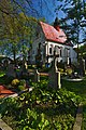
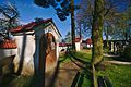
 Budova u kostala Narození Panny Marie, Hranice, okres Přerov.jpg 4,310 × 2,868; 5.66 MB
-
 Dominik Gabriel, Mähr. Weisskirchen, 1.jpg 3,126 × 2,011; 2.46 MB
-
 Kaple u kostela Narození Panny Marie, Hranice, okres Přerov (04).jpg 2,868 × 2,868; 4.4 MB
-
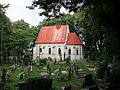 Kostel Narození P. Marie (Hranice).JPG 4,000 × 3,000; 3.03 MB
-
 Kostel Narození Panny Marie, Hranice, okres Přerov (02).jpg 4,173 × 2,775; 6.15 MB
-
 Kostel Narození Panny Marie, Hranice, okres Přerov (03).jpg 2,868 × 4,310; 5.71 MB
-
 Kostel Narození Panny Marie, Hranice, okres Přerov (04).jpg 2,645 × 3,976; 6.67 MB
-
 Kostel Narození Panny Marie, Hranice, okres Přerov (05).jpg 2,868 × 4,310; 8.22 MB
-
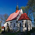 Kostel Narození Panny Marie, Hranice, okres Přerov.jpg 2,665 × 2,665; 3.72 MB
-
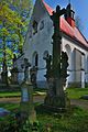 Kříž před kostelem Narození Panny Marie, Hranice, okres Přerov.jpg 2,193 × 3,297; 4.19 MB
-
 Poutní místo Kostelíček, Hranice l - Město, Hranice.jpg 9,248 × 6,944; 30.36 MB
-
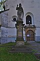
 Socha Panny Marie u kostela Narození Panny Marie, Hranice, okres Přerov.jpg 2,868 × 4,310; 6.73 MB
-
 Socha před kostelem Narození Panny Marie, Hranice, okres Přerov (02).jpg 2,430 × 3,653; 4.3 MB
-
 Socha před kostelem Narození Panny Marie, Hranice, okres Přerov.jpg 2,270 × 3,412; 3.26 MB
-
 Výklenkové kapličky u kostela Narození Panny Marie, Hranice, okres Přerov (02).jpg 4,310 × 2,868; 6.85 MB
-
 Výklenkové kapličky u kostela Narození Panny Marie, Hranice, okres Přerov.jpg 2,868 × 4,310; 6.99 MB


.jpg)
.jpg)
.jpg)
.jpg)
.jpg)


.jpg)

.jpg)
