Category:Church of the Nativity of the Virgin Mary, Kotešová
Jump to navigation
Jump to search
| Object location | | View all coordinates using: OpenStreetMap |
|---|
| This category shows the protected monument with the number 501-1347/0 (other) in the Slovak Republic. |
Slovenčina: Rímskokatolícky farský kostol Narodenia Panny Márie, Kráľovnej anjelov v obci Kotešová, okres Bytča
Media in category "Church of the Nativity of the Virgin Mary, Kotešová"
The following 7 files are in this category, out of 7 total.
-
 Erb maly kontrast.jpg 1,486 × 1,356; 1.98 MB
-
 Erb velky detail.jpg 2,704 × 2,124; 4.26 MB
-
 Erb velky kontrast detail.jpg 1,528 × 396; 481 KB
-
 Erb velky.jpg 1,724 × 1,308; 1.84 MB
-
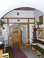 Interier portal.jpg 1,536 × 2,048; 1.47 MB
-
 Kotešová GS.jpg 2,007 × 1,277; 778 KB
-
 Rkk celkovy pohlad.jpg 1,536 × 2,048; 1.32 MB


