Category:Church of St. Barbara in Nowa Sól
Jump to navigation
Jump to search
| Object location | | View all coordinates using: OpenStreetMap |
|---|
Polski: Nowa Sól, ul. Św. Barbary - dawny kościół ewangelicki, obecnie rzymskokatolicki filialny p.w. św. Barbary, mur., 1910

church building in Nowa Sól, Poland   | |||||
| Upload media | |||||
| Instance of | |||||
|---|---|---|---|---|---|
| Named after | |||||
| Location | Nowa Sól, Nowa Sól County, Lubusz Voivodeship, Poland | ||||
| Heritage designation |
| ||||
 | |||||
Media in category "Church of St. Barbara in Nowa Sól"
The following 9 files are in this category, out of 9 total.
-
 Nowa sol kosciol barbary 09.jpg 4,646 × 4,000; 2.38 MB
-
 Sw barbara dobudowka.jpg 400 × 533; 79 KB
-
 Sw barbara jezus.jpg 300 × 592; 56 KB
-
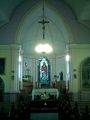 Sw barbara oltarz.jpg 400 × 533; 38 KB
-
 Sw barbara organy2.jpg 400 × 533; 47 KB
-
 Sw barbara perspektywa.jpg 2,324 × 1,744; 890 KB
-
 Sw barbara prezbiterium.jpg 400 × 533; 76 KB
-
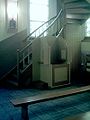 Sw barbara schody2.jpg 400 × 533; 40 KB
-
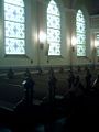 Szereg witrazy.jpg 400 × 533; 40 KB


