Category:Church of Name Our Lady (Vrakuňa)
Jump to navigation
Jump to search
| Object location | | View all coordinates using: OpenStreetMap |
|---|
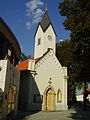
church building in Bratislava II, Slovakia  Kostel Jména Panny Marie ve Vrakuni | |||||
| Upload media | |||||
| Instance of | |||||
|---|---|---|---|---|---|
| Patron saint | |||||
| Location |
| ||||
| Architectural style | |||||
| Diocese | |||||
| official website | |||||
 | |||||
Subcategories
This category has only the following subcategory.
Media in category "Church of Name Our Lady (Vrakuňa)"
The following 18 files are in this category, out of 18 total.
-
 Kaplnka vrakuna.JPG 1,536 × 2,048; 2.03 MB
-
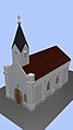 Kostol-wiki-01.jpg 269 × 477; 61 KB
-
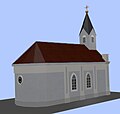
 Kostol-wiki-02.jpg 264 × 270; 39 KB
-
 Kostol-wiki-03.jpg 272 × 259; 40 KB
-
 Temp-kostol01.jpg 417 × 618; 51 KB
-
 Temp-kostol02.jpg 417 × 618; 50 KB
-
 Vrakuna 005.jpg 1,704 × 2,272; 2.63 MB
-
 Vrakuna 006.jpg 2,272 × 1,704; 2.74 MB
-
 Vrakuňa kostol 01.jpg 2,304 × 3,456; 1.48 MB
-
 Vrakuňa kostol 02.jpg 3,456 × 2,304; 1.77 MB
-
 Vrakuňa kostol 03.jpg 3,456 × 2,304; 1.73 MB
-
 Vrakuňa kostol 04.jpg 2,304 × 3,456; 2.36 MB
-
 Vrakuňa kostol 05.jpg 2,304 × 3,456; 1.6 MB
-
 Vrakuňa kostol 06.jpg 2,304 × 3,456; 1.55 MB
-
 Vrakuňa kostol 07.jpg 2,304 × 3,456; 1.48 MB
-
 Vrakuňa kostol 08.jpg 3,456 × 2,304; 1.99 MB
-
 Vrakuňa kríž 01.jpg 2,304 × 3,456; 2.27 MB
-
 Vrakuňa kríž 03.jpg 3,456 × 2,304; 1.7 MB


