Category:Church in Zernikow (Großwoltersdorf)
Jump to navigation
Jump to search
| Object location | | View all coordinates using: OpenStreetMap |
|---|
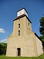
church building in Oberhavel district, Brandenburg state, Germany  | |||||
| Upload media | |||||
| Instance of | |||||
|---|---|---|---|---|---|
| Location | Zernikow, Großwoltersdorf, Oberhavel District, Brandenburg, Germany | ||||
| Heritage designation | |||||
 | |||||
This is the category of the Brandenburger Baudenkmal (cultural heritage monument) with the ID 09165184 (Wikidata)
|
Deutsch: Kirche in Zernikow, Gemeinde Großwoltersdorf, Landkreis Oberhavel, Land Brandenburg, Deutschland
English: Zernikow church, Großwoltersdorf municipality, Oberhavel district, Brandenburg state, Germany
Media in category "Church in Zernikow (Großwoltersdorf)"
The following 4 files are in this category, out of 4 total.
-
 Zernikow church E 2015.JPG 1,944 × 2,592; 2.15 MB
-
 Zernikow church north 2015.jpg 2,558 × 1,898; 1.81 MB
-
 Zernikow church spire W 2015.JPG 1,886 × 2,550; 1.59 MB
-
 Zernikow church SW 2015.JPG 1,944 × 2,592; 2.16 MB


Categories:
- Churches in Großwoltersdorf
- Cultural heritage monuments in Großwoltersdorf
- Zernikow (Großwoltersdorf)
- Churches in Kirchenkreis Oberes Havelland
- Lutheran churches in Brandenburg
- Gothic churches in Brandenburg
- Baroque churches in Brandenburg
- Fieldstone churches in Brandenburg
- 13th-century churches in Brandenburg