Category:Church cemetery in Nowy Dwór
Jump to navigation
Jump to search
| Object location | | View all coordinates using: OpenStreetMap |
|---|
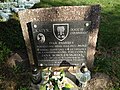
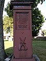
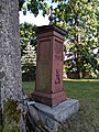
Polski: Nowy Dwór - cmentarz przykościelny.
| Upload media | |||||
| Instance of | |||||
|---|---|---|---|---|---|
| Location | Nowy Dwór, Gmina Nowy Dwór, Sokółka County, Podlaskie Voivodeship, Poland | ||||
| Heritage designation |
| ||||
| Inception |
| ||||
| Adjacent building | |||||
 | |||||
Media in category "Church cemetery in Nowy Dwór"
The following 15 files are in this category, out of 15 total.
-
 Nowy Dwor cmentarz przykoscielny 01.jpg 4,000 × 3,000; 9.63 MB
-
 Nowy Dwor cmentarz przykoscielny 02.jpg 2,250 × 4,000; 6.18 MB
-
 Nowy Dwor cmentarz przykoscielny 03.jpg 4,000 × 3,000; 9.26 MB
-
 Nowy Dwor cmentarz przykoscielny 04.jpg 4,000 × 3,000; 8.81 MB
-
 Nowy Dwor cmentarz przykoscielny 05.jpg 4,000 × 3,000; 8.85 MB
-
 Nowy Dwor cmentarz przykoscielny 06.jpg 4,000 × 3,000; 7.66 MB
-
 Nowy Dwor cmentarz przykoscielny 07.jpg 3,000 × 4,000; 8.05 MB
-
 Nowy Dwor cmentarz przykoscielny 08.jpg 4,000 × 3,000; 8.62 MB
-
 Nowy Dwor cmentarz przykoscielny 09.jpg 3,000 × 4,000; 8.95 MB
-
 Nowy Dwor cmentarz przykoscielny 10.jpg 3,000 × 4,000; 8.22 MB
-
 Nowy Dwor cmentarz przykoscielny 11.jpg 3,000 × 4,000; 6.44 MB
-
 Nowy Dwor cmentarz przykoscielny 12.jpg 3,000 × 4,000; 5.63 MB
-
 Nowy Dwor cmentarz przykoscielny 13.jpg 3,000 × 4,000; 5.35 MB
-
 Nowy Dwor cmentarz przykoscielny 14.jpg 3,000 × 4,000; 8.96 MB
-
 Nowy Dwor cmentarz przykoscielny 15.jpg 3,000 × 4,000; 8.01 MB


