Category:Church Kleinwolschendorf
Jump to navigation
Jump to search
| Object location | | View all coordinates using: OpenStreetMap |
|---|
 | |||||
| Upload media | |||||
| Instance of | |||||
|---|---|---|---|---|---|
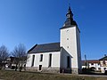
| Location | Kleinwolschendorf, Zeulenroda-Triebes, Greiz, Thuringia, Germany | ||||
 | |||||
Media in category "Church Kleinwolschendorf"
The following 10 files are in this category, out of 10 total.
-
 Church Kleinwolschendorf 01.jpg 4,608 × 3,456; 3.25 MB
-
 Church Kleinwolschendorf 02.jpg 4,608 × 3,456; 3.16 MB
-
 Church Kleinwolschendorf 03.jpg 4,608 × 3,456; 2.85 MB
-
 Church Kleinwolschendorf 04.jpg 3,456 × 4,608; 3.3 MB
-
 Church Kleinwolschendorf 05.jpg 3,456 × 4,608; 3.24 MB
-
 Church Kleinwolschendorf 06.jpg 3,456 × 4,608; 3.51 MB
-
 Church Kleinwolschendorf 07.jpg 3,456 × 4,608; 3.25 MB
-
 Church Kleinwolschendorf 08.jpg 3,456 × 4,608; 3.46 MB
-
 Church Kleinwolschendorf 09.jpg 3,456 × 4,608; 3.07 MB
-
 Church Kleinwolschendorf 10.jpg 3,456 × 4,608; 3.15 MB


