Category:Church Farm, Bidston
Jump to navigation
Jump to search
| Object location | | View all coordinates using: OpenStreetMap |
|---|
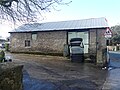
Grade II listed farmhouse in Bidston, Wirral, Merseyside, England, UK  | |||||
| Upload media | |||||
| Instance of | |||||
|---|---|---|---|---|---|
| Location | Bidston, Wirral, Merseyside, North West England, England | ||||
| Heritage designation |
| ||||
| Adjacent building |
| ||||
 | |||||
Media in category "Church Farm, Bidston"
The following 10 files are in this category, out of 10 total.
-
 Byre at Church Farmhouse, Bidston 01.jpg 4,000 × 3,000; 2.85 MB
-
 Byre at Church Farmhouse, Bidston 02.jpg 4,000 × 3,000; 4.82 MB
-
 Church Farm, Bidston, from the tower.jpg 5,093 × 3,396; 15.45 MB
-
 Church Farm, Bidston-by-Sue-Adair.jpg 640 × 480; 131 KB
-
 Church Farmhouse, Bidston 01.jpg 4,000 × 3,000; 4.99 MB
-
 Church Farmhouse, Bidston 02.jpg 4,000 × 3,000; 5.06 MB
-
 Church Farmhouse, Bidston 03.jpg 4,000 × 3,000; 2.91 MB
-
 Church Farmhouse.jpg 5,093 × 3,396; 10.65 MB
-
 Listed barn at Church Farmhouse, Bidston 02.jpg 4,000 × 3,000; 5.02 MB
-
 Old granary, cart shed and attached pigsties at Church Farmhouse, Bidston.jpg 4,000 × 3,000; 2.42 MB


