Category:Church Aston
Jump to navigation
Jump to search
village in the United Kingdom  | |||||
| Upload media | |||||
| Instance of | |||||
|---|---|---|---|---|---|
| Location | Telford and Wrekin, Shropshire, West Midlands, England | ||||
 | |||||
Subcategories
This category has the following 3 subcategories, out of 3 total.
Media in category "Church Aston"
The following 44 files are in this category, out of 44 total.
-
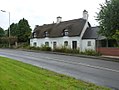 19 and 20 Wellington Road, Church Aston.jpg 1,142 × 857; 302 KB
-
 38 Wellington Road, Church Aston.jpg 640 × 480; 67 KB
-
 39 Wellington Road, Church Aston.jpg 640 × 480; 86 KB
-
 An old track south of Church Aston - geograph.org.uk - 3434601.jpg 734 × 979; 435 KB
-
 Aston Hill. - geograph.org.uk - 321199.jpg 640 × 480; 86 KB
-
 Back lane at Church Aston - geograph.org.uk - 3095131.jpg 857 × 1,142; 373 KB
-
 Barns at Cheswell Manor farm - geograph.org.uk - 4505268.jpg 1,142 × 857; 369 KB
-
 Brockton War Memorial cross - geograph.org.uk - 3094770.jpg 857 × 1,142; 354 KB
-
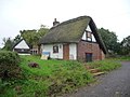
 Cottages at the northern end of Dark Lane - geograph.org.uk - 3436185.jpg 1,142 × 857; 268 KB
-
 Daft Dog makes for the Strine Brook - geograph.org.uk - 3094742.jpg 1,110 × 832; 338 KB
-
 Dark Lane, Church Aston - geograph.org.uk - 3436184.jpg 1,142 × 857; 311 KB
-
 Field access track beside Cheswell Wood - geograph.org.uk - 4505273.jpg 1,142 × 857; 468 KB
-
 Footbridge over the Strine - geograph.org.uk - 3094743.jpg 1,077 × 808; 358 KB
-
 Footpath into Church Aston - geograph.org.uk - 3434595.jpg 857 × 1,142; 330 KB
-
 Church Aston - geograph.org.uk - 287100.jpg 640 × 480; 113 KB
-
 Greenvale, Church Aston - geograph.org.uk - 3436183.jpg 1,142 × 857; 355 KB
-
 Horse pastures at Sunnyholme Farm - geograph.org.uk - 3093144.jpg 1,142 × 857; 324 KB
-
 Longford Bottoms - geograph.org.uk - 3093140.jpg 1,142 × 857; 351 KB
-
 Main entrance - Longford Hall - geograph.org.uk - 3093155.jpg 1,044 × 783; 344 KB
-
 On the footpath to Longford Road - geograph.org.uk - 3093146.jpg 1,044 × 783; 329 KB
-
 On the SE side of Cheswell Wood - geograph.org.uk - 4505278.jpg 1,142 × 857; 410 KB
-

-
 Pitchcroft Lane and Greenacres Cottage - geograph.org.uk - 3438530.jpg 1,112 × 832; 274 KB
-
 Pitchcroft railway bridge - geograph.org.uk - 2679261.jpg 1,024 × 696; 133 KB
-
 Pitchcroft roundabout from A518 west - geograph.org.uk - 3014661.jpg 640 × 394; 58 KB
-
 Pitchcroft traffic island - geograph.org.uk - 832556.jpg 640 × 480; 58 KB
-
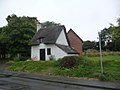
 Privatised church - geograph.org.uk - 832535.jpg 640 × 480; 70 KB
-
 Roadside wall and field near Red Gables cottage - geograph.org.uk - 3094768.jpg 1,142 × 857; 383 KB
-
 Sheep^ - geograph.org.uk - 287105.jpg 640 × 480; 134 KB
-

-

-

-
 The 'old' A518 main road - geograph.org.uk - 3095141.jpg 1,142 × 857; 398 KB
-

-
 The former Last Inn - now The Aston - geograph.org.uk - 3095149.jpg 1,142 × 857; 236 KB
-
 The Last Inn - geograph.org.uk - 287102.jpg 640 × 480; 85 KB
-
 The old railway bridge in Church Aston - geograph.org.uk - 3434613.jpg 979 × 734; 394 KB
-
 The War Memorial stone at Brockton - geograph.org.uk - 3094769.jpg 1,632 × 1,224; 885 KB
-
 Track from Cheswellhill to Longford - geograph.org.uk - 4505280.jpg 857 × 1,142; 438 KB
-
 Village Hall - geograph.org.uk - 3499912.jpg 1,600 × 1,064; 401 KB
-
 Bridge over Donnington Wood canal - geograph.org.uk - 341258.jpg 640 × 480; 117 KB
-
 Donnington Wood Canal - geograph.org.uk - 341246.jpg 640 × 480; 110 KB
-
 Lane - geograph.org.uk - 321176.jpg 480 × 640; 88 KB
-
 Stile - geograph.org.uk - 321168.jpg 480 × 640; 111 KB


,_Longford_-_Talbot_monument_-_geograph.org.uk_-_3424342.jpg)


